ESA TPM Map Catalogue - Product List
back to previous node |
list of download URLs

Collection G2_Portugal_2021
GEOSAT-2 Portugal Coverage 2021 collection. More details here.
List of available products (latitude from 39.9368 to 40.0152 dg, longitude from -7.90062 to -7.75625 dg)..
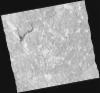
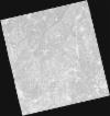
DE2_OPER_HRA_PSH_1C_20210727T111334_N40-079_W007-786_0001
Download Product | Product Info | Browse
Platform Short Name | GEOSAT |
Platform Serial Identifier | 2 |
Product Type | HRA_PSH_1C |
Start Date | 2021-07-27T11:13:34Z |
Stop Date | 2021-07-27T11:13:37Z |
Original Name | DE2_PSH_L1C_000000_20210727T111334_20210727T111337_DE2_38499_6D31.zip |
Footprint | 40.0212630258 -7.67031011648 40.1638076622 -7.70371201318 40.1376875671 -7.90477509146 39.9949026889 -7.86736711522 40.0212630258 -7.67031011648 |
Orbit Direction | ASCENDING |
Scene Centre Longitude | W007 |
Scene Centre Latitude | N40 |
Cloud Cover Percentage | -1 |
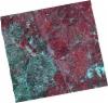
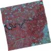
DE2_OPER_HRA_PM4_1C_20210727T111334_N40-079_W007-786_0001
Download Product | Product Info | Browse
Platform Short Name | GEOSAT |
Platform Serial Identifier | 2 |
Product Type | HRA_PM4_1C |
Start Date | 2021-07-27T11:13:34Z |
Stop Date | 2021-07-27T11:13:37Z |
Original Name | DE2_PM4_L1C_000000_20210727T111334_20210727T111337_DE2_38499_6D31.zip |
Footprint | 40.0212630258 -7.67031011648 40.1638076622 -7.70371201318 40.1376875671 -7.90477509146 39.9949026889 -7.86736711522 40.0212630258 -7.67031011648 |
Orbit Direction | ASCENDING |
Scene Centre Longitude | W007 |
Scene Centre Latitude | N40 |
Cloud Cover Percentage | -1 |
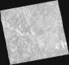
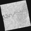
DE2_OPER_HRA_PSH_1C_20210727T111332_N39-949_W007-754_0001
Download Product | Product Info | Browse
Platform Short Name | GEOSAT |
Platform Serial Identifier | 2 |
Product Type | HRA_PSH_1C |
Start Date | 2021-07-27T11:13:32Z |
Stop Date | 2021-07-27T11:13:35Z |
Original Name | DE2_PSH_L1C_000000_20210727T111332_20210727T111335_DE2_38499_BEE2.zip |
Footprint | 39.8910980667 -7.63800420282 40.0339754404 -7.67288491234 40.0083337391 -7.86922768837 39.8650164835 -7.83806115574 39.8910980667 -7.63800420282 |
Orbit Direction | ASCENDING |
Scene Centre Longitude | W007 |
Scene Centre Latitude | N39 |
Cloud Cover Percentage | -1 |
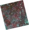
DE2_OPER_HRA_PM4_1C_20210727T111332_N39-949_W007-754_0001
Download Product | Product Info | Browse
Platform Short Name | GEOSAT |
Platform Serial Identifier | 2 |
Product Type | HRA_PM4_1C |
Start Date | 2021-07-27T11:13:32Z |
Stop Date | 2021-07-27T11:13:35Z |
Original Name | DE2_PM4_L1C_000000_20210727T111332_20210727T111335_DE2_38499_BEE2.zip |
Footprint | 39.8910980667 -7.63800420282 40.0339754404 -7.67288491234 40.0083337391 -7.86922768837 39.8650164835 -7.83806115574 39.8910980667 -7.63800420282 |
Orbit Direction | ASCENDING |
Scene Centre Longitude | W007 |
Scene Centre Latitude | N39 |
Cloud Cover Percentage | -1 |
DE2_OPER_HRA_PSH_1C_20210720T110137_N39-993_W007-699_0001
Download Product | Product Info | Browse
Platform Short Name | GEOSAT |
Platform Serial Identifier | 2 |
Product Type | HRA_PSH_1C |
Start Date | 2021-07-20T11:01:37Z |
Stop Date | 2021-07-20T11:01:39Z |
Original Name | DE2_PSH_L1C_000000_20210720T110137_20210720T110139_DE2_38395_9C59.zip |
Footprint | 39.9437221316 -7.60727160046 40.0684916118 -7.64327177 40.0439513408 -7.79038477097 39.9190849323 -7.7551041763 39.9437221316 -7.60727160046 |
Orbit Direction | ASCENDING |
Scene Centre Longitude | W007 |
Scene Centre Latitude | N39 |
Cloud Cover Percentage | -1 |
DE2_OPER_HRA_PM4_1C_20210720T110137_N39-993_W007-699_0001
Download Product | Product Info | Browse
Platform Short Name | GEOSAT |
Platform Serial Identifier | 2 |
Product Type | HRA_PM4_1C |
Start Date | 2021-07-20T11:01:37Z |
Stop Date | 2021-07-20T11:01:39Z |
Original Name | DE2_PM4_L1C_000000_20210720T110137_20210720T110139_DE2_38395_9C59.zip |
Footprint | 39.9437221316 -7.60727160046 40.0684916118 -7.64327177 40.0439513408 -7.79038477097 39.9190849323 -7.7551041763 39.9437221316 -7.60727160046 |
Orbit Direction | ASCENDING |
Scene Centre Longitude | W007 |
Scene Centre Latitude | N39 |
Cloud Cover Percentage | -1 |
DE2_OPER_HRA_PSH_1C_20210702T111206_N39-983_W007-947_0001
Download Product | Product Info | Browse
Platform Short Name | GEOSAT |
Platform Serial Identifier | 2 |
Product Type | HRA_PSH_1C |
Start Date | 2021-07-02T11:12:06Z |
Stop Date | 2021-07-02T11:12:09Z |
Original Name | DE2_PSH_L1C_000000_20210702T111206_20210702T111209_DE2_38128_1670.zip |
Footprint | 39.9276794445 -7.84040771086 40.065162491 -7.87425996983 40.0400653266 -8.05314374785 39.9024793177 -8.02034062252 39.9276794445 -7.84040771086 |
Orbit Direction | ASCENDING |
Scene Centre Longitude | W007 |
Scene Centre Latitude | N39 |
Cloud Cover Percentage | -1 |
DE2_OPER_HRA_PM4_1C_20210702T111206_N39-983_W007-947_0001
Download Product | Product Info | Browse
Platform Short Name | GEOSAT |
Platform Serial Identifier | 2 |
Product Type | HRA_PM4_1C |
Start Date | 2021-07-02T11:12:06Z |
Stop Date | 2021-07-02T11:12:09Z |
Original Name | DE2_PM4_L1C_000000_20210702T111206_20210702T111209_DE2_38128_1670.zip |
Footprint | 39.9276794445 -7.84040771086 40.065162491 -7.87425996983 40.0400653266 -8.05314374785 39.9024793177 -8.02034062252 39.9276794445 -7.84040771086 |
Orbit Direction | ASCENDING |
Scene Centre Longitude | W007 |
Scene Centre Latitude | N39 |
Cloud Cover Percentage | -1 |