ESA TPM Map Catalogue - Product List
back to previous node |
list of download URLs
Collection G2_Portugal_2021
GEOSAT-2 Portugal Coverage 2021 collection. More details here.
List of available products (latitude from 39.9368 to 40.0152 dg, longitude from -8.8325 to -8.68812 dg)..
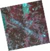
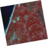
DE2_OPER_HRA_PSH_1C_20210331T111543_N40-050_W008-649_0001
Download Product | Product Info | Browse
Platform Short Name | GEOSAT |
Platform Serial Identifier | 2 |
Product Type | HRA_PSH_1C |
Start Date | 2021-03-31T11:15:43Z |
Stop Date | 2021-03-31T11:15:45Z |
Original Name | DE2_PSH_L1C_000000_20210331T111543_20210331T111545_DE2_36748_28BD.zip |
Footprint | 39.9956336884 -8.5489794571 40.1290435572 -8.58182280152 40.1042256091 -8.75121971659 39.9709941162 -8.71681006626 39.9956336884 -8.5489794571 |
Orbit Direction | ASCENDING |
Scene Centre Longitude | W008 |
Scene Centre Latitude | N40 |
Cloud Cover Percentage | -1 |
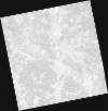
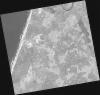
DE2_OPER_HRA_PM4_1C_20210331T111543_N40-050_W008-649_0001
Download Product | Product Info | Browse
Platform Short Name | GEOSAT |
Platform Serial Identifier | 2 |
Product Type | HRA_PM4_1C |
Start Date | 2021-03-31T11:15:43Z |
Stop Date | 2021-03-31T11:15:45Z |
Original Name | DE2_PM4_L1C_000000_20210331T111543_20210331T111545_DE2_36748_28BD.zip |
Footprint | 39.9956336884 -8.5489794571 40.1290435572 -8.58182280152 40.1042256091 -8.75121971659 39.9709941162 -8.71681006626 39.9956336884 -8.5489794571 |
Orbit Direction | ASCENDING |
Scene Centre Longitude | W008 |
Scene Centre Latitude | N40 |
Cloud Cover Percentage | -1 |
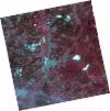
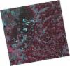
DE2_OPER_HRA_PSH_1C_20210331T111541_N39-929_W008-618_0001
Download Product | Product Info | Browse
Platform Short Name | GEOSAT |
Platform Serial Identifier | 2 |
Product Type | HRA_PSH_1C |
Start Date | 2021-03-31T11:15:41Z |
Stop Date | 2021-03-31T11:15:43Z |
Original Name | DE2_PSH_L1C_000000_20210331T111541_20210331T111543_DE2_36748_83F0.zip |
Footprint | 39.8749478769 -8.51737341623 40.0080706401 -8.55162169119 39.983334163 -8.72004441448 39.8501855703 -8.68571013271 39.8749478769 -8.51737341623 |
Orbit Direction | ASCENDING |
Scene Centre Longitude | W008 |
Scene Centre Latitude | N39 |
Cloud Cover Percentage | -1 |
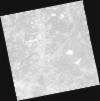
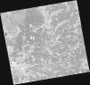
DE2_OPER_HRA_PM4_1C_20210331T111541_N39-929_W008-618_0001
Download Product | Product Info | Browse
Platform Short Name | GEOSAT |
Platform Serial Identifier | 2 |
Product Type | HRA_PM4_1C |
Start Date | 2021-03-31T11:15:41Z |
Stop Date | 2021-03-31T11:15:43Z |
Original Name | DE2_PM4_L1C_000000_20210331T111541_20210331T111543_DE2_36748_83F0.zip |
Footprint | 39.8749478769 -8.51737341623 40.0080706401 -8.55162169119 39.983334163 -8.72004441448 39.8501855703 -8.68571013271 39.8749478769 -8.51737341623 |
Orbit Direction | ASCENDING |
Scene Centre Longitude | W008 |
Scene Centre Latitude | N39 |
Cloud Cover Percentage | -1 |
DE2_OPER_HRA_PSH_1C_20210319T112204_N40-043_W008-824_0001
Download Product | Product Info | Browse
Platform Short Name | GEOSAT |
Platform Serial Identifier | 2 |
Product Type | HRA_PSH_1C |
Start Date | 2021-03-19T11:22:04Z |
Stop Date | 2021-03-19T11:22:07Z |
Original Name | DE2_PSH_L1C_000000_20210319T112204_20210319T112207_DE2_36570_713E.zip |
Footprint | 39.9845209828 -8.70808407655 40.1288830262 -8.74212447316 40.1030051585 -8.94195501238 39.9585859048 -8.90774341924 39.9845209828 -8.70808407655 |
Orbit Direction | ASCENDING |
Scene Centre Longitude | W008 |
Scene Centre Latitude | N40 |
Cloud Cover Percentage | -1 |
DE2_OPER_HRA_PM4_1C_20210319T112204_N40-043_W008-824_0001
Download Product | Product Info | Browse
Platform Short Name | GEOSAT |
Platform Serial Identifier | 2 |
Product Type | HRA_PM4_1C |
Start Date | 2021-03-19T11:22:04Z |
Stop Date | 2021-03-19T11:22:07Z |
Original Name | DE2_PM4_L1C_000000_20210319T112204_20210319T112207_DE2_36570_713E.zip |
Footprint | 39.9845209828 -8.70808407655 40.1288830262 -8.74212447316 40.1030051585 -8.94195501238 39.9585859048 -8.90774341924 39.9845209828 -8.70808407655 |
Orbit Direction | ASCENDING |
Scene Centre Longitude | W008 |
Scene Centre Latitude | N40 |
Cloud Cover Percentage | -1 |
DE2_OPER_HRA_PSH_1C_20210319T112202_N39-912_W008-794_0001
Download Product | Product Info | Browse
Platform Short Name | GEOSAT |
Platform Serial Identifier | 2 |
Product Type | HRA_PSH_1C |
Start Date | 2021-03-19T11:22:02Z |
Stop Date | 2021-03-19T11:22:04Z |
Original Name | DE2_PSH_L1C_000000_20210319T112202_20210319T112204_DE2_36570_609F.zip |
Footprint | 39.8535420982 -8.67761107843 39.997874875 -8.71133078054 39.9719342795 -8.9109750936 39.8277048259 -8.87624433561 39.8535420982 -8.67761107843 |
Orbit Direction | ASCENDING |
Scene Centre Longitude | W008 |
Scene Centre Latitude | N39 |
Cloud Cover Percentage | -1 |
DE2_OPER_HRA_PM4_1C_20210319T112202_N39-912_W008-794_0001
Download Product | Product Info | Browse
Platform Short Name | GEOSAT |
Platform Serial Identifier | 2 |
Product Type | HRA_PM4_1C |
Start Date | 2021-03-19T11:22:02Z |
Stop Date | 2021-03-19T11:22:04Z |
Original Name | DE2_PM4_L1C_000000_20210319T112202_20210319T112204_DE2_36570_609F.zip |
Footprint | 39.8535420982 -8.67761107843 39.997874875 -8.71133078054 39.9719342795 -8.9109750936 39.8277048259 -8.87624433561 39.8535420982 -8.67761107843 |
Orbit Direction | ASCENDING |
Scene Centre Longitude | W008 |
Scene Centre Latitude | N39 |
Cloud Cover Percentage | -1 |