ESA TPM Map Catalogue - Product List
back to previous node |
list of download URLs
Collection G2_Portugal_2021
GEOSAT-2 Portugal Coverage 2021 collection. More details here.
List of available products (latitude from 39.8583 to 39.9368 dg, longitude from -7.2575 to -7.11312 dg)..
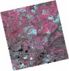
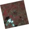
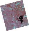
DE2_OPER_HRA_PSH_1C_20211103T110024_N39-808_W007-220_0001
Download Product | Product Info | Browse
Platform Short Name | GEOSAT |
Platform Serial Identifier | 2 |
Product Type | HRA_PSH_1C |
Start Date | 2021-11-03T11:00:24Z |
Stop Date | 2021-11-03T11:00:27Z |
Original Name | DE2_PSH_L1C_000000_20211103T110024_20211103T110027_DE2_39968_DCEB.zip |
Footprint | 39.755700825 -7.12392754333 39.8849534838 -7.15805259779 39.8607307713 -7.31680177231 39.73146383 -7.28282709275 39.755700825 -7.12392754333 |
Orbit Direction | ASCENDING |
Scene Centre Longitude | W007 |
Scene Centre Latitude | N39 |
Cloud Cover Percentage | -1 |
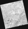
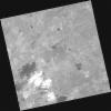
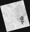
DE2_OPER_HRA_PM4_1C_20211103T110024_N39-808_W007-220_0001
Download Product | Product Info | Browse
Platform Short Name | GEOSAT |
Platform Serial Identifier | 2 |
Product Type | HRA_PM4_1C |
Start Date | 2021-11-03T11:00:24Z |
Stop Date | 2021-11-03T11:00:27Z |
Original Name | DE2_PM4_L1C_000000_20211103T110024_20211103T110027_DE2_39968_DCEB.zip |
Footprint | 39.755700825 -7.12392754333 39.8849534838 -7.15805259779 39.8607307713 -7.31680177231 39.73146383 -7.28282709275 39.755700825 -7.12392754333 |
Orbit Direction | ASCENDING |
Scene Centre Longitude | W007 |
Scene Centre Latitude | N39 |
Cloud Cover Percentage | -1 |
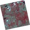
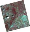
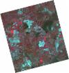
DE2_OPER_HRA_PSH_1C_20211003T110419_N39-984_W007-100_0001
Download Product | Product Info | Browse
Platform Short Name | GEOSAT |
Platform Serial Identifier | 2 |
Product Type | HRA_PSH_1C |
Start Date | 2021-10-03T11:04:19Z |
Stop Date | 2021-10-03T11:04:22Z |
Original Name | DE2_PSH_L1C_000000_20211003T110419_20211003T110422_DE2_39508_374F.zip |
Footprint | 39.9296570179 -6.99598197788 40.0645025544 -7.03164176443 40.0397244382 -7.20410576943 39.9047463036 -7.16927003747 39.9296570179 -6.99598197788 |
Orbit Direction | ASCENDING |
Scene Centre Longitude | W007 |
Scene Centre Latitude | N39 |
Cloud Cover Percentage | -1 |
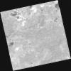
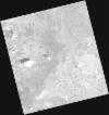
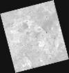
DE2_OPER_HRA_PM4_1C_20211003T110419_N39-984_W007-100_0001
Download Product | Product Info | Browse
Platform Short Name | GEOSAT |
Platform Serial Identifier | 2 |
Product Type | HRA_PM4_1C |
Start Date | 2021-10-03T11:04:19Z |
Stop Date | 2021-10-03T11:04:22Z |
Original Name | DE2_PM4_L1C_000000_20211003T110419_20211003T110422_DE2_39508_374F.zip |
Footprint | 39.9296570179 -6.99598197788 40.0645025544 -7.03164176443 40.0397244382 -7.20410576943 39.9047463036 -7.16927003747 39.9296570179 -6.99598197788 |
Orbit Direction | ASCENDING |
Scene Centre Longitude | W007 |
Scene Centre Latitude | N39 |
Cloud Cover Percentage | -1 |
DE2_OPER_HRA_PSH_1C_20211003T110417_N39-862_W007-068_0001
Download Product | Product Info | Browse
Platform Short Name | GEOSAT |
Platform Serial Identifier | 2 |
Product Type | HRA_PSH_1C |
Start Date | 2021-10-03T11:04:17Z |
Stop Date | 2021-10-03T11:04:20Z |
Original Name | DE2_PSH_L1C_000000_20211003T110417_20211003T110420_DE2_39508_427D.zip |
Footprint | 39.8072216122 -6.96477126998 39.9421456714 -6.99924285156 39.9172608618 -7.17232387839 39.7823117118 -7.13789158397 39.8072216122 -6.96477126998 |
Orbit Direction | ASCENDING |
Scene Centre Longitude | W007 |
Scene Centre Latitude | N39 |
Cloud Cover Percentage | -1 |
DE2_OPER_HRA_PM4_1C_20211003T110417_N39-862_W007-068_0001
Download Product | Product Info | Browse
Platform Short Name | GEOSAT |
Platform Serial Identifier | 2 |
Product Type | HRA_PM4_1C |
Start Date | 2021-10-03T11:04:17Z |
Stop Date | 2021-10-03T11:04:20Z |
Original Name | DE2_PM4_L1C_000000_20211003T110417_20211003T110420_DE2_39508_427D.zip |
Footprint | 39.8072216122 -6.96477126998 39.9421456714 -6.99924285156 39.9172608618 -7.17232387839 39.7823117118 -7.13789158397 39.8072216122 -6.96477126998 |
Orbit Direction | ASCENDING |
Scene Centre Longitude | W007 |
Scene Centre Latitude | N39 |
Cloud Cover Percentage | -1 |
DE2_OPER_HRA_PSH_1C_20210531T105814_N39-884_W007-316_0001
Download Product | Product Info | Browse
Platform Short Name | GEOSAT |
Platform Serial Identifier | 2 |
Product Type | HRA_PSH_1C |
Start Date | 2021-05-31T10:58:14Z |
Stop Date | 2021-05-31T10:58:17Z |
Original Name | DE2_PSH_L1C_000000_20210531T105814_20210531T105817_DE2_37653_5ACC.zip |
Footprint | 39.8354533963 -7.22616190538 39.958307742 -7.26277419771 39.9330787352 -7.40628641404 39.8102575017 -7.36942855683 39.8354533963 -7.22616190538 |
Orbit Direction | ASCENDING |
Scene Centre Longitude | W007 |
Scene Centre Latitude | N39 |
Cloud Cover Percentage | -1 |
DE2_OPER_HRA_PM4_1C_20210531T105814_N39-884_W007-316_0001
Download Product | Product Info | Browse
Platform Short Name | GEOSAT |
Platform Serial Identifier | 2 |
Product Type | HRA_PM4_1C |
Start Date | 2021-05-31T10:58:14Z |
Stop Date | 2021-05-31T10:58:17Z |
Original Name | DE2_PM4_L1C_000000_20210531T105814_20210531T105817_DE2_37653_5ACC.zip |
Footprint | 39.8354533963 -7.22616190538 39.958307742 -7.26277419771 39.9330787352 -7.40628641404 39.8102575017 -7.36942855683 39.8354533963 -7.22616190538 |
Orbit Direction | ASCENDING |
Scene Centre Longitude | W007 |
Scene Centre Latitude | N39 |
Cloud Cover Percentage | -1 |
DE2_OPER_HRA_PSH_1C_20210506T105610_N39-984_W007-238_0001
Download Product | Product Info | Browse
Platform Short Name | GEOSAT |
Platform Serial Identifier | 2 |
Product Type | HRA_PSH_1C |
Start Date | 2021-05-06T10:56:10Z |
Stop Date | 2021-05-06T10:56:12Z |
Original Name | DE2_PSH_L1C_000000_20210506T105610_20210506T105612_DE2_37282_DEA3.zip |
Footprint | 39.9364414039 -7.14793026021 40.05929994 -7.18597901418 40.0332983555 -7.32962738338 39.9104758625 -7.29142035032 39.9364414039 -7.14793026021 |
Orbit Direction | ASCENDING |
Scene Centre Longitude | W007 |
Scene Centre Latitude | N39 |
Cloud Cover Percentage | -1 |
DE2_OPER_HRA_PM4_1C_20210506T105610_N39-984_W007-238_0001
Download Product | Product Info | Browse
Platform Short Name | GEOSAT |
Platform Serial Identifier | 2 |
Product Type | HRA_PM4_1C |
Start Date | 2021-05-06T10:56:10Z |
Stop Date | 2021-05-06T10:56:12Z |
Original Name | DE2_PM4_L1C_000000_20210506T105610_20210506T105612_DE2_37282_DEA3.zip |
Footprint | 39.9364414039 -7.14793026021 40.05929994 -7.18597901418 40.0332983555 -7.32962738338 39.9104758625 -7.29142035032 39.9364414039 -7.14793026021 |
Orbit Direction | ASCENDING |
Scene Centre Longitude | W007 |
Scene Centre Latitude | N39 |
Cloud Cover Percentage | -1 |
DE2_OPER_HRA_PSH_1C_20210506T105608_N39-873_W007-204_0001
Download Product | Product Info | Browse
Platform Short Name | GEOSAT |
Platform Serial Identifier | 2 |
Product Type | HRA_PSH_1C |
Start Date | 2021-05-06T10:56:08Z |
Stop Date | 2021-05-06T10:56:10Z |
Original Name | DE2_PSH_L1C_000000_20210506T105608_20210506T105610_DE2_37282_5EB6.zip |
Footprint | 39.8250608744 -7.11393592287 39.9478226948 -7.15149474864 39.9218588597 -7.29492846489 39.7991047438 -7.25717816269 39.8250608744 -7.11393592287 |
Orbit Direction | ASCENDING |
Scene Centre Longitude | W007 |
Scene Centre Latitude | N39 |
Cloud Cover Percentage | -1 |
DE2_OPER_HRA_PM4_1C_20210506T105608_N39-873_W007-204_0001
Download Product | Product Info | Browse
Platform Short Name | GEOSAT |
Platform Serial Identifier | 2 |
Product Type | HRA_PM4_1C |
Start Date | 2021-05-06T10:56:08Z |
Stop Date | 2021-05-06T10:56:10Z |
Original Name | DE2_PM4_L1C_000000_20210506T105608_20210506T105610_DE2_37282_5EB6.zip |
Footprint | 39.8250608744 -7.11393592287 39.9478226948 -7.15149474864 39.9218588597 -7.29492846489 39.7991047438 -7.25717816269 39.8250608744 -7.11393592287 |
Orbit Direction | ASCENDING |
Scene Centre Longitude | W007 |
Scene Centre Latitude | N39 |
Cloud Cover Percentage | -1 |