ESA TPM Map Catalogue - Product List
back to previous node |
list of download URLs
Collection G2_Portugal_2021
GEOSAT-2 Portugal Coverage 2021 collection. More details here.
List of available products (latitude from 39.8583 to 39.9368 dg, longitude from -7.61188 to -7.4675 dg)..
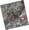
DE2_OPER_HRA_PSH_1C_20210720T110135_N39-880_W007-666_0001
Download Product | Product Info | BrowsePlatform Short Name | GEOSAT |
Platform Serial Identifier | 2 |
Product Type | HRA_PSH_1C |
Start Date | 2021-07-20T11:01:35Z |
Stop Date | 2021-07-20T11:01:37Z |
Original Name | DE2_PSH_L1C_000000_20210720T110135_20210720T110137_DE2_38395_3CE6.zip |
Footprint | 39.8304008889 -7.57520744855 39.9553099021 -7.61060128434 39.930648983 -7.75849329923 39.8058555925 -7.7222969541 39.8304008889 -7.57520744855 |
Orbit Direction | ASCENDING |
Scene Centre Longitude | W007 |
Scene Centre Latitude | N39 |
Cloud Cover Percentage | -1 |
DE2_OPER_HRA_PM4_1C_20210720T110135_N39-880_W007-666_0001
Download Product | Product Info | BrowsePlatform Short Name | GEOSAT |
Platform Serial Identifier | 2 |
Product Type | HRA_PM4_1C |
Start Date | 2021-07-20T11:01:35Z |
Stop Date | 2021-07-20T11:01:37Z |
Original Name | DE2_PM4_L1C_000000_20210720T110135_20210720T110137_DE2_38395_3CE6.zip |
Footprint | 39.8304008889 -7.57520744855 39.9553099021 -7.61060128434 39.930648983 -7.75849329923 39.8058555925 -7.7222969541 39.8304008889 -7.57520744855 |
Orbit Direction | ASCENDING |
Scene Centre Longitude | W007 |
Scene Centre Latitude | N39 |
Cloud Cover Percentage | -1 |
DE2_OPER_HRA_PSH_1C_20210714T110506_N39-956_W007-413_0001
Download Product | Product Info | BrowsePlatform Short Name | GEOSAT |
Platform Serial Identifier | 2 |
Product Type | HRA_PSH_1C |
Start Date | 2021-07-14T11:05:06Z |
Stop Date | 2021-07-14T11:05:09Z |
Original Name | DE2_PSH_L1C_000000_20210714T110506_20210714T110509_DE2_38306_CF73.zip |
Footprint | 39.9047607163 -7.31644395606 40.0337778821 -7.35130949258 40.0091689366 -7.51095433668 39.8801382037 -7.47619431793 39.9047607163 -7.31644395606 |
Orbit Direction | ASCENDING |
Scene Centre Longitude | W007 |
Scene Centre Latitude | N39 |
Cloud Cover Percentage | -1 |
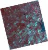
DE2_OPER_HRA_PM4_1C_20210714T110506_N39-956_W007-413_0001
Download Product | Product Info | BrowsePlatform Short Name | GEOSAT |
Platform Serial Identifier | 2 |
Product Type | HRA_PM4_1C |
Start Date | 2021-07-14T11:05:06Z |
Stop Date | 2021-07-14T11:05:09Z |
Original Name | DE2_PM4_L1C_000000_20210714T110506_20210714T110509_DE2_38306_CF73.zip |
Footprint | 39.9047607163 -7.31644395606 40.0337778821 -7.35130949258 40.0091689366 -7.51095433668 39.8801382037 -7.47619431793 39.9047607163 -7.31644395606 |
Orbit Direction | ASCENDING |
Scene Centre Longitude | W007 |
Scene Centre Latitude | N39 |
Cloud Cover Percentage | -1 |
DE2_OPER_HRA_PSH_1C_20210714T110504_N39-839_W007-382_0001
Download Product | Product Info | BrowsePlatform Short Name | GEOSAT |
Platform Serial Identifier | 2 |
Product Type | HRA_PSH_1C |
Start Date | 2021-07-14T11:05:04Z |
Stop Date | 2021-07-14T11:05:07Z |
Original Name | DE2_PSH_L1C_000000_20210714T110504_20210714T110507_DE2_38306_D09D.zip |
Footprint | 39.7876479449 -7.28550346607 39.9166885121 -7.31982857625 39.8920986257 -7.47931543877 39.7631326395 -7.44417504189 39.7876479449 -7.28550346607 |
Orbit Direction | ASCENDING |
Scene Centre Longitude | W007 |
Scene Centre Latitude | N39 |
Cloud Cover Percentage | -1 |
DE2_OPER_HRA_PM4_1C_20210714T110504_N39-839_W007-382_0001
Download Product | Product Info | BrowsePlatform Short Name | GEOSAT |
Platform Serial Identifier | 2 |
Product Type | HRA_PM4_1C |
Start Date | 2021-07-14T11:05:04Z |
Stop Date | 2021-07-14T11:05:07Z |
Original Name | DE2_PM4_L1C_000000_20210714T110504_20210714T110507_DE2_38306_D09D.zip |
Footprint | 39.7876479449 -7.28550346607 39.9166885121 -7.31982857625 39.8920986257 -7.47931543877 39.7631326395 -7.44417504189 39.7876479449 -7.28550346607 |
Orbit Direction | ASCENDING |
Scene Centre Longitude | W007 |
Scene Centre Latitude | N39 |
Cloud Cover Percentage | -1 |
DE2_OPER_HRA_PM4_1C_20210519T110500_N39-990_W007-559_0001
Download Product | Product Info | BrowsePlatform Short Name | GEOSAT |
Platform Serial Identifier | 2 |
Product Type | HRA_PM4_1C |
Start Date | 2021-05-19T11:05:00Z |
Stop Date | 2021-05-19T11:05:03Z |
Original Name | DE2_PM4_L1C_000000_20210519T110500_20210519T110503_DE2_37475_AA3E.zip |
Footprint | 39.9397377407 -7.46562955475 40.0656224988 -7.50201311778 40.0412344186 -7.65314853338 39.915303652 -7.61701743897 39.9397377407 -7.46562955475 |
Orbit Direction | ASCENDING |
Scene Centre Longitude | W007 |
Scene Centre Latitude | N39 |
Cloud Cover Percentage | -1 |
DE2_OPER_HRA_PSH_1C_20210519T110500_N39-990_W007-559_0001
Download Product | Product Info | BrowsePlatform Short Name | GEOSAT |
Platform Serial Identifier | 2 |
Product Type | HRA_PSH_1C |
Start Date | 2021-05-19T11:05:00Z |
Stop Date | 2021-05-19T11:05:03Z |
Original Name | DE2_PSH_L1C_000000_20210519T110500_20210519T110503_DE2_37475_AA3E.zip |
Footprint | 39.9397377407 -7.46562955475 40.0656224988 -7.50201311778 40.0412344186 -7.65314853338 39.915303652 -7.61701743897 39.9397377407 -7.46562955475 |
Orbit Direction | ASCENDING |
Scene Centre Longitude | W007 |
Scene Centre Latitude | N39 |
Cloud Cover Percentage | -1 |
DE2_OPER_HRA_PSH_1C_20210519T110458_N39-876_W007-527_0001
Download Product | Product Info | BrowsePlatform Short Name | GEOSAT |
Platform Serial Identifier | 2 |
Product Type | HRA_PSH_1C |
Start Date | 2021-05-19T11:04:58Z |
Stop Date | 2021-05-19T11:05:01Z |
Original Name | DE2_PSH_L1C_000000_20210519T110458_20210519T110501_DE2_37475_D7CD.zip |
Footprint | 39.8253127825 -7.43370297166 39.9514106628 -7.46896833055 39.926958966 -7.62036372852 39.8008571979 -7.58504222827 39.8253127825 -7.43370297166 |
Orbit Direction | ASCENDING |
Scene Centre Longitude | W007 |
Scene Centre Latitude | N39 |
Cloud Cover Percentage | -1 |
DE2_OPER_HRA_PM4_1C_20210519T110458_N39-876_W007-527_0001
Download Product | Product Info | BrowsePlatform Short Name | GEOSAT |
Platform Serial Identifier | 2 |
Product Type | HRA_PM4_1C |
Start Date | 2021-05-19T11:04:58Z |
Stop Date | 2021-05-19T11:05:01Z |
Original Name | DE2_PM4_L1C_000000_20210519T110458_20210519T110501_DE2_37475_D7CD.zip |
Footprint | 39.8253127825 -7.43370297166 39.9514106628 -7.46896833055 39.926958966 -7.62036372852 39.8008571979 -7.58504222827 39.8253127825 -7.43370297166 |
Orbit Direction | ASCENDING |
Scene Centre Longitude | W007 |
Scene Centre Latitude | N39 |
Cloud Cover Percentage | -1 |
