ESA TPM Map Catalogue - Product List
back to previous node |
list of download URLs
Collection G2_Portugal_2021
GEOSAT-2 Portugal Coverage 2021 collection. More details here.
List of available products (latitude from 39.8583 to 39.9368 dg, longitude from -8.39938 to -8.255 dg)..
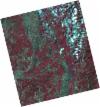
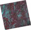
DE2_OPER_HRA_PSH_1C_20210820T105916_N39-987_W008-417_0001
Download Product | Product Info | Browse
Platform Short Name | GEOSAT |
Platform Serial Identifier | 2 |
Product Type | HRA_PSH_1C |
Start Date | 2021-08-20T10:59:16Z |
Stop Date | 2021-08-20T10:59:19Z |
Original Name | DE2_PSH_L1C_000000_20210820T105916_20210820T105919_DE2_38855_9F3A.zip |
Footprint | 39.9385346222 -8.32737498875 40.0609404646 -8.36409287805 40.0355622976 -8.50742587261 39.9132196555 -8.47039458023 39.9385346222 -8.32737498875 |
Orbit Direction | ASCENDING |
Scene Centre Longitude | W008 |
Scene Centre Latitude | N39 |
Cloud Cover Percentage | -1 |
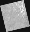
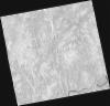
DE2_OPER_HRA_PM4_1C_20210820T105916_N39-987_W008-417_0001
Download Product | Product Info | Browse
Platform Short Name | GEOSAT |
Platform Serial Identifier | 2 |
Product Type | HRA_PM4_1C |
Start Date | 2021-08-20T10:59:16Z |
Stop Date | 2021-08-20T10:59:19Z |
Original Name | DE2_PM4_L1C_000000_20210820T105916_20210820T105919_DE2_38855_9F3A.zip |
Footprint | 39.9385346222 -8.32737498875 40.0609404646 -8.36409287805 40.0355622976 -8.50742587261 39.9132196555 -8.47039458023 39.9385346222 -8.32737498875 |
Orbit Direction | ASCENDING |
Scene Centre Longitude | W008 |
Scene Centre Latitude | N39 |
Cloud Cover Percentage | -1 |
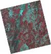
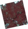
DE2_OPER_HRA_PSH_1C_20210820T105915_N39-876_W008-383_0001
Download Product | Product Info | Browse
Platform Short Name | GEOSAT |
Platform Serial Identifier | 2 |
Product Type | HRA_PSH_1C |
Start Date | 2021-08-20T10:59:15Z |
Stop Date | 2021-08-20T10:59:17Z |
Original Name | DE2_PSH_L1C_000000_20210820T105915_20210820T105917_DE2_38855_6434.zip |
Footprint | 39.8275015186 -8.2940244623 39.9498726369 -8.3307407587 39.9245471213 -8.4738179633 39.8021851667 -8.43684275877 39.8275015186 -8.2940244623 |
Orbit Direction | ASCENDING |
Scene Centre Longitude | W008 |
Scene Centre Latitude | N39 |
Cloud Cover Percentage | -1 |
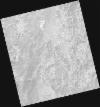
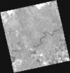
DE2_OPER_HRA_PM4_1C_20210820T105915_N39-876_W008-383_0001
Download Product | Product Info | Browse
Platform Short Name | GEOSAT |
Platform Serial Identifier | 2 |
Product Type | HRA_PM4_1C |
Start Date | 2021-08-20T10:59:15Z |
Stop Date | 2021-08-20T10:59:17Z |
Original Name | DE2_PM4_L1C_000000_20210820T105915_20210820T105917_DE2_38855_6434.zip |
Footprint | 39.8275015186 -8.2940244623 39.9498726369 -8.3307407587 39.9245471213 -8.4738179633 39.8021851667 -8.43684275877 39.8275015186 -8.2940244623 |
Orbit Direction | ASCENDING |
Scene Centre Longitude | W008 |
Scene Centre Latitude | N39 |
Cloud Cover Percentage | -1 |
DE2_OPER_HRA_PSH_1C_20210626T111533_N39-903_W008-304_0001
Download Product | Product Info | Browse
Platform Short Name | GEOSAT |
Platform Serial Identifier | 2 |
Product Type | HRA_PSH_1C |
Start Date | 2021-06-26T11:15:33Z |
Stop Date | 2021-06-26T11:15:36Z |
Original Name | DE2_PSH_L1C_000000_20210626T111533_20210626T111536_DE2_38039_DCF5.zip |
Footprint | 39.8461165961 -8.19226445048 39.9868483292 -8.2284969738 39.9614853447 -8.41644741929 39.8205962196 -8.38179873819 39.8461165961 -8.19226445048 |
Orbit Direction | ASCENDING |
Scene Centre Longitude | W008 |
Scene Centre Latitude | N39 |
Cloud Cover Percentage | -1 |
DE2_OPER_HRA_PM4_1C_20210626T111533_N39-903_W008-304_0001
Download Product | Product Info | Browse
Platform Short Name | GEOSAT |
Platform Serial Identifier | 2 |
Product Type | HRA_PM4_1C |
Start Date | 2021-06-26T11:15:33Z |
Stop Date | 2021-06-26T11:15:36Z |
Original Name | DE2_PM4_L1C_000000_20210626T111533_20210626T111536_DE2_38039_DCF5.zip |
Footprint | 39.8461165961 -8.19226445048 39.9868483292 -8.2284969738 39.9614853447 -8.41644741929 39.8205962196 -8.38179873819 39.8461165961 -8.19226445048 |
Orbit Direction | ASCENDING |
Scene Centre Longitude | W008 |
Scene Centre Latitude | N39 |
Cloud Cover Percentage | -1 |
DE2_OPER_HRA_PSH_1C_20210613T110656_N39-871_W008-213_0001
Download Product | Product Info | Browse
Platform Short Name | GEOSAT |
Platform Serial Identifier | 2 |
Product Type | HRA_PSH_1C |
Start Date | 2021-06-13T11:06:56Z |
Stop Date | 2021-06-13T11:06:59Z |
Original Name | DE2_PSH_L1C_000000_20210613T110656_20210613T110659_DE2_37846_AFBE.zip |
Footprint | 39.8209031374 -8.12049894281 39.9474669581 -8.15578025257 39.9229636672 -8.30751723154 39.7964618024 -8.27173168239 39.8209031374 -8.12049894281 |
Orbit Direction | ASCENDING |
Scene Centre Longitude | W008 |
Scene Centre Latitude | N39 |
Cloud Cover Percentage | -1 |
DE2_OPER_HRA_PM4_1C_20210613T110656_N39-871_W008-213_0001
Download Product | Product Info | Browse
Platform Short Name | GEOSAT |
Platform Serial Identifier | 2 |
Product Type | HRA_PM4_1C |
Start Date | 2021-06-13T11:06:56Z |
Stop Date | 2021-06-13T11:06:59Z |
Original Name | DE2_PM4_L1C_000000_20210613T110656_20210613T110659_DE2_37846_AFBE.zip |
Footprint | 39.8209031374 -8.12049894281 39.9474669581 -8.15578025257 39.9229636672 -8.30751723154 39.7964618024 -8.27173168239 39.8209031374 -8.12049894281 |
Orbit Direction | ASCENDING |
Scene Centre Longitude | W008 |
Scene Centre Latitude | N39 |
Cloud Cover Percentage | -1 |
DE2_OPER_HRA_PSH_1C_20210325T111849_N39-801_W008-363_0001
Download Product | Product Info | Browse
Platform Short Name | GEOSAT |
Platform Serial Identifier | 2 |
Product Type | HRA_PSH_1C |
Start Date | 2021-03-25T11:18:49Z |
Stop Date | 2021-03-25T11:18:52Z |
Original Name | DE2_PSH_L1C_000000_20210325T111849_20210325T111852_DE2_36659_208B.zip |
Footprint | 39.7440449946 -8.25069739935 39.8846766679 -8.28638611162 39.8592557381 -8.47506227431 39.7185086683 -8.4401578155 39.7440449946 -8.25069739935 |
Orbit Direction | ASCENDING |
Scene Centre Longitude | W008 |
Scene Centre Latitude | N39 |
Cloud Cover Percentage | -1 |
DE2_OPER_HRA_PM4_1C_20210325T111849_N39-801_W008-363_0001
Download Product | Product Info | Browse
Platform Short Name | GEOSAT |
Platform Serial Identifier | 2 |
Product Type | HRA_PM4_1C |
Start Date | 2021-03-25T11:18:49Z |
Stop Date | 2021-03-25T11:18:52Z |
Original Name | DE2_PM4_L1C_000000_20210325T111849_20210325T111852_DE2_36659_208B.zip |
Footprint | 39.7440449946 -8.25069739935 39.8846766679 -8.28638611162 39.8592557381 -8.47506227431 39.7185086683 -8.4401578155 39.7440449946 -8.25069739935 |
Orbit Direction | ASCENDING |
Scene Centre Longitude | W008 |
Scene Centre Latitude | N39 |
Cloud Cover Percentage | -1 |