ESA TPM Map Catalogue - Product List
back to previous node |
list of download URLs
Collection G2_Portugal_2021
GEOSAT-2 Portugal Coverage 2021 collection. More details here.
List of available products (latitude from 39.8583 to 39.9368 dg, longitude from -8.54375 to -8.39938 dg)..
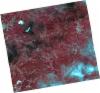
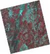
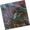
DE2_OPER_HRA_PSH_1C_20211010T111558_N39-880_W008-507_0001
Download Product | Product Info | Browse
Platform Short Name | GEOSAT |
Platform Serial Identifier | 2 |
Product Type | HRA_PSH_1C |
Start Date | 2021-10-10T11:15:58Z |
Stop Date | 2021-10-10T11:16:01Z |
Original Name | DE2_PSH_L1C_000000_20211010T111558_20211010T111601_DE2_39612_30A3.zip |
Footprint | 39.8191940721 -8.38498357563 39.9676130415 -8.41889822304 39.941480509 -8.62911710858 39.7929499451 -8.59638311344 39.8191940721 -8.38498357563 |
Orbit Direction | ASCENDING |
Scene Centre Longitude | W008 |
Scene Centre Latitude | N39 |
Cloud Cover Percentage | -1 |
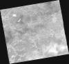
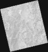
DE2_OPER_HRA_PM4_1C_20211010T111558_N39-880_W008-507_0001
Download Product | Product Info | Browse
Platform Short Name | GEOSAT |
Platform Serial Identifier | 2 |
Product Type | HRA_PM4_1C |
Start Date | 2021-10-10T11:15:58Z |
Stop Date | 2021-10-10T11:16:01Z |
Original Name | DE2_PM4_L1C_000000_20211010T111558_20211010T111601_DE2_39612_30A3.zip |
Footprint | 39.8191940721 -8.38498357563 39.9676130415 -8.41889822304 39.941480509 -8.62911710858 39.7929499451 -8.59638311344 39.8191940721 -8.38498357563 |
Orbit Direction | ASCENDING |
Scene Centre Longitude | W008 |
Scene Centre Latitude | N39 |
Cloud Cover Percentage | -1 |
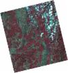
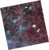
DE2_OPER_HRA_PSH_1C_20210820T105916_N39-987_W008-417_0001
Download Product | Product Info | Browse
Platform Short Name | GEOSAT |
Platform Serial Identifier | 2 |
Product Type | HRA_PSH_1C |
Start Date | 2021-08-20T10:59:16Z |
Stop Date | 2021-08-20T10:59:19Z |
Original Name | DE2_PSH_L1C_000000_20210820T105916_20210820T105919_DE2_38855_9F3A.zip |
Footprint | 39.9385346222 -8.32737498875 40.0609404646 -8.36409287805 40.0355622976 -8.50742587261 39.9132196555 -8.47039458023 39.9385346222 -8.32737498875 |
Orbit Direction | ASCENDING |
Scene Centre Longitude | W008 |
Scene Centre Latitude | N39 |
Cloud Cover Percentage | -1 |
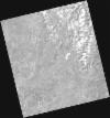
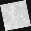
DE2_OPER_HRA_PM4_1C_20210820T105916_N39-987_W008-417_0001
Download Product | Product Info | Browse
Platform Short Name | GEOSAT |
Platform Serial Identifier | 2 |
Product Type | HRA_PM4_1C |
Start Date | 2021-08-20T10:59:16Z |
Stop Date | 2021-08-20T10:59:19Z |
Original Name | DE2_PM4_L1C_000000_20210820T105916_20210820T105919_DE2_38855_9F3A.zip |
Footprint | 39.9385346222 -8.32737498875 40.0609404646 -8.36409287805 40.0355622976 -8.50742587261 39.9132196555 -8.47039458023 39.9385346222 -8.32737498875 |
Orbit Direction | ASCENDING |
Scene Centre Longitude | W008 |
Scene Centre Latitude | N39 |
Cloud Cover Percentage | -1 |
DE2_OPER_HRA_PSH_1C_20210820T105915_N39-876_W008-383_0001
Download Product | Product Info | Browse
Platform Short Name | GEOSAT |
Platform Serial Identifier | 2 |
Product Type | HRA_PSH_1C |
Start Date | 2021-08-20T10:59:15Z |
Stop Date | 2021-08-20T10:59:17Z |
Original Name | DE2_PSH_L1C_000000_20210820T105915_20210820T105917_DE2_38855_6434.zip |
Footprint | 39.8275015186 -8.2940244623 39.9498726369 -8.3307407587 39.9245471213 -8.4738179633 39.8021851667 -8.43684275877 39.8275015186 -8.2940244623 |
Orbit Direction | ASCENDING |
Scene Centre Longitude | W008 |
Scene Centre Latitude | N39 |
Cloud Cover Percentage | -1 |
DE2_OPER_HRA_PM4_1C_20210820T105915_N39-876_W008-383_0001
Download Product | Product Info | Browse
Platform Short Name | GEOSAT |
Platform Serial Identifier | 2 |
Product Type | HRA_PM4_1C |
Start Date | 2021-08-20T10:59:15Z |
Stop Date | 2021-08-20T10:59:17Z |
Original Name | DE2_PM4_L1C_000000_20210820T105915_20210820T105917_DE2_38855_6434.zip |
Footprint | 39.8275015186 -8.2940244623 39.9498726369 -8.3307407587 39.9245471213 -8.4738179633 39.8021851667 -8.43684275877 39.8275015186 -8.2940244623 |
Orbit Direction | ASCENDING |
Scene Centre Longitude | W008 |
Scene Centre Latitude | N39 |
Cloud Cover Percentage | -1 |
DE2_OPER_HRA_PSH_1C_20210331T111541_N39-929_W008-618_0001
Download Product | Product Info | Browse
Platform Short Name | GEOSAT |
Platform Serial Identifier | 2 |
Product Type | HRA_PSH_1C |
Start Date | 2021-03-31T11:15:41Z |
Stop Date | 2021-03-31T11:15:43Z |
Original Name | DE2_PSH_L1C_000000_20210331T111541_20210331T111543_DE2_36748_83F0.zip |
Footprint | 39.8749478769 -8.51737341623 40.0080706401 -8.55162169119 39.983334163 -8.72004441448 39.8501855703 -8.68571013271 39.8749478769 -8.51737341623 |
Orbit Direction | ASCENDING |
Scene Centre Longitude | W008 |
Scene Centre Latitude | N39 |
Cloud Cover Percentage | -1 |
DE2_OPER_HRA_PM4_1C_20210331T111541_N39-929_W008-618_0001
Download Product | Product Info | Browse
Platform Short Name | GEOSAT |
Platform Serial Identifier | 2 |
Product Type | HRA_PM4_1C |
Start Date | 2021-03-31T11:15:41Z |
Stop Date | 2021-03-31T11:15:43Z |
Original Name | DE2_PM4_L1C_000000_20210331T111541_20210331T111543_DE2_36748_83F0.zip |
Footprint | 39.8749478769 -8.51737341623 40.0080706401 -8.55162169119 39.983334163 -8.72004441448 39.8501855703 -8.68571013271 39.8749478769 -8.51737341623 |
Orbit Direction | ASCENDING |
Scene Centre Longitude | W008 |
Scene Centre Latitude | N39 |
Cloud Cover Percentage | -1 |
DE2_OPER_HRA_PSH_1C_20210331T111539_N39-808_W008-587_0001
Download Product | Product Info | Browse
Platform Short Name | GEOSAT |
Platform Serial Identifier | 2 |
Product Type | HRA_PSH_1C |
Start Date | 2021-03-31T11:15:39Z |
Stop Date | 2021-03-31T11:15:41Z |
Original Name | DE2_PSH_L1C_000000_20210331T111539_20210331T111541_DE2_36748_AD16.zip |
Footprint | 39.7542247987 -8.48591991272 39.8872995357 -8.52040083488 39.8625070148 -8.68915266162 39.7293741066 -8.65496272593 39.7542247987 -8.48591991272 |
Orbit Direction | ASCENDING |
Scene Centre Longitude | W008 |
Scene Centre Latitude | N39 |
Cloud Cover Percentage | -1 |
DE2_OPER_HRA_PM4_1C_20210331T111539_N39-808_W008-587_0001
Download Product | Product Info | Browse
Platform Short Name | GEOSAT |
Platform Serial Identifier | 2 |
Product Type | HRA_PM4_1C |
Start Date | 2021-03-31T11:15:39Z |
Stop Date | 2021-03-31T11:15:41Z |
Original Name | DE2_PM4_L1C_000000_20210331T111539_20210331T111541_DE2_36748_AD16.zip |
Footprint | 39.7542247987 -8.48591991272 39.8872995357 -8.52040083488 39.8625070148 -8.68915266162 39.7293741066 -8.65496272593 39.7542247987 -8.48591991272 |
Orbit Direction | ASCENDING |
Scene Centre Longitude | W008 |
Scene Centre Latitude | N39 |
Cloud Cover Percentage | -1 |
DE2_OPER_HRA_PSH_1C_20210325T111849_N39-801_W008-363_0001
Download Product | Product Info | Browse
Platform Short Name | GEOSAT |
Platform Serial Identifier | 2 |
Product Type | HRA_PSH_1C |
Start Date | 2021-03-25T11:18:49Z |
Stop Date | 2021-03-25T11:18:52Z |
Original Name | DE2_PSH_L1C_000000_20210325T111849_20210325T111852_DE2_36659_208B.zip |
Footprint | 39.7440449946 -8.25069739935 39.8846766679 -8.28638611162 39.8592557381 -8.47506227431 39.7185086683 -8.4401578155 39.7440449946 -8.25069739935 |
Orbit Direction | ASCENDING |
Scene Centre Longitude | W008 |
Scene Centre Latitude | N39 |
Cloud Cover Percentage | -1 |
DE2_OPER_HRA_PM4_1C_20210325T111849_N39-801_W008-363_0001
Download Product | Product Info | Browse
Platform Short Name | GEOSAT |
Platform Serial Identifier | 2 |
Product Type | HRA_PM4_1C |
Start Date | 2021-03-25T11:18:49Z |
Stop Date | 2021-03-25T11:18:52Z |
Original Name | DE2_PM4_L1C_000000_20210325T111849_20210325T111852_DE2_36659_208B.zip |
Footprint | 39.7440449946 -8.25069739935 39.8846766679 -8.28638611162 39.8592557381 -8.47506227431 39.7185086683 -8.4401578155 39.7440449946 -8.25069739935 |
Orbit Direction | ASCENDING |
Scene Centre Longitude | W008 |
Scene Centre Latitude | N39 |
Cloud Cover Percentage | -1 |