ESA TPM Map Catalogue - Product List
back to previous node |
list of download URLs
Collection G2_Portugal_2021
GEOSAT-2 Portugal Coverage 2021 collection. More details here.
List of available products (latitude from 39.7799 to 39.8583 dg, longitude from -7.4675 to -7.32313 dg)..
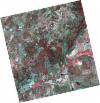
DE2_OPER_HRA_PSH_1C_20210714T110504_N39-839_W007-382_0001
Download Product | Product Info | BrowsePlatform Short Name | GEOSAT |
Platform Serial Identifier | 2 |
Product Type | HRA_PSH_1C |
Start Date | 2021-07-14T11:05:04Z |
Stop Date | 2021-07-14T11:05:07Z |
Original Name | DE2_PSH_L1C_000000_20210714T110504_20210714T110507_DE2_38306_D09D.zip |
Footprint | 39.7876479449 -7.28550346607 39.9166885121 -7.31982857625 39.8920986257 -7.47931543877 39.7631326395 -7.44417504189 39.7876479449 -7.28550346607 |
Orbit Direction | ASCENDING |
Scene Centre Longitude | W007 |
Scene Centre Latitude | N39 |
Cloud Cover Percentage | -1 |
DE2_OPER_HRA_PM4_1C_20210714T110504_N39-839_W007-382_0001
Download Product | Product Info | BrowsePlatform Short Name | GEOSAT |
Platform Serial Identifier | 2 |
Product Type | HRA_PM4_1C |
Start Date | 2021-07-14T11:05:04Z |
Stop Date | 2021-07-14T11:05:07Z |
Original Name | DE2_PM4_L1C_000000_20210714T110504_20210714T110507_DE2_38306_D09D.zip |
Footprint | 39.7876479449 -7.28550346607 39.9166885121 -7.31982857625 39.8920986257 -7.47931543877 39.7631326395 -7.44417504189 39.7876479449 -7.28550346607 |
Orbit Direction | ASCENDING |
Scene Centre Longitude | W007 |
Scene Centre Latitude | N39 |
Cloud Cover Percentage | -1 |
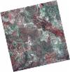
DE2_OPER_HRA_PSH_1C_20210714T110502_N39-722_W007-350_0001
Download Product | Product Info | BrowsePlatform Short Name | GEOSAT |
Platform Serial Identifier | 2 |
Product Type | HRA_PSH_1C |
Start Date | 2021-07-14T11:05:02Z |
Stop Date | 2021-07-14T11:05:05Z |
Original Name | DE2_PSH_L1C_000000_20210714T110502_20210714T110505_DE2_38306_8162.zip |
Footprint | 39.6704335401 -7.25474199393 39.799603787 -7.28888575557 39.775069153 -7.44745288624 39.645997985 -7.41286371247 39.6704335401 -7.25474199393 |
Orbit Direction | ASCENDING |
Scene Centre Longitude | W007 |
Scene Centre Latitude | N39 |
Cloud Cover Percentage | -1 |
DE2_OPER_HRA_PM4_1C_20210714T110502_N39-722_W007-350_0001
Download Product | Product Info | BrowsePlatform Short Name | GEOSAT |
Platform Serial Identifier | 2 |
Product Type | HRA_PM4_1C |
Start Date | 2021-07-14T11:05:02Z |
Stop Date | 2021-07-14T11:05:05Z |
Original Name | DE2_PM4_L1C_000000_20210714T110502_20210714T110505_DE2_38306_8162.zip |
Footprint | 39.6704335401 -7.25474199393 39.799603787 -7.28888575557 39.775069153 -7.44745288624 39.645997985 -7.41286371247 39.6704335401 -7.25474199393 |
Orbit Direction | ASCENDING |
Scene Centre Longitude | W007 |
Scene Centre Latitude | N39 |
Cloud Cover Percentage | -1 |
DE2_OPER_HRA_PSH_1C_20210531T105814_N39-884_W007-316_0001
Download Product | Product Info | BrowsePlatform Short Name | GEOSAT |
Platform Serial Identifier | 2 |
Product Type | HRA_PSH_1C |
Start Date | 2021-05-31T10:58:14Z |
Stop Date | 2021-05-31T10:58:17Z |
Original Name | DE2_PSH_L1C_000000_20210531T105814_20210531T105817_DE2_37653_5ACC.zip |
Footprint | 39.8354533963 -7.22616190538 39.958307742 -7.26277419771 39.9330787352 -7.40628641404 39.8102575017 -7.36942855683 39.8354533963 -7.22616190538 |
Orbit Direction | ASCENDING |
Scene Centre Longitude | W007 |
Scene Centre Latitude | N39 |
Cloud Cover Percentage | -1 |
DE2_OPER_HRA_PM4_1C_20210531T105814_N39-884_W007-316_0001
Download Product | Product Info | BrowsePlatform Short Name | GEOSAT |
Platform Serial Identifier | 2 |
Product Type | HRA_PM4_1C |
Start Date | 2021-05-31T10:58:14Z |
Stop Date | 2021-05-31T10:58:17Z |
Original Name | DE2_PM4_L1C_000000_20210531T105814_20210531T105817_DE2_37653_5ACC.zip |
Footprint | 39.8354533963 -7.22616190538 39.958307742 -7.26277419771 39.9330787352 -7.40628641404 39.8102575017 -7.36942855683 39.8354533963 -7.22616190538 |
Orbit Direction | ASCENDING |
Scene Centre Longitude | W007 |
Scene Centre Latitude | N39 |
Cloud Cover Percentage | -1 |
DE2_OPER_HRA_PSH_1C_20210519T110458_N39-876_W007-527_0001
Download Product | Product Info | BrowsePlatform Short Name | GEOSAT |
Platform Serial Identifier | 2 |
Product Type | HRA_PSH_1C |
Start Date | 2021-05-19T11:04:58Z |
Stop Date | 2021-05-19T11:05:01Z |
Original Name | DE2_PSH_L1C_000000_20210519T110458_20210519T110501_DE2_37475_D7CD.zip |
Footprint | 39.8253127825 -7.43370297166 39.9514106628 -7.46896833055 39.926958966 -7.62036372852 39.8008571979 -7.58504222827 39.8253127825 -7.43370297166 |
Orbit Direction | ASCENDING |
Scene Centre Longitude | W007 |
Scene Centre Latitude | N39 |
Cloud Cover Percentage | -1 |
DE2_OPER_HRA_PM4_1C_20210519T110458_N39-876_W007-527_0001
Download Product | Product Info | BrowsePlatform Short Name | GEOSAT |
Platform Serial Identifier | 2 |
Product Type | HRA_PM4_1C |
Start Date | 2021-05-19T11:04:58Z |
Stop Date | 2021-05-19T11:05:01Z |
Original Name | DE2_PM4_L1C_000000_20210519T110458_20210519T110501_DE2_37475_D7CD.zip |
Footprint | 39.8253127825 -7.43370297166 39.9514106628 -7.46896833055 39.926958966 -7.62036372852 39.8008571979 -7.58504222827 39.8253127825 -7.43370297166 |
Orbit Direction | ASCENDING |
Scene Centre Longitude | W007 |
Scene Centre Latitude | N39 |
Cloud Cover Percentage | -1 |
DE2_OPER_HRA_PSH_1C_20210519T110456_N39-761_W007-494_0001
Download Product | Product Info | BrowsePlatform Short Name | GEOSAT |
Platform Serial Identifier | 2 |
Product Type | HRA_PSH_1C |
Start Date | 2021-05-19T11:04:56Z |
Stop Date | 2021-05-19T11:04:59Z |
Original Name | DE2_PSH_L1C_000000_20210519T110456_20210519T110459_DE2_37475_AC55.zip |
Footprint | 39.7109334668 -7.40190999705 39.8369799981 -7.4370402979 39.8125785705 -7.58817523349 39.6865388099 -7.55278860016 39.7109334668 -7.40190999705 |
Orbit Direction | ASCENDING |
Scene Centre Longitude | W007 |
Scene Centre Latitude | N39 |
Cloud Cover Percentage | -1 |
DE2_OPER_HRA_PM4_1C_20210519T110456_N39-761_W007-494_0001
Download Product | Product Info | BrowsePlatform Short Name | GEOSAT |
Platform Serial Identifier | 2 |
Product Type | HRA_PM4_1C |
Start Date | 2021-05-19T11:04:56Z |
Stop Date | 2021-05-19T11:04:59Z |
Original Name | DE2_PM4_L1C_000000_20210519T110456_20210519T110459_DE2_37475_AC55.zip |
Footprint | 39.7109334668 -7.40190999705 39.8369799981 -7.4370402979 39.8125785705 -7.58817523349 39.6865388099 -7.55278860016 39.7109334668 -7.40190999705 |
Orbit Direction | ASCENDING |
Scene Centre Longitude | W007 |
Scene Centre Latitude | N39 |
Cloud Cover Percentage | -1 |
