ESA TPM Map Catalogue - Product List
back to previous node |
list of download URLs
Collection G2_Portugal_2021
GEOSAT-2 Portugal Coverage 2021 collection. More details here.
List of available products (latitude from 39.7799 to 39.8583 dg, longitude from -7.61188 to -7.4675 dg)..
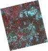
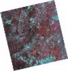
DE2_OPER_HRA_PSH_1C_20210720T110135_N39-880_W007-666_0001
Download Product | Product Info | Browse
Platform Short Name | GEOSAT |
Platform Serial Identifier | 2 |
Product Type | HRA_PSH_1C |
Start Date | 2021-07-20T11:01:35Z |
Stop Date | 2021-07-20T11:01:37Z |
Original Name | DE2_PSH_L1C_000000_20210720T110135_20210720T110137_DE2_38395_3CE6.zip |
Footprint | 39.8304008889 -7.57520744855 39.9553099021 -7.61060128434 39.930648983 -7.75849329923 39.8058555925 -7.7222969541 39.8304008889 -7.57520744855 |
Orbit Direction | ASCENDING |
Scene Centre Longitude | W007 |
Scene Centre Latitude | N39 |
Cloud Cover Percentage | -1 |
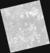
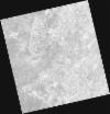
DE2_OPER_HRA_PM4_1C_20210720T110135_N39-880_W007-666_0001
Download Product | Product Info | Browse
Platform Short Name | GEOSAT |
Platform Serial Identifier | 2 |
Product Type | HRA_PM4_1C |
Start Date | 2021-07-20T11:01:35Z |
Stop Date | 2021-07-20T11:01:37Z |
Original Name | DE2_PM4_L1C_000000_20210720T110135_20210720T110137_DE2_38395_3CE6.zip |
Footprint | 39.8304008889 -7.57520744855 39.9553099021 -7.61060128434 39.930648983 -7.75849329923 39.8058555925 -7.7222969541 39.8304008889 -7.57520744855 |
Orbit Direction | ASCENDING |
Scene Centre Longitude | W007 |
Scene Centre Latitude | N39 |
Cloud Cover Percentage | -1 |
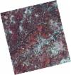
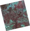
DE2_OPER_HRA_PSH_1C_20210720T110133_N39-767_W007-634_0001
Download Product | Product Info | Browse
Platform Short Name | GEOSAT |
Platform Serial Identifier | 2 |
Product Type | HRA_PSH_1C |
Start Date | 2021-07-20T11:01:33Z |
Stop Date | 2021-07-20T11:01:36Z |
Original Name | DE2_PSH_L1C_000000_20210720T110133_20210720T110136_DE2_38395_1CB7.zip |
Footprint | 39.7171475258 -7.54291789352 39.8419425363 -7.5785452892 39.817366409 -7.72565895322 39.6926210926 -7.68999477548 39.7171475258 -7.54291789352 |
Orbit Direction | ASCENDING |
Scene Centre Longitude | W007 |
Scene Centre Latitude | N39 |
Cloud Cover Percentage | -1 |
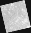
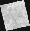
DE2_OPER_HRA_PM4_1C_20210720T110133_N39-767_W007-634_0001
Download Product | Product Info | Browse
Platform Short Name | GEOSAT |
Platform Serial Identifier | 2 |
Product Type | HRA_PM4_1C |
Start Date | 2021-07-20T11:01:33Z |
Stop Date | 2021-07-20T11:01:36Z |
Original Name | DE2_PM4_L1C_000000_20210720T110133_20210720T110136_DE2_38395_1CB7.zip |
Footprint | 39.7171475258 -7.54291789352 39.8419425363 -7.5785452892 39.817366409 -7.72565895322 39.6926210926 -7.68999477548 39.7171475258 -7.54291789352 |
Orbit Direction | ASCENDING |
Scene Centre Longitude | W007 |
Scene Centre Latitude | N39 |
Cloud Cover Percentage | -1 |
DE2_OPER_HRA_PSH_1C_20210519T110458_N39-876_W007-527_0001
Download Product | Product Info | Browse
Platform Short Name | GEOSAT |
Platform Serial Identifier | 2 |
Product Type | HRA_PSH_1C |
Start Date | 2021-05-19T11:04:58Z |
Stop Date | 2021-05-19T11:05:01Z |
Original Name | DE2_PSH_L1C_000000_20210519T110458_20210519T110501_DE2_37475_D7CD.zip |
Footprint | 39.8253127825 -7.43370297166 39.9514106628 -7.46896833055 39.926958966 -7.62036372852 39.8008571979 -7.58504222827 39.8253127825 -7.43370297166 |
Orbit Direction | ASCENDING |
Scene Centre Longitude | W007 |
Scene Centre Latitude | N39 |
Cloud Cover Percentage | -1 |
DE2_OPER_HRA_PM4_1C_20210519T110458_N39-876_W007-527_0001
Download Product | Product Info | Browse
Platform Short Name | GEOSAT |
Platform Serial Identifier | 2 |
Product Type | HRA_PM4_1C |
Start Date | 2021-05-19T11:04:58Z |
Stop Date | 2021-05-19T11:05:01Z |
Original Name | DE2_PM4_L1C_000000_20210519T110458_20210519T110501_DE2_37475_D7CD.zip |
Footprint | 39.8253127825 -7.43370297166 39.9514106628 -7.46896833055 39.926958966 -7.62036372852 39.8008571979 -7.58504222827 39.8253127825 -7.43370297166 |
Orbit Direction | ASCENDING |
Scene Centre Longitude | W007 |
Scene Centre Latitude | N39 |
Cloud Cover Percentage | -1 |
DE2_OPER_HRA_PSH_1C_20210519T110456_N39-761_W007-494_0001
Download Product | Product Info | Browse
Platform Short Name | GEOSAT |
Platform Serial Identifier | 2 |
Product Type | HRA_PSH_1C |
Start Date | 2021-05-19T11:04:56Z |
Stop Date | 2021-05-19T11:04:59Z |
Original Name | DE2_PSH_L1C_000000_20210519T110456_20210519T110459_DE2_37475_AC55.zip |
Footprint | 39.7109334668 -7.40190999705 39.8369799981 -7.4370402979 39.8125785705 -7.58817523349 39.6865388099 -7.55278860016 39.7109334668 -7.40190999705 |
Orbit Direction | ASCENDING |
Scene Centre Longitude | W007 |
Scene Centre Latitude | N39 |
Cloud Cover Percentage | -1 |
DE2_OPER_HRA_PM4_1C_20210519T110456_N39-761_W007-494_0001
Download Product | Product Info | Browse
Platform Short Name | GEOSAT |
Platform Serial Identifier | 2 |
Product Type | HRA_PM4_1C |
Start Date | 2021-05-19T11:04:56Z |
Stop Date | 2021-05-19T11:04:59Z |
Original Name | DE2_PM4_L1C_000000_20210519T110456_20210519T110459_DE2_37475_AC55.zip |
Footprint | 39.7109334668 -7.40190999705 39.8369799981 -7.4370402979 39.8125785705 -7.58817523349 39.6865388099 -7.55278860016 39.7109334668 -7.40190999705 |
Orbit Direction | ASCENDING |
Scene Centre Longitude | W007 |
Scene Centre Latitude | N39 |
Cloud Cover Percentage | -1 |