ESA TPM Map Catalogue - Product List
back to previous node |
list of download URLs


Collection G2_Portugal_2021
GEOSAT-2 Portugal Coverage 2021 collection. More details here.
List of available products (latitude from 39.7015 to 39.7799 dg, longitude from -7.90062 to -7.75625 dg)..
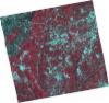
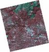
DE2_OPER_HRA_PSH_1C_20210727T111330_N39-819_W007-723_0001
Download Product | Product Info | Browse
Platform Short Name | GEOSAT |
Platform Serial Identifier | 2 |
Product Type | HRA_PSH_1C |
Start Date | 2021-07-27T11:13:30Z |
Stop Date | 2021-07-27T11:13:33Z |
Original Name | DE2_PSH_L1C_000000_20210727T111330_20210727T111333_DE2_38499_4577.zip |
Footprint | 39.7610472772 -7.60769349565 39.9043257773 -7.64122542287 39.8783527021 -7.84050231429 39.7353727451 -7.80370910396 39.7610472772 -7.60769349565 |
Orbit Direction | ASCENDING |
Scene Centre Longitude | W007 |
Scene Centre Latitude | N39 |
Cloud Cover Percentage | -1 |
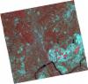
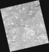
DE2_OPER_HRA_PM4_1C_20210727T111330_N39-819_W007-723_0001
Download Product | Product Info | Browse
Platform Short Name | GEOSAT |
Platform Serial Identifier | 2 |
Product Type | HRA_PM4_1C |
Start Date | 2021-07-27T11:13:30Z |
Stop Date | 2021-07-27T11:13:33Z |
Original Name | DE2_PM4_L1C_000000_20210727T111330_20210727T111333_DE2_38499_4577.zip |
Footprint | 39.7610472772 -7.60769349565 39.9043257773 -7.64122542287 39.8783527021 -7.84050231429 39.7353727451 -7.80370910396 39.7610472772 -7.60769349565 |
Orbit Direction | ASCENDING |
Scene Centre Longitude | W007 |
Scene Centre Latitude | N39 |
Cloud Cover Percentage | -1 |
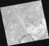
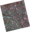
DE2_OPER_HRA_PSH_1C_20210727T111328_N39-689_W007-691_0001
Download Product | Product Info | Browse
Platform Short Name | GEOSAT |
Platform Serial Identifier | 2 |
Product Type | HRA_PSH_1C |
Start Date | 2021-07-27T11:13:28Z |
Stop Date | 2021-07-27T11:13:31Z |
Original Name | DE2_PSH_L1C_000000_20210727T111328_20210727T111331_DE2_38499_9B2D.zip |
Footprint | 39.6311731757 -7.5760789702 39.774370854 -7.61036743297 39.7486725166 -7.8064554338 39.6054499776 -7.77225374997 39.6311731757 -7.5760789702 |
Orbit Direction | ASCENDING |
Scene Centre Longitude | W007 |
Scene Centre Latitude | N39 |
Cloud Cover Percentage | -1 |
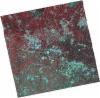
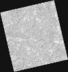
DE2_OPER_HRA_PM4_1C_20210727T111328_N39-689_W007-691_0001
Download Product | Product Info | Browse
Platform Short Name | GEOSAT |
Platform Serial Identifier | 2 |
Product Type | HRA_PM4_1C |
Start Date | 2021-07-27T11:13:28Z |
Stop Date | 2021-07-27T11:13:31Z |
Original Name | DE2_PM4_L1C_000000_20210727T111328_20210727T111331_DE2_38499_9B2D.zip |
Footprint | 39.6311731757 -7.5760789702 39.774370854 -7.61036743297 39.7486725166 -7.8064554338 39.6054499776 -7.77225374997 39.6311731757 -7.5760789702 |
Orbit Direction | ASCENDING |
Scene Centre Longitude | W007 |
Scene Centre Latitude | N39 |
Cloud Cover Percentage | -1 |
DE2_OPER_HRA_PSH_1C_20210702T111202_N39-734_W007-882_0001
Download Product | Product Info | Browse
Platform Short Name | GEOSAT |
Platform Serial Identifier | 2 |
Product Type | HRA_PSH_1C |
Start Date | 2021-07-02T11:12:02Z |
Stop Date | 2021-07-02T11:12:05Z |
Original Name | DE2_PSH_L1C_000000_20210702T111202_20210702T111205_DE2_38128_9A85.zip |
Footprint | 39.6788916143 -7.77494198909 39.8160011431 -7.8109170478 39.7907689861 -7.99063853567 39.6536372521 -7.95449434863 39.6788916143 -7.77494198909 |
Orbit Direction | ASCENDING |
Scene Centre Longitude | W007 |
Scene Centre Latitude | N39 |
Cloud Cover Percentage | -1 |
DE2_OPER_HRA_PM4_1C_20210702T111202_N39-734_W007-882_0001
Download Product | Product Info | Browse
Platform Short Name | GEOSAT |
Platform Serial Identifier | 2 |
Product Type | HRA_PM4_1C |
Start Date | 2021-07-02T11:12:02Z |
Stop Date | 2021-07-02T11:12:05Z |
Original Name | DE2_PM4_L1C_000000_20210702T111202_20210702T111205_DE2_38128_9A85.zip |
Footprint | 39.6788916143 -7.77494198909 39.8160011431 -7.8109170478 39.7907689861 -7.99063853567 39.6536372521 -7.95449434863 39.6788916143 -7.77494198909 |
Orbit Direction | ASCENDING |
Scene Centre Longitude | W007 |
Scene Centre Latitude | N39 |
Cloud Cover Percentage | -1 |
DE2_OPER_HRA_PSH_1C_20210318T110626_N39-764_W007-938_0001
Download Product | Product Info | Browse
Platform Short Name | GEOSAT |
Platform Serial Identifier | 2 |
Product Type | HRA_PSH_1C |
Start Date | 2021-03-18T11:06:26Z |
Stop Date | 2021-03-18T11:06:29Z |
Original Name | DE2_PSH_L1C_000000_20210318T110626_20210318T110629_DE2_36555_0F09.zip |
Footprint | 39.7138952967 -7.84755699559 39.8386696999 -7.88345452439 39.8141067552 -8.02998210885 39.6892771417 -7.99435732406 39.7138952967 -7.84755699559 |
Orbit Direction | ASCENDING |
Scene Centre Longitude | W007 |
Scene Centre Latitude | N39 |
Cloud Cover Percentage | -1 |
DE2_OPER_HRA_PM4_1C_20210318T110626_N39-764_W007-938_0001
Download Product | Product Info | Browse
Platform Short Name | GEOSAT |
Platform Serial Identifier | 2 |
Product Type | HRA_PM4_1C |
Start Date | 2021-03-18T11:06:26Z |
Stop Date | 2021-03-18T11:06:29Z |
Original Name | DE2_PM4_L1C_000000_20210318T110626_20210318T110629_DE2_36555_0F09.zip |
Footprint | 39.7138952967 -7.84755699559 39.8386696999 -7.88345452439 39.8141067552 -8.02998210885 39.6892771417 -7.99435732406 39.7138952967 -7.84755699559 |
Orbit Direction | ASCENDING |
Scene Centre Longitude | W007 |
Scene Centre Latitude | N39 |
Cloud Cover Percentage | -1 |
DE2_OPER_HRA_PSH_1C_20210318T110624_N39-650_W007-906_0001
Download Product | Product Info | Browse
Platform Short Name | GEOSAT |
Platform Serial Identifier | 2 |
Product Type | HRA_PSH_1C |
Start Date | 2021-03-18T11:06:24Z |
Stop Date | 2021-03-18T11:06:27Z |
Original Name | DE2_PSH_L1C_000000_20210318T110624_20210318T110627_DE2_36555_0466.zip |
Footprint | 39.6006120834 -7.81525571769 39.7254758352 -7.85079462603 39.7008414788 -7.99774118353 39.576004622 -7.96187035669 39.6006120834 -7.81525571769 |
Orbit Direction | ASCENDING |
Scene Centre Longitude | W007 |
Scene Centre Latitude | N39 |
Cloud Cover Percentage | -1 |
DE2_OPER_HRA_PM4_1C_20210318T110624_N39-650_W007-906_0001
Download Product | Product Info | Browse
Platform Short Name | GEOSAT |
Platform Serial Identifier | 2 |
Product Type | HRA_PM4_1C |
Start Date | 2021-03-18T11:06:24Z |
Stop Date | 2021-03-18T11:06:27Z |
Original Name | DE2_PM4_L1C_000000_20210318T110624_20210318T110627_DE2_36555_0466.zip |
Footprint | 39.6006120834 -7.81525571769 39.7254758352 -7.85079462603 39.7008414788 -7.99774118353 39.576004622 -7.96187035669 39.6006120834 -7.81525571769 |
Orbit Direction | ASCENDING |
Scene Centre Longitude | W007 |
Scene Centre Latitude | N39 |
Cloud Cover Percentage | -1 |