ESA TPM Map Catalogue - Product List
back to previous node |
list of download URLs

Collection G2_Portugal_2021
GEOSAT-2 Portugal Coverage 2021 collection. More details here.
List of available products (latitude from 39.7015 to 39.7799 dg, longitude from -8.54375 to -8.39938 dg)..
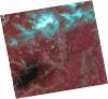
DE2_OPER_HRA_PSH_1C_20211010T111556_N39-745_W008-476_0001
Download Product | Product Info | Browse
Platform Short Name | GEOSAT |
Platform Serial Identifier | 2 |
Product Type | HRA_PSH_1C |
Start Date | 2021-10-10T11:15:56Z |
Stop Date | 2021-10-10T11:15:59Z |
Original Name | DE2_PSH_L1C_000000_20211010T111556_20211010T111559_DE2_39612_EDA0.zip |
Footprint | 39.6844846734 -8.35315499436 39.832908596 -8.38821824662 39.8066783738 -8.59943951961 39.6582610463 -8.56395347904 39.6844846734 -8.35315499436 |
Orbit Direction | ASCENDING |
Scene Centre Longitude | W008 |
Scene Centre Latitude | N39 |
Cloud Cover Percentage | -1 |
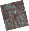
DE2_OPER_HRA_PM4_1C_20211010T111556_N39-745_W008-476_0001
Download Product | Product Info | Browse
Platform Short Name | GEOSAT |
Platform Serial Identifier | 2 |
Product Type | HRA_PM4_1C |
Start Date | 2021-10-10T11:15:56Z |
Stop Date | 2021-10-10T11:15:59Z |
Original Name | DE2_PM4_L1C_000000_20211010T111556_20211010T111559_DE2_39612_EDA0.zip |
Footprint | 39.6844846734 -8.35315499436 39.832908596 -8.38821824662 39.8066783738 -8.59943951961 39.6582610463 -8.56395347904 39.6844846734 -8.35315499436 |
Orbit Direction | ASCENDING |
Scene Centre Longitude | W008 |
Scene Centre Latitude | N39 |
Cloud Cover Percentage | -1 |
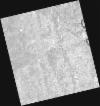
DE2_OPER_HRA_PSH_1C_20210820T105913_N39-765_W008-350_0001
Download Product | Product Info | Browse
Platform Short Name | GEOSAT |
Platform Serial Identifier | 2 |
Product Type | HRA_PSH_1C |
Start Date | 2021-08-20T10:59:13Z |
Stop Date | 2021-08-20T10:59:15Z |
Original Name | DE2_PSH_L1C_000000_20210820T105913_20210820T105915_DE2_38855_41FF.zip |
Footprint | 39.716566745 -8.26092624397 39.8388141788 -8.29747625524 39.8135275314 -8.44030777354 39.6912957352 -8.40352657293 39.716566745 -8.26092624397 |
Orbit Direction | ASCENDING |
Scene Centre Longitude | W008 |
Scene Centre Latitude | N39 |
Cloud Cover Percentage | -1 |
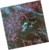
DE2_OPER_HRA_PM4_1C_20210820T105913_N39-765_W008-350_0001
Download Product | Product Info | Browse
Platform Short Name | GEOSAT |
Platform Serial Identifier | 2 |
Product Type | HRA_PM4_1C |
Start Date | 2021-08-20T10:59:13Z |
Stop Date | 2021-08-20T10:59:15Z |
Original Name | DE2_PM4_L1C_000000_20210820T105913_20210820T105915_DE2_38855_41FF.zip |
Footprint | 39.716566745 -8.26092624397 39.8388141788 -8.29747625524 39.8135275314 -8.44030777354 39.6912957352 -8.40352657293 39.716566745 -8.26092624397 |
Orbit Direction | ASCENDING |
Scene Centre Longitude | W008 |
Scene Centre Latitude | N39 |
Cloud Cover Percentage | -1 |
DE2_OPER_HRA_PSH_1C_20210331T111539_N39-808_W008-587_0001
Download Product | Product Info | Browse
Platform Short Name | GEOSAT |
Platform Serial Identifier | 2 |
Product Type | HRA_PSH_1C |
Start Date | 2021-03-31T11:15:39Z |
Stop Date | 2021-03-31T11:15:41Z |
Original Name | DE2_PSH_L1C_000000_20210331T111539_20210331T111541_DE2_36748_AD16.zip |
Footprint | 39.7542247987 -8.48591991272 39.8872995357 -8.52040083488 39.8625070148 -8.68915266162 39.7293741066 -8.65496272593 39.7542247987 -8.48591991272 |
Orbit Direction | ASCENDING |
Scene Centre Longitude | W008 |
Scene Centre Latitude | N39 |
Cloud Cover Percentage | -1 |
DE2_OPER_HRA_PM4_1C_20210331T111539_N39-808_W008-587_0001
Download Product | Product Info | Browse
Platform Short Name | GEOSAT |
Platform Serial Identifier | 2 |
Product Type | HRA_PM4_1C |
Start Date | 2021-03-31T11:15:39Z |
Stop Date | 2021-03-31T11:15:41Z |
Original Name | DE2_PM4_L1C_000000_20210331T111539_20210331T111541_DE2_36748_AD16.zip |
Footprint | 39.7542247987 -8.48591991272 39.8872995357 -8.52040083488 39.8625070148 -8.68915266162 39.7293741066 -8.65496272593 39.7542247987 -8.48591991272 |
Orbit Direction | ASCENDING |
Scene Centre Longitude | W008 |
Scene Centre Latitude | N39 |
Cloud Cover Percentage | -1 |
DE2_OPER_HRA_PSH_1C_20210331T111537_N39-687_W008-556_0001
Download Product | Product Info | Browse
Platform Short Name | GEOSAT |
Platform Serial Identifier | 2 |
Product Type | HRA_PSH_1C |
Start Date | 2021-03-31T11:15:37Z |
Stop Date | 2021-03-31T11:15:39Z |
Original Name | DE2_PSH_L1C_000000_20210331T111537_20210331T111539_DE2_36748_540B.zip |
Footprint | 39.633210889 -8.45527524486 39.766564337 -8.48902428911 39.7417427889 -8.65799101019 39.6083492346 -8.62416484663 39.633210889 -8.45527524486 |
Orbit Direction | ASCENDING |
Scene Centre Longitude | W008 |
Scene Centre Latitude | N39 |
Cloud Cover Percentage | -1 |
DE2_OPER_HRA_PM4_1C_20210331T111537_N39-687_W008-556_0001
Download Product | Product Info | Browse
Platform Short Name | GEOSAT |
Platform Serial Identifier | 2 |
Product Type | HRA_PM4_1C |
Start Date | 2021-03-31T11:15:37Z |
Stop Date | 2021-03-31T11:15:39Z |
Original Name | DE2_PM4_L1C_000000_20210331T111537_20210331T111539_DE2_36748_540B.zip |
Footprint | 39.633210889 -8.45527524486 39.766564337 -8.48902428911 39.7417427889 -8.65799101019 39.6083492346 -8.62416484663 39.633210889 -8.45527524486 |
Orbit Direction | ASCENDING |
Scene Centre Longitude | W008 |
Scene Centre Latitude | N39 |
Cloud Cover Percentage | -1 |
DE2_OPER_HRA_PSH_1C_20210325T111849_N39-801_W008-363_0001
Download Product | Product Info | Browse
Platform Short Name | GEOSAT |
Platform Serial Identifier | 2 |
Product Type | HRA_PSH_1C |
Start Date | 2021-03-25T11:18:49Z |
Stop Date | 2021-03-25T11:18:52Z |
Original Name | DE2_PSH_L1C_000000_20210325T111849_20210325T111852_DE2_36659_208B.zip |
Footprint | 39.7440449946 -8.25069739935 39.8846766679 -8.28638611162 39.8592557381 -8.47506227431 39.7185086683 -8.4401578155 39.7440449946 -8.25069739935 |
Orbit Direction | ASCENDING |
Scene Centre Longitude | W008 |
Scene Centre Latitude | N39 |
Cloud Cover Percentage | -1 |
DE2_OPER_HRA_PM4_1C_20210325T111849_N39-801_W008-363_0001
Download Product | Product Info | Browse
Platform Short Name | GEOSAT |
Platform Serial Identifier | 2 |
Product Type | HRA_PM4_1C |
Start Date | 2021-03-25T11:18:49Z |
Stop Date | 2021-03-25T11:18:52Z |
Original Name | DE2_PM4_L1C_000000_20210325T111849_20210325T111852_DE2_36659_208B.zip |
Footprint | 39.7440449946 -8.25069739935 39.8846766679 -8.28638611162 39.8592557381 -8.47506227431 39.7185086683 -8.4401578155 39.7440449946 -8.25069739935 |
Orbit Direction | ASCENDING |
Scene Centre Longitude | W008 |
Scene Centre Latitude | N39 |
Cloud Cover Percentage | -1 |