ESA TPM Map Catalogue - Product List
back to previous node |
list of download URLs

Collection G2_Portugal_2021
GEOSAT-2 Portugal Coverage 2021 collection. More details here.
List of available products (latitude from 39.7015 to 39.7799 dg, longitude from -8.97687 to -8.8325 dg)..
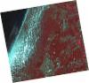
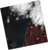
DE2_OPER_HRA_PSH_1C_20210815T111817_N39-796_W008-937_0001
Download Product | Product Info | Browse
Platform Short Name | GEOSAT |
Platform Serial Identifier | 2 |
Product Type | HRA_PSH_1C |
Start Date | 2021-08-15T11:18:17Z |
Stop Date | 2021-08-15T11:18:20Z |
Original Name | DE2_PSH_L1C_000000_20210815T111817_20210815T111820_DE2_38781_2276.zip |
Footprint | 39.7376473525 -8.82022921014 39.8818199026 -8.85376290147 39.8559978222 -9.05439348404 39.711720311 -9.02092628123 39.7376473525 -8.82022921014 |
Orbit Direction | ASCENDING |
Scene Centre Longitude | W008 |
Scene Centre Latitude | N39 |
Cloud Cover Percentage | -1 |
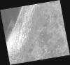
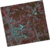
DE2_OPER_HRA_PM4_1C_20210815T111817_N39-796_W008-937_0001
Download Product | Product Info | Browse
Platform Short Name | GEOSAT |
Platform Serial Identifier | 2 |
Product Type | HRA_PM4_1C |
Start Date | 2021-08-15T11:18:17Z |
Stop Date | 2021-08-15T11:18:20Z |
Original Name | DE2_PM4_L1C_000000_20210815T111817_20210815T111820_DE2_38781_2276.zip |
Footprint | 39.7376473525 -8.82022921014 39.8818199026 -8.85376290147 39.8559978222 -9.05439348404 39.711720311 -9.02092628123 39.7376473525 -8.82022921014 |
Orbit Direction | ASCENDING |
Scene Centre Longitude | W008 |
Scene Centre Latitude | N39 |
Cloud Cover Percentage | -1 |
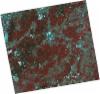
DE2_OPER_HRA_PSH_1C_20210815T111815_N39-665_W008-906_0001
Download Product | Product Info | Browse
Platform Short Name | GEOSAT |
Platform Serial Identifier | 2 |
Product Type | HRA_PSH_1C |
Start Date | 2021-08-15T11:18:15Z |
Stop Date | 2021-08-15T11:18:18Z |
Original Name | DE2_PSH_L1C_000000_20210815T111815_20210815T111818_DE2_38781_7C61.zip |
Footprint | 39.6063424108 -8.79062965811 39.7510186526 -8.8232760881 39.725086411 -9.02399329484 39.5805939989 -8.98906318077 39.6063424108 -8.79062965811 |
Orbit Direction | ASCENDING |
Scene Centre Longitude | W008 |
Scene Centre Latitude | N39 |
Cloud Cover Percentage | -1 |
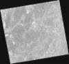
DE2_OPER_HRA_PM4_1C_20210815T111815_N39-665_W008-906_0001
Download Product | Product Info | Browse
Platform Short Name | GEOSAT |
Platform Serial Identifier | 2 |
Product Type | HRA_PM4_1C |
Start Date | 2021-08-15T11:18:15Z |
Stop Date | 2021-08-15T11:18:18Z |
Original Name | DE2_PM4_L1C_000000_20210815T111815_20210815T111818_DE2_38781_7C61.zip |
Footprint | 39.6063424108 -8.79062965811 39.7510186526 -8.8232760881 39.725086411 -9.02399329484 39.5805939989 -8.98906318077 39.6063424108 -8.79062965811 |
Orbit Direction | ASCENDING |
Scene Centre Longitude | W008 |
Scene Centre Latitude | N39 |
Cloud Cover Percentage | -1 |
DE2_OPER_HRA_PSH_1C_20210501T111457_N39-749_W009-055_0001
Download Product | Product Info | Browse
Platform Short Name | GEOSAT |
Platform Serial Identifier | 2 |
Product Type | HRA_PSH_1C |
Start Date | 2021-05-01T11:14:57Z |
Stop Date | 2021-05-01T11:14:59Z |
Original Name | DE2_PSH_L1C_000000_20210501T111457_20210501T111459_DE2_37208_B469.zip |
Footprint | 39.6971586807 -8.95844491248 39.8275880961 -8.99197770291 39.8023487973 -9.15342212842 39.6725945442 -9.11934509865 39.6971586807 -8.95844491248 |
Orbit Direction | ASCENDING |
Scene Centre Longitude | W009 |
Scene Centre Latitude | N39 |
Cloud Cover Percentage | -1 |
DE2_OPER_HRA_PM4_1C_20210501T111457_N39-749_W009-055_0001
Download Product | Product Info | Browse
Platform Short Name | GEOSAT |
Platform Serial Identifier | 2 |
Product Type | HRA_PM4_1C |
Start Date | 2021-05-01T11:14:57Z |
Stop Date | 2021-05-01T11:14:59Z |
Original Name | DE2_PM4_L1C_000000_20210501T111457_20210501T111459_DE2_37208_B469.zip |
Footprint | 39.6971586807 -8.95844491248 39.8275880961 -8.99197770291 39.8023487973 -9.15342212842 39.6725945442 -9.11934509865 39.6971586807 -8.95844491248 |
Orbit Direction | ASCENDING |
Scene Centre Longitude | W009 |
Scene Centre Latitude | N39 |
Cloud Cover Percentage | -1 |
DE2_OPER_HRA_PSH_1C_20210319T112159_N39-781_W008-763_0001
Download Product | Product Info | Browse
Platform Short Name | GEOSAT |
Platform Serial Identifier | 2 |
Product Type | HRA_PSH_1C |
Start Date | 2021-03-19T11:21:59Z |
Stop Date | 2021-03-19T11:22:02Z |
Original Name | DE2_PSH_L1C_000000_20210319T112159_20210319T112202_DE2_36570_23E2.zip |
Footprint | 39.7225607727 -8.64767209385 39.866897533 -8.68100368736 39.8410745717 -8.87940241726 39.6967791871 -8.84525767707 39.7225607727 -8.64767209385 |
Orbit Direction | ASCENDING |
Scene Centre Longitude | W008 |
Scene Centre Latitude | N39 |
Cloud Cover Percentage | -1 |
DE2_OPER_HRA_PM4_1C_20210319T112159_N39-781_W008-763_0001
Download Product | Product Info | Browse
Platform Short Name | GEOSAT |
Platform Serial Identifier | 2 |
Product Type | HRA_PM4_1C |
Start Date | 2021-03-19T11:21:59Z |
Stop Date | 2021-03-19T11:22:02Z |
Original Name | DE2_PM4_L1C_000000_20210319T112159_20210319T112202_DE2_36570_23E2.zip |
Footprint | 39.7225607727 -8.64767209385 39.866897533 -8.68100368736 39.8410745717 -8.87940241726 39.6967791871 -8.84525767707 39.7225607727 -8.64767209385 |
Orbit Direction | ASCENDING |
Scene Centre Longitude | W008 |
Scene Centre Latitude | N39 |
Cloud Cover Percentage | -1 |