ESA TPM Map Catalogue - Product List
back to previous node |
list of download URLs
Collection G2_Portugal_2021
GEOSAT-2 Portugal Coverage 2021 collection. More details here.
List of available products (latitude from 39.6231 to 39.7015 dg, longitude from -7.75625 to -7.61188 dg)..
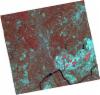
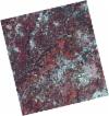
DE2_OPER_HRA_PSH_1C_20210727T111328_N39-689_W007-691_0001
Download Product | Product Info | Browse
Platform Short Name | GEOSAT |
Platform Serial Identifier | 2 |
Product Type | HRA_PSH_1C |
Start Date | 2021-07-27T11:13:28Z |
Stop Date | 2021-07-27T11:13:31Z |
Original Name | DE2_PSH_L1C_000000_20210727T111328_20210727T111331_DE2_38499_9B2D.zip |
Footprint | 39.6311731757 -7.5760789702 39.774370854 -7.61036743297 39.7486725166 -7.8064554338 39.6054499776 -7.77225374997 39.6311731757 -7.5760789702 |
Orbit Direction | ASCENDING |
Scene Centre Longitude | W007 |
Scene Centre Latitude | N39 |
Cloud Cover Percentage | -1 |
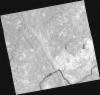
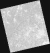
DE2_OPER_HRA_PM4_1C_20210727T111328_N39-689_W007-691_0001
Download Product | Product Info | Browse
Platform Short Name | GEOSAT |
Platform Serial Identifier | 2 |
Product Type | HRA_PM4_1C |
Start Date | 2021-07-27T11:13:28Z |
Stop Date | 2021-07-27T11:13:31Z |
Original Name | DE2_PM4_L1C_000000_20210727T111328_20210727T111331_DE2_38499_9B2D.zip |
Footprint | 39.6311731757 -7.5760789702 39.774370854 -7.61036743297 39.7486725166 -7.8064554338 39.6054499776 -7.77225374997 39.6311731757 -7.5760789702 |
Orbit Direction | ASCENDING |
Scene Centre Longitude | W007 |
Scene Centre Latitude | N39 |
Cloud Cover Percentage | -1 |
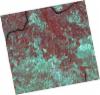
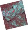
DE2_OPER_HRA_PSH_1C_20210727T111326_N39-559_W007-660_0001
Download Product | Product Info | Browse
Platform Short Name | GEOSAT |
Platform Serial Identifier | 2 |
Product Type | HRA_PSH_1C |
Start Date | 2021-07-27T11:13:26Z |
Stop Date | 2021-07-27T11:13:29Z |
Original Name | DE2_PSH_L1C_000000_20210727T111326_20210727T111329_DE2_38499_6CDF.zip |
Footprint | 39.5010259164 -7.54670931151 39.6445184825 -7.57879455279 39.6186971757 -7.77568947024 39.4753356306 -7.74219478284 39.5010259164 -7.54670931151 |
Orbit Direction | ASCENDING |
Scene Centre Longitude | W007 |
Scene Centre Latitude | N39 |
Cloud Cover Percentage | -1 |
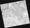
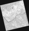
DE2_OPER_HRA_PM4_1C_20210727T111326_N39-559_W007-660_0001
Download Product | Product Info | Browse
Platform Short Name | GEOSAT |
Platform Serial Identifier | 2 |
Product Type | HRA_PM4_1C |
Start Date | 2021-07-27T11:13:26Z |
Stop Date | 2021-07-27T11:13:29Z |
Original Name | DE2_PM4_L1C_000000_20210727T111326_20210727T111329_DE2_38499_6CDF.zip |
Footprint | 39.5010259164 -7.54670931151 39.6445184825 -7.57879455279 39.6186971757 -7.77568947024 39.4753356306 -7.74219478284 39.5010259164 -7.54670931151 |
Orbit Direction | ASCENDING |
Scene Centre Longitude | W007 |
Scene Centre Latitude | N39 |
Cloud Cover Percentage | -1 |
DE2_OPER_HRA_PSH_1C_20210720T110133_N39-767_W007-634_0001
Download Product | Product Info | Browse
Platform Short Name | GEOSAT |
Platform Serial Identifier | 2 |
Product Type | HRA_PSH_1C |
Start Date | 2021-07-20T11:01:33Z |
Stop Date | 2021-07-20T11:01:36Z |
Original Name | DE2_PSH_L1C_000000_20210720T110133_20210720T110136_DE2_38395_1CB7.zip |
Footprint | 39.7171475258 -7.54291789352 39.8419425363 -7.5785452892 39.817366409 -7.72565895322 39.6926210926 -7.68999477548 39.7171475258 -7.54291789352 |
Orbit Direction | ASCENDING |
Scene Centre Longitude | W007 |
Scene Centre Latitude | N39 |
Cloud Cover Percentage | -1 |
DE2_OPER_HRA_PM4_1C_20210720T110133_N39-767_W007-634_0001
Download Product | Product Info | Browse
Platform Short Name | GEOSAT |
Platform Serial Identifier | 2 |
Product Type | HRA_PM4_1C |
Start Date | 2021-07-20T11:01:33Z |
Stop Date | 2021-07-20T11:01:36Z |
Original Name | DE2_PM4_L1C_000000_20210720T110133_20210720T110136_DE2_38395_1CB7.zip |
Footprint | 39.7171475258 -7.54291789352 39.8419425363 -7.5785452892 39.817366409 -7.72565895322 39.6926210926 -7.68999477548 39.7171475258 -7.54291789352 |
Orbit Direction | ASCENDING |
Scene Centre Longitude | W007 |
Scene Centre Latitude | N39 |
Cloud Cover Percentage | -1 |
DE2_OPER_HRA_PSH_1C_20210720T110131_N39-654_W007-602_0001
Download Product | Product Info | Browse
Platform Short Name | GEOSAT |
Platform Serial Identifier | 2 |
Product Type | HRA_PSH_1C |
Start Date | 2021-07-20T11:01:31Z |
Stop Date | 2021-07-20T11:01:34Z |
Original Name | DE2_PSH_L1C_000000_20210720T110131_20210720T110134_DE2_38395_3736.zip |
Footprint | 39.6037747341 -7.5110889618 39.7287184615 -7.5463498354 39.7041592222 -7.69328464767 39.5792954302 -7.65773362197 39.6037747341 -7.5110889618 |
Orbit Direction | ASCENDING |
Scene Centre Longitude | W007 |
Scene Centre Latitude | N39 |
Cloud Cover Percentage | -1 |
DE2_OPER_HRA_PM4_1C_20210720T110131_N39-654_W007-602_0001
Download Product | Product Info | Browse
Platform Short Name | GEOSAT |
Platform Serial Identifier | 2 |
Product Type | HRA_PM4_1C |
Start Date | 2021-07-20T11:01:31Z |
Stop Date | 2021-07-20T11:01:34Z |
Original Name | DE2_PM4_L1C_000000_20210720T110131_20210720T110134_DE2_38395_3736.zip |
Footprint | 39.6037747341 -7.5110889618 39.7287184615 -7.5463498354 39.7041592222 -7.69328464767 39.5792954302 -7.65773362197 39.6037747341 -7.5110889618 |
Orbit Direction | ASCENDING |
Scene Centre Longitude | W007 |
Scene Centre Latitude | N39 |
Cloud Cover Percentage | -1 |