ESA TPM Map Catalogue - Product List
back to previous node |
list of download URLs
Collection G2_Portugal_2021
GEOSAT-2 Portugal Coverage 2021 collection. More details here.
List of available products (latitude from 39.6231 to 39.7015 dg, longitude from -8.18938 to -8.045 dg)..
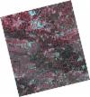
DE2_OPER_HRA_PSH_1C_20210626T111529_N39-648_W008-242_0001
Download Product | Product Info | BrowsePlatform Short Name | GEOSAT |
Platform Serial Identifier | 2 |
Product Type | HRA_PSH_1C |
Start Date | 2021-06-26T11:15:29Z |
Stop Date | 2021-06-26T11:15:32Z |
Original Name | DE2_PSH_L1C_000000_20210626T111529_20210626T111532_DE2_38039_E898.zip |
Footprint | 39.590832713 -8.13088308507 39.7315628401 -8.16443264517 39.7060172057 -8.35364512911 39.565374645 -8.31908534557 39.590832713 -8.13088308507 |
Orbit Direction | ASCENDING |
Scene Centre Longitude | W008 |
Scene Centre Latitude | N39 |
Cloud Cover Percentage | -1 |
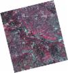
DE2_OPER_HRA_PM4_1C_20210626T111529_N39-648_W008-242_0001
Download Product | Product Info | BrowsePlatform Short Name | GEOSAT |
Platform Serial Identifier | 2 |
Product Type | HRA_PM4_1C |
Start Date | 2021-06-26T11:15:29Z |
Stop Date | 2021-06-26T11:15:32Z |
Original Name | DE2_PM4_L1C_000000_20210626T111529_20210626T111532_DE2_38039_E898.zip |
Footprint | 39.590832713 -8.13088308507 39.7315628401 -8.16443264517 39.7060172057 -8.35364512911 39.565374645 -8.31908534557 39.590832713 -8.13088308507 |
Orbit Direction | ASCENDING |
Scene Centre Longitude | W008 |
Scene Centre Latitude | N39 |
Cloud Cover Percentage | -1 |
DE2_OPER_HRA_PSH_1C_20210525T110136_N39-763_W008-081_0001
Download Product | Product Info | BrowsePlatform Short Name | GEOSAT |
Platform Serial Identifier | 2 |
Product Type | HRA_PSH_1C |
Start Date | 2021-05-25T11:01:36Z |
Stop Date | 2021-05-25T11:01:39Z |
Original Name | DE2_PSH_L1C_000000_20210525T110136_20210525T110139_DE2_37564_8464.zip |
Footprint | 39.7150239581 -7.99210228791 39.8378878139 -8.02858697733 39.8127257184 -8.17179241413 39.6898632282 -8.13507426801 39.7150239581 -7.99210228791 |
Orbit Direction | ASCENDING |
Scene Centre Longitude | W008 |
Scene Centre Latitude | N39 |
Cloud Cover Percentage | -1 |
DE2_OPER_HRA_PM4_1C_20210525T110136_N39-763_W008-081_0001
Download Product | Product Info | BrowsePlatform Short Name | GEOSAT |
Platform Serial Identifier | 2 |
Product Type | HRA_PM4_1C |
Start Date | 2021-05-25T11:01:36Z |
Stop Date | 2021-05-25T11:01:39Z |
Original Name | DE2_PM4_L1C_000000_20210525T110136_20210525T110139_DE2_37564_8464.zip |
Footprint | 39.7150239581 -7.99210228791 39.8378878139 -8.02858697733 39.8127257184 -8.17179241413 39.6898632282 -8.13507426801 39.7150239581 -7.99210228791 |
Orbit Direction | ASCENDING |
Scene Centre Longitude | W008 |
Scene Centre Latitude | N39 |
Cloud Cover Percentage | -1 |
DE2_OPER_HRA_PSH_1C_20210525T110135_N39-652_W008-048_0001
Download Product | Product Info | BrowsePlatform Short Name | GEOSAT |
Platform Serial Identifier | 2 |
Product Type | HRA_PSH_1C |
Start Date | 2021-05-25T11:01:35Z |
Stop Date | 2021-05-25T11:01:37Z |
Original Name | DE2_PSH_L1C_000000_20210525T110135_20210525T110137_DE2_37564_05A1.zip |
Footprint | 39.6034366921 -7.95917206951 39.7264124219 -7.99546323583 39.7012611029 -8.13842250388 39.5783200036 -8.10188973778 39.6034366921 -7.95917206951 |
Orbit Direction | ASCENDING |
Scene Centre Longitude | W008 |
Scene Centre Latitude | N39 |
Cloud Cover Percentage | -1 |
DE2_OPER_HRA_PM4_1C_20210525T110135_N39-652_W008-048_0001
Download Product | Product Info | BrowsePlatform Short Name | GEOSAT |
Platform Serial Identifier | 2 |
Product Type | HRA_PM4_1C |
Start Date | 2021-05-25T11:01:35Z |
Stop Date | 2021-05-25T11:01:37Z |
Original Name | DE2_PM4_L1C_000000_20210525T110135_20210525T110137_DE2_37564_05A1.zip |
Footprint | 39.6034366921 -7.95917206951 39.7264124219 -7.99546323583 39.7012611029 -8.13842250388 39.5783200036 -8.10188973778 39.6034366921 -7.95917206951 |
Orbit Direction | ASCENDING |
Scene Centre Longitude | W008 |
Scene Centre Latitude | N39 |
Cloud Cover Percentage | -1 |


