ESA TPM Map Catalogue - Product List
back to previous node |
list of download URLs

Collection G2_Portugal_2021
GEOSAT-2 Portugal Coverage 2021 collection. More details here.
List of available products (latitude from 39.5874 to 39.6658 dg, longitude from -8.255 to -8.11063 dg)..
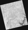
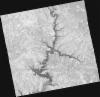
DE2_OPER_HRA_PSH_1C_20210820T105911_N39-654_W008-317_0001
Download Product | Product Info | Browse
Platform Short Name | GEOSAT |
Platform Serial Identifier | 2 |
Product Type | HRA_PSH_1C |
Start Date | 2021-08-20T10:59:11Z |
Stop Date | 2021-08-20T10:59:13Z |
Original Name | DE2_PSH_L1C_000000_20210820T105911_20210820T105913_DE2_38855_EC28.zip |
Footprint | 39.6055449592 -8.22760892127 39.7279142905 -8.26436698315 39.7026526104 -8.40695442354 39.5802721684 -8.37001019225 39.6055449592 -8.22760892127 |
Orbit Direction | ASCENDING |
Scene Centre Longitude | W008 |
Scene Centre Latitude | N39 |
Cloud Cover Percentage | -1 |
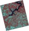
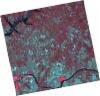
DE2_OPER_HRA_PM4_1C_20210820T105911_N39-654_W008-317_0001
Download Product | Product Info | Browse
Platform Short Name | GEOSAT |
Platform Serial Identifier | 2 |
Product Type | HRA_PM4_1C |
Start Date | 2021-08-20T10:59:11Z |
Stop Date | 2021-08-20T10:59:13Z |
Original Name | DE2_PM4_L1C_000000_20210820T105911_20210820T105913_DE2_38855_EC28.zip |
Footprint | 39.6055449592 -8.22760892127 39.7279142905 -8.26436698315 39.7026526104 -8.40695442354 39.5802721684 -8.37001019225 39.6055449592 -8.22760892127 |
Orbit Direction | ASCENDING |
Scene Centre Longitude | W008 |
Scene Centre Latitude | N39 |
Cloud Cover Percentage | -1 |
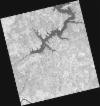
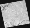
DE2_OPER_HRA_PSH_1C_20210820T105909_N39-543_W008-283_0001
Download Product | Product Info | Browse
Platform Short Name | GEOSAT |
Platform Serial Identifier | 2 |
Product Type | HRA_PSH_1C |
Start Date | 2021-08-20T10:59:09Z |
Stop Date | 2021-08-20T10:59:12Z |
Original Name | DE2_PSH_L1C_000000_20210820T105909_20210820T105912_DE2_38855_8A74.zip |
Footprint | 39.4944105514 -8.19430036072 39.6168597585 -8.23103061966 39.5916031808 -8.37343628504 39.4691828937 -8.33646811563 39.4944105514 -8.19430036072 |
Orbit Direction | ASCENDING |
Scene Centre Longitude | W008 |
Scene Centre Latitude | N39 |
Cloud Cover Percentage | -1 |
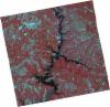
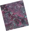
DE2_OPER_HRA_PM4_1C_20210820T105909_N39-543_W008-283_0001
Download Product | Product Info | Browse
Platform Short Name | GEOSAT |
Platform Serial Identifier | 2 |
Product Type | HRA_PM4_1C |
Start Date | 2021-08-20T10:59:09Z |
Stop Date | 2021-08-20T10:59:12Z |
Original Name | DE2_PM4_L1C_000000_20210820T105909_20210820T105912_DE2_38855_8A74.zip |
Footprint | 39.4944105514 -8.19430036072 39.6168597585 -8.23103061966 39.5916031808 -8.37343628504 39.4691828937 -8.33646811563 39.4944105514 -8.19430036072 |
Orbit Direction | ASCENDING |
Scene Centre Longitude | W008 |
Scene Centre Latitude | N39 |
Cloud Cover Percentage | -1 |
DE2_OPER_HRA_PSH_1C_20210626T111529_N39-648_W008-242_0001
Download Product | Product Info | Browse
Platform Short Name | GEOSAT |
Platform Serial Identifier | 2 |
Product Type | HRA_PSH_1C |
Start Date | 2021-06-26T11:15:29Z |
Stop Date | 2021-06-26T11:15:32Z |
Original Name | DE2_PSH_L1C_000000_20210626T111529_20210626T111532_DE2_38039_E898.zip |
Footprint | 39.590832713 -8.13088308507 39.7315628401 -8.16443264517 39.7060172057 -8.35364512911 39.565374645 -8.31908534557 39.590832713 -8.13088308507 |
Orbit Direction | ASCENDING |
Scene Centre Longitude | W008 |
Scene Centre Latitude | N39 |
Cloud Cover Percentage | -1 |
DE2_OPER_HRA_PM4_1C_20210626T111529_N39-648_W008-242_0001
Download Product | Product Info | Browse
Platform Short Name | GEOSAT |
Platform Serial Identifier | 2 |
Product Type | HRA_PM4_1C |
Start Date | 2021-06-26T11:15:29Z |
Stop Date | 2021-06-26T11:15:32Z |
Original Name | DE2_PM4_L1C_000000_20210626T111529_20210626T111532_DE2_38039_E898.zip |
Footprint | 39.590832713 -8.13088308507 39.7315628401 -8.16443264517 39.7060172057 -8.35364512911 39.565374645 -8.31908534557 39.590832713 -8.13088308507 |
Orbit Direction | ASCENDING |
Scene Centre Longitude | W008 |
Scene Centre Latitude | N39 |
Cloud Cover Percentage | -1 |
DE2_OPER_HRA_PSH_1C_20210626T111527_N39-520_W008-210_0001
Download Product | Product Info | Browse
Platform Short Name | GEOSAT |
Platform Serial Identifier | 2 |
Product Type | HRA_PSH_1C |
Start Date | 2021-06-26T11:15:27Z |
Stop Date | 2021-06-26T11:15:30Z |
Original Name | DE2_PSH_L1C_000000_20210626T111527_20210626T111530_DE2_38039_7B20.zip |
Footprint | 39.4633340433 -8.09890583298 39.603903528 -8.13379473596 39.5784215487 -8.32215388806 39.4378197558 -8.28739430892 39.4633340433 -8.09890583298 |
Orbit Direction | ASCENDING |
Scene Centre Longitude | W008 |
Scene Centre Latitude | N39 |
Cloud Cover Percentage | -1 |
DE2_OPER_HRA_PM4_1C_20210626T111527_N39-520_W008-210_0001
Download Product | Product Info | Browse
Platform Short Name | GEOSAT |
Platform Serial Identifier | 2 |
Product Type | HRA_PM4_1C |
Start Date | 2021-06-26T11:15:27Z |
Stop Date | 2021-06-26T11:15:30Z |
Original Name | DE2_PM4_L1C_000000_20210626T111527_20210626T111530_DE2_38039_7B20.zip |
Footprint | 39.4633340433 -8.09890583298 39.603903528 -8.13379473596 39.5784215487 -8.32215388806 39.4378197558 -8.28739430892 39.4633340433 -8.09890583298 |
Orbit Direction | ASCENDING |
Scene Centre Longitude | W008 |
Scene Centre Latitude | N39 |
Cloud Cover Percentage | -1 |
DE2_OPER_HRA_PSH_1C_20210525T110135_N39-652_W008-048_0001
Download Product | Product Info | Browse
Platform Short Name | GEOSAT |
Platform Serial Identifier | 2 |
Product Type | HRA_PSH_1C |
Start Date | 2021-05-25T11:01:35Z |
Stop Date | 2021-05-25T11:01:37Z |
Original Name | DE2_PSH_L1C_000000_20210525T110135_20210525T110137_DE2_37564_05A1.zip |
Footprint | 39.6034366921 -7.95917206951 39.7264124219 -7.99546323583 39.7012611029 -8.13842250388 39.5783200036 -8.10188973778 39.6034366921 -7.95917206951 |
Orbit Direction | ASCENDING |
Scene Centre Longitude | W008 |
Scene Centre Latitude | N39 |
Cloud Cover Percentage | -1 |
DE2_OPER_HRA_PM4_1C_20210525T110135_N39-652_W008-048_0001
Download Product | Product Info | Browse
Platform Short Name | GEOSAT |
Platform Serial Identifier | 2 |
Product Type | HRA_PM4_1C |
Start Date | 2021-05-25T11:01:35Z |
Stop Date | 2021-05-25T11:01:37Z |
Original Name | DE2_PM4_L1C_000000_20210525T110135_20210525T110137_DE2_37564_05A1.zip |
Footprint | 39.6034366921 -7.95917206951 39.7264124219 -7.99546323583 39.7012611029 -8.13842250388 39.5783200036 -8.10188973778 39.6034366921 -7.95917206951 |
Orbit Direction | ASCENDING |
Scene Centre Longitude | W008 |
Scene Centre Latitude | N39 |
Cloud Cover Percentage | -1 |