ESA TPM Map Catalogue - Product List
back to previous node |
list of download URLs
Collection G2_Portugal_2021
GEOSAT-2 Portugal Coverage 2021 collection. More details here.
List of available products (latitude from 39.5874 to 39.6658 dg, longitude from -8.68812 to -8.54375 dg)..
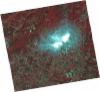
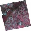
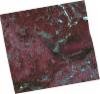
DE2_OPER_HRA_PSH_1C_20211010T111554_N39-610_W008-444_0001
Download Product | Product Info | Browse
Platform Short Name | GEOSAT |
Platform Serial Identifier | 2 |
Product Type | HRA_PSH_1C |
Start Date | 2021-10-10T11:15:54Z |
Stop Date | 2021-10-10T11:15:57Z |
Original Name | DE2_PSH_L1C_000000_20211010T111554_20211010T111557_DE2_39612_7002.zip |
Footprint | 39.5498150844 -8.32201334726 39.6983079325 -8.35628892247 39.6719994564 -8.56756608524 39.5235651867 -8.53276408089 39.5498150844 -8.32201334726 |
Orbit Direction | ASCENDING |
Scene Centre Longitude | W008 |
Scene Centre Latitude | N39 |
Cloud Cover Percentage | -1 |
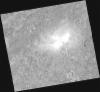
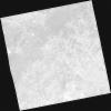
DE2_OPER_HRA_PM4_1C_20211010T111554_N39-610_W008-444_0001
Download Product | Product Info | Browse
Platform Short Name | GEOSAT |
Platform Serial Identifier | 2 |
Product Type | HRA_PM4_1C |
Start Date | 2021-10-10T11:15:54Z |
Stop Date | 2021-10-10T11:15:57Z |
Original Name | DE2_PM4_L1C_000000_20211010T111554_20211010T111557_DE2_39612_7002.zip |
Footprint | 39.5498150844 -8.32201334726 39.6983079325 -8.35628892247 39.6719994564 -8.56756608524 39.5235651867 -8.53276408089 39.5498150844 -8.32201334726 |
Orbit Direction | ASCENDING |
Scene Centre Longitude | W008 |
Scene Centre Latitude | N39 |
Cloud Cover Percentage | -1 |
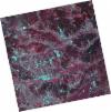
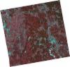
DE2_OPER_HRA_PSH_1C_20210331T111537_N39-687_W008-556_0001
Download Product | Product Info | Browse
Platform Short Name | GEOSAT |
Platform Serial Identifier | 2 |
Product Type | HRA_PSH_1C |
Start Date | 2021-03-31T11:15:37Z |
Stop Date | 2021-03-31T11:15:39Z |
Original Name | DE2_PSH_L1C_000000_20210331T111537_20210331T111539_DE2_36748_540B.zip |
Footprint | 39.633210889 -8.45527524486 39.766564337 -8.48902428911 39.7417427889 -8.65799101019 39.6083492346 -8.62416484663 39.633210889 -8.45527524486 |
Orbit Direction | ASCENDING |
Scene Centre Longitude | W008 |
Scene Centre Latitude | N39 |
Cloud Cover Percentage | -1 |
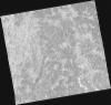
DE2_OPER_HRA_PM4_1C_20210331T111537_N39-687_W008-556_0001
Download Product | Product Info | Browse
Platform Short Name | GEOSAT |
Platform Serial Identifier | 2 |
Product Type | HRA_PM4_1C |
Start Date | 2021-03-31T11:15:37Z |
Stop Date | 2021-03-31T11:15:39Z |
Original Name | DE2_PM4_L1C_000000_20210331T111537_20210331T111539_DE2_36748_540B.zip |
Footprint | 39.633210889 -8.45527524486 39.766564337 -8.48902428911 39.7417427889 -8.65799101019 39.6083492346 -8.62416484663 39.633210889 -8.45527524486 |
Orbit Direction | ASCENDING |
Scene Centre Longitude | W008 |
Scene Centre Latitude | N39 |
Cloud Cover Percentage | -1 |
DE2_OPER_HRA_PSH_1C_20210331T111535_N39-566_W008-525_0001
Download Product | Product Info | Browse
Platform Short Name | GEOSAT |
Platform Serial Identifier | 2 |
Product Type | HRA_PSH_1C |
Start Date | 2021-03-31T11:15:35Z |
Stop Date | 2021-03-31T11:15:38Z |
Original Name | DE2_PSH_L1C_000000_20210331T111535_20210331T111538_DE2_36748_0E28.zip |
Footprint | 39.5122237511 -8.42394063467 39.6455515932 -8.45840394332 39.6206858688 -8.62740988754 39.4874376607 -8.59205882952 39.5122237511 -8.42394063467 |
Orbit Direction | ASCENDING |
Scene Centre Longitude | W008 |
Scene Centre Latitude | N39 |
Cloud Cover Percentage | -1 |
DE2_OPER_HRA_PM4_1C_20210331T111535_N39-566_W008-525_0001
Download Product | Product Info | Browse
Platform Short Name | GEOSAT |
Platform Serial Identifier | 2 |
Product Type | HRA_PM4_1C |
Start Date | 2021-03-31T11:15:35Z |
Stop Date | 2021-03-31T11:15:38Z |
Original Name | DE2_PM4_L1C_000000_20210331T111535_20210331T111538_DE2_36748_0E28.zip |
Footprint | 39.5122237511 -8.42394063467 39.6455515932 -8.45840394332 39.6206858688 -8.62740988754 39.4874376607 -8.59205882952 39.5122237511 -8.42394063467 |
Orbit Direction | ASCENDING |
Scene Centre Longitude | W008 |
Scene Centre Latitude | N39 |
Cloud Cover Percentage | -1 |
DE2_OPER_HRA_PSH_1C_20210319T112157_N39-650_W008-733_0001
Download Product | Product Info | Browse
Platform Short Name | GEOSAT |
Platform Serial Identifier | 2 |
Product Type | HRA_PSH_1C |
Start Date | 2021-03-19T11:21:57Z |
Stop Date | 2021-03-19T11:22:00Z |
Original Name | DE2_PSH_L1C_000000_20210319T112157_20210319T112200_DE2_36570_21CD.zip |
Footprint | 39.5916085772 -8.61745987786 39.7359504882 -8.65084242739 39.710137214 -8.84892010952 39.565603422 -8.81698967078 39.5916085772 -8.61745987786 |
Orbit Direction | ASCENDING |
Scene Centre Longitude | W008 |
Scene Centre Latitude | N39 |
Cloud Cover Percentage | -1 |
DE2_OPER_HRA_PM4_1C_20210319T112157_N39-650_W008-733_0001
Download Product | Product Info | Browse
Platform Short Name | GEOSAT |
Platform Serial Identifier | 2 |
Product Type | HRA_PM4_1C |
Start Date | 2021-03-19T11:21:57Z |
Stop Date | 2021-03-19T11:22:00Z |
Original Name | DE2_PM4_L1C_000000_20210319T112157_20210319T112200_DE2_36570_21CD.zip |
Footprint | 39.5916085772 -8.61745987786 39.7359504882 -8.65084242739 39.710137214 -8.84892010952 39.565603422 -8.81698967078 39.5916085772 -8.61745987786 |
Orbit Direction | ASCENDING |
Scene Centre Longitude | W008 |
Scene Centre Latitude | N39 |
Cloud Cover Percentage | -1 |
DE2_OPER_HRA_PSH_1C_20210319T112155_N39-519_W008-702_0001
Download Product | Product Info | Browse
Platform Short Name | GEOSAT |
Platform Serial Identifier | 2 |
Product Type | HRA_PSH_1C |
Start Date | 2021-03-19T11:21:55Z |
Stop Date | 2021-03-19T11:21:58Z |
Original Name | DE2_PSH_L1C_000000_20210319T112155_20210319T112158_DE2_36570_7094.zip |
Footprint | 39.4607129504 -8.58524039653 39.6049594739 -8.62081974386 39.579128334 -8.81856097109 39.4347935163 -8.78350983496 39.4607129504 -8.58524039653 |
Orbit Direction | ASCENDING |
Scene Centre Longitude | W008 |
Scene Centre Latitude | N39 |
Cloud Cover Percentage | -1 |
DE2_OPER_HRA_PM4_1C_20210319T112155_N39-519_W008-702_0001
Download Product | Product Info | Browse
Platform Short Name | GEOSAT |
Platform Serial Identifier | 2 |
Product Type | HRA_PM4_1C |
Start Date | 2021-03-19T11:21:55Z |
Stop Date | 2021-03-19T11:21:58Z |
Original Name | DE2_PM4_L1C_000000_20210319T112155_20210319T112158_DE2_36570_7094.zip |
Footprint | 39.4607129504 -8.58524039653 39.6049594739 -8.62081974386 39.579128334 -8.81856097109 39.4347935163 -8.78350983496 39.4607129504 -8.58524039653 |
Orbit Direction | ASCENDING |
Scene Centre Longitude | W008 |
Scene Centre Latitude | N39 |
Cloud Cover Percentage | -1 |