ESA TPM Map Catalogue - Product List
back to previous node |
list of download URLs
Collection G2_Portugal_2021
GEOSAT-2 Portugal Coverage 2021 collection. More details here.
List of available products (latitude from 39.509 to 39.5874 dg, longitude from -7.75625 to -7.61188 dg)..
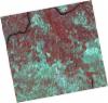
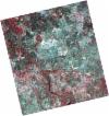
DE2_OPER_HRA_PSH_1C_20210727T111326_N39-559_W007-660_0001
Download Product | Product Info | Browse
Platform Short Name | GEOSAT |
Platform Serial Identifier | 2 |
Product Type | HRA_PSH_1C |
Start Date | 2021-07-27T11:13:26Z |
Stop Date | 2021-07-27T11:13:29Z |
Original Name | DE2_PSH_L1C_000000_20210727T111326_20210727T111329_DE2_38499_6CDF.zip |
Footprint | 39.5010259164 -7.54670931151 39.6445184825 -7.57879455279 39.6186971757 -7.77568947024 39.4753356306 -7.74219478284 39.5010259164 -7.54670931151 |
Orbit Direction | ASCENDING |
Scene Centre Longitude | W007 |
Scene Centre Latitude | N39 |
Cloud Cover Percentage | -1 |
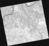
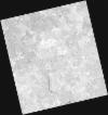
DE2_OPER_HRA_PM4_1C_20210727T111326_N39-559_W007-660_0001
Download Product | Product Info | Browse
Platform Short Name | GEOSAT |
Platform Serial Identifier | 2 |
Product Type | HRA_PM4_1C |
Start Date | 2021-07-27T11:13:26Z |
Stop Date | 2021-07-27T11:13:29Z |
Original Name | DE2_PM4_L1C_000000_20210727T111326_20210727T111329_DE2_38499_6CDF.zip |
Footprint | 39.5010259164 -7.54670931151 39.6445184825 -7.57879455279 39.6186971757 -7.77568947024 39.4753356306 -7.74219478284 39.5010259164 -7.54670931151 |
Orbit Direction | ASCENDING |
Scene Centre Longitude | W007 |
Scene Centre Latitude | N39 |
Cloud Cover Percentage | -1 |
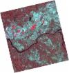
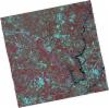
DE2_OPER_HRA_PSH_1C_20210720T110131_N39-654_W007-602_0001
Download Product | Product Info | Browse
Platform Short Name | GEOSAT |
Platform Serial Identifier | 2 |
Product Type | HRA_PSH_1C |
Start Date | 2021-07-20T11:01:31Z |
Stop Date | 2021-07-20T11:01:34Z |
Original Name | DE2_PSH_L1C_000000_20210720T110131_20210720T110134_DE2_38395_3736.zip |
Footprint | 39.6037747341 -7.5110889618 39.7287184615 -7.5463498354 39.7041592222 -7.69328464767 39.5792954302 -7.65773362197 39.6037747341 -7.5110889618 |
Orbit Direction | ASCENDING |
Scene Centre Longitude | W007 |
Scene Centre Latitude | N39 |
Cloud Cover Percentage | -1 |
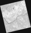
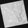
DE2_OPER_HRA_PM4_1C_20210720T110131_N39-654_W007-602_0001
Download Product | Product Info | Browse
Platform Short Name | GEOSAT |
Platform Serial Identifier | 2 |
Product Type | HRA_PM4_1C |
Start Date | 2021-07-20T11:01:31Z |
Stop Date | 2021-07-20T11:01:34Z |
Original Name | DE2_PM4_L1C_000000_20210720T110131_20210720T110134_DE2_38395_3736.zip |
Footprint | 39.6037747341 -7.5110889618 39.7287184615 -7.5463498354 39.7041592222 -7.69328464767 39.5792954302 -7.65773362197 39.6037747341 -7.5110889618 |
Orbit Direction | ASCENDING |
Scene Centre Longitude | W007 |
Scene Centre Latitude | N39 |
Cloud Cover Percentage | -1 |
DE2_OPER_HRA_PSH_1C_20210720T110129_N39-540_W007-570_0001
Download Product | Product Info | Browse
Platform Short Name | GEOSAT |
Platform Serial Identifier | 2 |
Product Type | HRA_PSH_1C |
Start Date | 2021-07-20T11:01:29Z |
Stop Date | 2021-07-20T11:01:32Z |
Original Name | DE2_PSH_L1C_000000_20210720T110129_20210720T110132_DE2_38395_CF86.zip |
Footprint | 39.4903669406 -7.47942852489 39.6153571216 -7.51427442317 39.5908216053 -7.66106591972 39.465900996 -7.62568695272 39.4903669406 -7.47942852489 |
Orbit Direction | ASCENDING |
Scene Centre Longitude | W007 |
Scene Centre Latitude | N39 |
Cloud Cover Percentage | -1 |
DE2_OPER_HRA_PM4_1C_20210720T110129_N39-540_W007-570_0001
Download Product | Product Info | Browse
Platform Short Name | GEOSAT |
Platform Serial Identifier | 2 |
Product Type | HRA_PM4_1C |
Start Date | 2021-07-20T11:01:29Z |
Stop Date | 2021-07-20T11:01:32Z |
Original Name | DE2_PM4_L1C_000000_20210720T110129_20210720T110132_DE2_38395_CF86.zip |
Footprint | 39.4903669406 -7.47942852489 39.6153571216 -7.51427442317 39.5908216053 -7.66106591972 39.465900996 -7.62568695272 39.4903669406 -7.47942852489 |
Orbit Direction | ASCENDING |
Scene Centre Longitude | W007 |
Scene Centre Latitude | N39 |
Cloud Cover Percentage | -1 |
DE2_OPER_HRA_PSH_1C_20210702T111200_N39-610_W007-850_0001
Download Product | Product Info | Browse
Platform Short Name | GEOSAT |
Platform Serial Identifier | 2 |
Product Type | HRA_PSH_1C |
Start Date | 2021-07-02T11:12:00Z |
Stop Date | 2021-07-02T11:12:03Z |
Original Name | DE2_PSH_L1C_000000_20210702T111200_20210702T111203_DE2_38128_A9BB.zip |
Footprint | 39.5543035315 -7.74455824214 39.691542433 -7.77823457009 39.6663538568 -7.95738047092 39.529146773 -7.92322115186 39.5543035315 -7.74455824214 |
Orbit Direction | ASCENDING |
Scene Centre Longitude | W007 |
Scene Centre Latitude | N39 |
Cloud Cover Percentage | -1 |
DE2_OPER_HRA_PM4_1C_20210702T111200_N39-610_W007-850_0001
Download Product | Product Info | Browse
Platform Short Name | GEOSAT |
Platform Serial Identifier | 2 |
Product Type | HRA_PM4_1C |
Start Date | 2021-07-02T11:12:00Z |
Stop Date | 2021-07-02T11:12:03Z |
Original Name | DE2_PM4_L1C_000000_20210702T111200_20210702T111203_DE2_38128_A9BB.zip |
Footprint | 39.5543035315 -7.74455824214 39.691542433 -7.77823457009 39.6663538568 -7.95738047092 39.529146773 -7.92322115186 39.5543035315 -7.74455824214 |
Orbit Direction | ASCENDING |
Scene Centre Longitude | W007 |
Scene Centre Latitude | N39 |
Cloud Cover Percentage | -1 |
DE2_OPER_HRA_PSH_1C_20210702T111158_N39-485_W007-819_0001
Download Product | Product Info | Browse
Platform Short Name | GEOSAT |
Platform Serial Identifier | 2 |
Product Type | HRA_PSH_1C |
Start Date | 2021-07-02T11:11:58Z |
Stop Date | 2021-07-02T11:12:01Z |
Original Name | DE2_PSH_L1C_000000_20210702T111158_20210702T111201_DE2_38128_C48E.zip |
Footprint | 39.4296683324 -7.71386849746 39.5670619864 -7.74770707677 39.5419389225 -7.92613064784 39.4045432948 -7.89182977134 39.4296683324 -7.71386849746 |
Orbit Direction | ASCENDING |
Scene Centre Longitude | W007 |
Scene Centre Latitude | N39 |
Cloud Cover Percentage | -1 |
DE2_OPER_HRA_PM4_1C_20210702T111158_N39-485_W007-819_0001
Download Product | Product Info | Browse
Platform Short Name | GEOSAT |
Platform Serial Identifier | 2 |
Product Type | HRA_PM4_1C |
Start Date | 2021-07-02T11:11:58Z |
Stop Date | 2021-07-02T11:12:01Z |
Original Name | DE2_PM4_L1C_000000_20210702T111158_20210702T111201_DE2_38128_C48E.zip |
Footprint | 39.4296683324 -7.71386849746 39.5670619864 -7.74770707677 39.5419389225 -7.92613064784 39.4045432948 -7.89182977134 39.4296683324 -7.71386849746 |
Orbit Direction | ASCENDING |
Scene Centre Longitude | W007 |
Scene Centre Latitude | N39 |
Cloud Cover Percentage | -1 |