ESA TPM Map Catalogue - Product List
back to previous node |
list of download URLs
Collection G2_Portugal_2021
GEOSAT-2 Portugal Coverage 2021 collection. More details here.
List of available products (latitude from 39.509 to 39.5874 dg, longitude from -8.97687 to -8.8325 dg)..
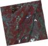
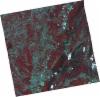
DE2_OPER_HRA_PSH_1C_20210815T111813_N39-534_W008-876_0001
Download Product | Product Info | Browse
Platform Short Name | GEOSAT |
Platform Serial Identifier | 2 |
Product Type | HRA_PSH_1C |
Start Date | 2021-08-15T11:18:13Z |
Stop Date | 2021-08-15T11:18:15Z |
Original Name | DE2_PSH_L1C_000000_20210815T111813_20210815T111815_DE2_38781_30AB.zip |
Footprint | 39.4750524782 -8.76025113311 39.6196750985 -8.79416335452 39.5939950409 -8.99225802372 39.4493959037 -8.95925504599 39.4750524782 -8.76025113311 |
Orbit Direction | ASCENDING |
Scene Centre Longitude | W008 |
Scene Centre Latitude | N39 |
Cloud Cover Percentage | -1 |
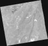
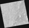
DE2_OPER_HRA_PM4_1C_20210815T111813_N39-534_W008-876_0001
Download Product | Product Info | Browse
Platform Short Name | GEOSAT |
Platform Serial Identifier | 2 |
Product Type | HRA_PM4_1C |
Start Date | 2021-08-15T11:18:13Z |
Stop Date | 2021-08-15T11:18:15Z |
Original Name | DE2_PM4_L1C_000000_20210815T111813_20210815T111815_DE2_38781_30AB.zip |
Footprint | 39.4750524782 -8.76025113311 39.6196750985 -8.79416335452 39.5939950409 -8.99225802372 39.4493959037 -8.95925504599 39.4750524782 -8.76025113311 |
Orbit Direction | ASCENDING |
Scene Centre Longitude | W008 |
Scene Centre Latitude | N39 |
Cloud Cover Percentage | -1 |
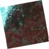
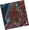
DE2_OPER_HRA_PSH_1C_20210721T111701_N39-606_W008-972_0001
Download Product | Product Info | Browse
Platform Short Name | GEOSAT |
Platform Serial Identifier | 2 |
Product Type | HRA_PSH_1C |
Start Date | 2021-07-21T11:17:01Z |
Stop Date | 2021-07-21T11:17:03Z |
Original Name | DE2_PSH_L1C_000000_20210721T111701_20210721T111703_DE2_38410_F3FC.zip |
Footprint | 39.5496667143 -8.86519964997 39.6891525781 -8.89641730868 39.663917374 -9.08030734835 39.5245823254 -9.04744107854 39.5496667143 -8.86519964997 |
Orbit Direction | ASCENDING |
Scene Centre Longitude | W008 |
Scene Centre Latitude | N39 |
Cloud Cover Percentage | -1 |
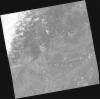
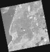
DE2_OPER_HRA_PM4_1C_20210721T111701_N39-606_W008-972_0001
Download Product | Product Info | Browse
Platform Short Name | GEOSAT |
Platform Serial Identifier | 2 |
Product Type | HRA_PM4_1C |
Start Date | 2021-07-21T11:17:01Z |
Stop Date | 2021-07-21T11:17:03Z |
Original Name | DE2_PM4_L1C_000000_20210721T111701_20210721T111703_DE2_38410_F3FC.zip |
Footprint | 39.5496667143 -8.86519964997 39.6891525781 -8.89641730868 39.663917374 -9.08030734835 39.5245823254 -9.04744107854 39.5496667143 -8.86519964997 |
Orbit Direction | ASCENDING |
Scene Centre Longitude | W008 |
Scene Centre Latitude | N39 |
Cloud Cover Percentage | -1 |
DE2_OPER_HRA_PSH_1C_20210721T111659_N39-480_W008-941_0001
Download Product | Product Info | Browse
Platform Short Name | GEOSAT |
Platform Serial Identifier | 2 |
Product Type | HRA_PSH_1C |
Start Date | 2021-07-21T11:16:59Z |
Stop Date | 2021-07-21T11:17:01Z |
Original Name | DE2_PSH_L1C_000000_20210721T111659_20210721T111701_DE2_38410_8648.zip |
Footprint | 39.4236885035 -8.83155573798 39.5627042827 -8.8666237429 39.537468349 -9.05050456048 39.398331522 -9.01618098725 39.4236885035 -8.83155573798 |
Orbit Direction | ASCENDING |
Scene Centre Longitude | W008 |
Scene Centre Latitude | N39 |
Cloud Cover Percentage | -1 |
DE2_OPER_HRA_PM4_1C_20210721T111659_N39-480_W008-941_0001
Download Product | Product Info | Browse
Platform Short Name | GEOSAT |
Platform Serial Identifier | 2 |
Product Type | HRA_PM4_1C |
Start Date | 2021-07-21T11:16:59Z |
Stop Date | 2021-07-21T11:17:01Z |
Original Name | DE2_PM4_L1C_000000_20210721T111659_20210721T111701_DE2_38410_8648.zip |
Footprint | 39.4236885035 -8.83155573798 39.5627042827 -8.8666237429 39.537468349 -9.05050456048 39.398331522 -9.01618098725 39.4236885035 -8.83155573798 |
Orbit Direction | ASCENDING |
Scene Centre Longitude | W008 |
Scene Centre Latitude | N39 |
Cloud Cover Percentage | -1 |
DE2_OPER_HRA_PSH_1C_20210501T111455_N39-631_W009-025_0001
Download Product | Product Info | Browse
Platform Short Name | GEOSAT |
Platform Serial Identifier | 2 |
Product Type | HRA_PSH_1C |
Start Date | 2021-05-01T11:14:55Z |
Stop Date | 2021-05-01T11:14:58Z |
Original Name | DE2_PSH_L1C_000000_20210501T111455_20210501T111458_DE2_37208_74C5.zip |
Footprint | 39.5789164361 -8.92783678487 39.7092425425 -8.96163117705 39.6847619983 -9.12242723247 39.5543604136 -9.08875360254 39.5789164361 -8.92783678487 |
Orbit Direction | ASCENDING |
Scene Centre Longitude | W009 |
Scene Centre Latitude | N39 |
Cloud Cover Percentage | -1 |
DE2_OPER_HRA_PM4_1C_20210501T111455_N39-631_W009-025_0001
Download Product | Product Info | Browse
Platform Short Name | GEOSAT |
Platform Serial Identifier | 2 |
Product Type | HRA_PM4_1C |
Start Date | 2021-05-01T11:14:55Z |
Stop Date | 2021-05-01T11:14:58Z |
Original Name | DE2_PM4_L1C_000000_20210501T111455_20210501T111458_DE2_37208_74C5.zip |
Footprint | 39.5789164361 -8.92783678487 39.7092425425 -8.96163117705 39.6847619983 -9.12242723247 39.5543604136 -9.08875360254 39.5789164361 -8.92783678487 |
Orbit Direction | ASCENDING |
Scene Centre Longitude | W009 |
Scene Centre Latitude | N39 |
Cloud Cover Percentage | -1 |