ESA TPM Map Catalogue - Product List
back to previous node |
list of download URLs
Collection G2_Portugal_2021
GEOSAT-2 Portugal Coverage 2021 collection. More details here.
List of available products (latitude from 39.3521 to 39.4306 dg, longitude from -8.54375 to -8.39938 dg)..
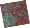
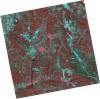
DE2_OPER_HRA_PSH_1C_20211010T111552_N39-476_W008-413_0001
Download Product | Product Info | Browse
Platform Short Name | GEOSAT |
Platform Serial Identifier | 2 |
Product Type | HRA_PSH_1C |
Start Date | 2021-10-10T11:15:52Z |
Stop Date | 2021-10-10T11:15:54Z |
Original Name | DE2_PSH_L1C_000000_20211010T111552_20211010T111554_DE2_39612_F4E9.zip |
Footprint | 39.4152262981 -8.29153624055 39.563553378 -8.32545052159 39.5372815048 -8.53560462982 39.3890846533 -8.500828663 39.4152262981 -8.29153624055 |
Orbit Direction | ASCENDING |
Scene Centre Longitude | W008 |
Scene Centre Latitude | N39 |
Cloud Cover Percentage | -1 |
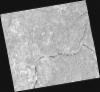
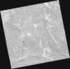
DE2_OPER_HRA_PM4_1C_20211010T111552_N39-476_W008-413_0001
Download Product | Product Info | Browse
Platform Short Name | GEOSAT |
Platform Serial Identifier | 2 |
Product Type | HRA_PM4_1C |
Start Date | 2021-10-10T11:15:52Z |
Stop Date | 2021-10-10T11:15:54Z |
Original Name | DE2_PM4_L1C_000000_20211010T111552_20211010T111554_DE2_39612_F4E9.zip |
Footprint | 39.4152262981 -8.29153624055 39.563553378 -8.32545052159 39.5372815048 -8.53560462982 39.3890846533 -8.500828663 39.4152262981 -8.29153624055 |
Orbit Direction | ASCENDING |
Scene Centre Longitude | W008 |
Scene Centre Latitude | N39 |
Cloud Cover Percentage | -1 |
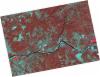
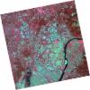
DE2_OPER_HRA_PSH_1C_20210921T111143_N39-482_W008-356_0001
Download Product | Product Info | Browse
Platform Short Name | GEOSAT |
Platform Serial Identifier | 2 |
Product Type | HRA_PSH_1C |
Start Date | 2021-09-21T11:11:43Z |
Stop Date | 2021-09-21T11:11:45Z |
Original Name | DE2_PSH_L1C_000000_20210921T111143_20210921T111145_DE2_39330_A4CB.zip |
Footprint | 39.4470886966 -8.25458750731 39.5428297209 -8.27859696676 39.5177553515 -8.45844673376 39.4219620948 -8.43433867118 39.4470886966 -8.25458750731 |
Orbit Direction | ASCENDING |
Scene Centre Longitude | W008 |
Scene Centre Latitude | N39 |
Cloud Cover Percentage | -1 |
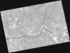
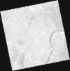
DE2_OPER_HRA_PM4_1C_20210921T111143_N39-482_W008-356_0001
Download Product | Product Info | Browse
Platform Short Name | GEOSAT |
Platform Serial Identifier | 2 |
Product Type | HRA_PM4_1C |
Start Date | 2021-09-21T11:11:43Z |
Stop Date | 2021-09-21T11:11:45Z |
Original Name | DE2_PM4_L1C_000000_20210921T111143_20210921T111145_DE2_39330_A4CB.zip |
Footprint | 39.4470886966 -8.25458750731 39.5428297209 -8.27859696676 39.5177553515 -8.45844673376 39.4219620948 -8.43433867118 39.4470886966 -8.25458750731 |
Orbit Direction | ASCENDING |
Scene Centre Longitude | W008 |
Scene Centre Latitude | N39 |
Cloud Cover Percentage | -1 |
DE2_OPER_HRA_PSH_1C_20210921T111141_N39-378_W008-330_0001
Download Product | Product Info | Browse
Platform Short Name | GEOSAT |
Platform Serial Identifier | 2 |
Product Type | HRA_PSH_1C |
Start Date | 2021-09-21T11:11:41Z |
Stop Date | 2021-09-21T11:11:44Z |
Original Name | DE2_PSH_L1C_000000_20210921T111141_20210921T111144_DE2_39330_209D.zip |
Footprint | 39.3217773986 -8.22481431655 39.4599275373 -8.25758030432 39.4348040806 -8.43751160847 39.2967064118 -8.4040798407 39.3217773986 -8.22481431655 |
Orbit Direction | ASCENDING |
Scene Centre Longitude | W008 |
Scene Centre Latitude | N39 |
Cloud Cover Percentage | -1 |
DE2_OPER_HRA_PM4_1C_20210921T111141_N39-378_W008-330_0001
Download Product | Product Info | Browse
Platform Short Name | GEOSAT |
Platform Serial Identifier | 2 |
Product Type | HRA_PM4_1C |
Start Date | 2021-09-21T11:11:41Z |
Stop Date | 2021-09-21T11:11:44Z |
Original Name | DE2_PM4_L1C_000000_20210921T111141_20210921T111144_DE2_39330_209D.zip |
Footprint | 39.3217773986 -8.22481431655 39.4599275373 -8.25758030432 39.4348040806 -8.43751160847 39.2967064118 -8.4040798407 39.3217773986 -8.22481431655 |
Orbit Direction | ASCENDING |
Scene Centre Longitude | W008 |
Scene Centre Latitude | N39 |
Cloud Cover Percentage | -1 |
DE2_OPER_HRA_PSH_1C_20210331T111533_N39-445_W008-494_0001
Download Product | Product Info | Browse
Platform Short Name | GEOSAT |
Platform Serial Identifier | 2 |
Product Type | HRA_PSH_1C |
Start Date | 2021-03-31T11:15:33Z |
Stop Date | 2021-03-31T11:15:36Z |
Original Name | DE2_PSH_L1C_000000_20210331T111533_20210331T111536_DE2_36748_9F77.zip |
Footprint | 39.391276189 -8.39317326258 39.5245922058 -8.42699728543 39.4997622396 -8.59539747982 39.3665380527 -8.56071494127 39.391276189 -8.39317326258 |
Orbit Direction | ASCENDING |
Scene Centre Longitude | W008 |
Scene Centre Latitude | N39 |
Cloud Cover Percentage | -1 |
DE2_OPER_HRA_PM4_1C_20210331T111533_N39-445_W008-494_0001
Download Product | Product Info | Browse
Platform Short Name | GEOSAT |
Platform Serial Identifier | 2 |
Product Type | HRA_PM4_1C |
Start Date | 2021-03-31T11:15:33Z |
Stop Date | 2021-03-31T11:15:36Z |
Original Name | DE2_PM4_L1C_000000_20210331T111533_20210331T111536_DE2_36748_9F77.zip |
Footprint | 39.391276189 -8.39317326258 39.5245922058 -8.42699728543 39.4997622396 -8.59539747982 39.3665380527 -8.56071494127 39.391276189 -8.39317326258 |
Orbit Direction | ASCENDING |
Scene Centre Longitude | W008 |
Scene Centre Latitude | N39 |
Cloud Cover Percentage | -1 |
DE2_OPER_HRA_PSH_1C_20210331T111531_N39-324_W008-463_0001
Download Product | Product Info | Browse
Platform Short Name | GEOSAT |
Platform Serial Identifier | 2 |
Product Type | HRA_PSH_1C |
Start Date | 2021-03-31T11:15:31Z |
Stop Date | 2021-03-31T11:15:34Z |
Original Name | DE2_PSH_L1C_000000_20210331T111531_20210331T111534_DE2_36748_BAB6.zip |
Footprint | 39.2704276724 -8.36263880154 39.4036139627 -8.39662913095 39.3788706137 -8.56407727832 39.2456976718 -8.52996335264 39.2704276724 -8.36263880154 |
Orbit Direction | ASCENDING |
Scene Centre Longitude | W008 |
Scene Centre Latitude | N39 |
Cloud Cover Percentage | -1 |
DE2_OPER_HRA_PM4_1C_20210331T111531_N39-324_W008-463_0001
Download Product | Product Info | Browse
Platform Short Name | GEOSAT |
Platform Serial Identifier | 2 |
Product Type | HRA_PM4_1C |
Start Date | 2021-03-31T11:15:31Z |
Stop Date | 2021-03-31T11:15:34Z |
Original Name | DE2_PM4_L1C_000000_20210331T111531_20210331T111534_DE2_36748_BAB6.zip |
Footprint | 39.2704276724 -8.36263880154 39.4036139627 -8.39662913095 39.3788706137 -8.56407727832 39.2456976718 -8.52996335264 39.2704276724 -8.36263880154 |
Orbit Direction | ASCENDING |
Scene Centre Longitude | W008 |
Scene Centre Latitude | N39 |
Cloud Cover Percentage | -1 |