ESA TPM Map Catalogue - Product List
back to previous node |
list of download URLs

Collection G2_Portugal_2021
GEOSAT-2 Portugal Coverage 2021 collection. More details here.
List of available products (latitude from 39.1953 to 39.2737 dg, longitude from -8.255 to -8.11063 dg)..
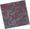
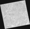
DE2_OPER_HRA_PSH_1C_20210921T111139_N39-253_W008-300_0001
Download Product | Product Info | Browse
Platform Short Name | GEOSAT |
Platform Serial Identifier | 2 |
Product Type | HRA_PSH_1C |
Start Date | 2021-09-21T11:11:39Z |
Stop Date | 2021-09-21T11:11:42Z |
Original Name | DE2_PSH_L1C_000000_20210921T111139_20210921T111142_DE2_39330_9E91.zip |
Footprint | 39.19663316 -8.19424704786 39.3345636911 -8.22788428051 39.3094748569 -8.40719898148 39.1715589384 -8.37323031098 39.19663316 -8.19424704786 |
Orbit Direction | ASCENDING |
Scene Centre Longitude | W008 |
Scene Centre Latitude | N39 |
Cloud Cover Percentage | -1 |
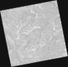
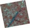
DE2_OPER_HRA_PM4_1C_20210921T111139_N39-253_W008-300_0001
Download Product | Product Info | Browse
Platform Short Name | GEOSAT |
Platform Serial Identifier | 2 |
Product Type | HRA_PM4_1C |
Start Date | 2021-09-21T11:11:39Z |
Stop Date | 2021-09-21T11:11:42Z |
Original Name | DE2_PM4_L1C_000000_20210921T111139_20210921T111142_DE2_39330_9E91.zip |
Footprint | 39.19663316 -8.19424704786 39.3345636911 -8.22788428051 39.3094748569 -8.40719898148 39.1715589384 -8.37323031098 39.19663316 -8.19424704786 |
Orbit Direction | ASCENDING |
Scene Centre Longitude | W008 |
Scene Centre Latitude | N39 |
Cloud Cover Percentage | -1 |
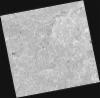
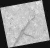
DE2_OPER_HRA_PSH_1C_20210921T111137_N39-127_W008-270_0001
Download Product | Product Info | Browse
Platform Short Name | GEOSAT |
Platform Serial Identifier | 2 |
Product Type | HRA_PSH_1C |
Start Date | 2021-09-21T11:11:37Z |
Stop Date | 2021-09-21T11:11:40Z |
Original Name | DE2_PSH_L1C_000000_20210921T111137_20210921T111140_DE2_39330_EBA3.zip |
Footprint | 39.071571759 -8.16347116552 39.2094010429 -8.1974368977 39.1843286731 -8.37639071008 39.0464569663 -8.34272925256 39.071571759 -8.16347116552 |
Orbit Direction | ASCENDING |
Scene Centre Longitude | W008 |
Scene Centre Latitude | N39 |
Cloud Cover Percentage | -1 |
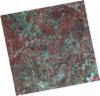
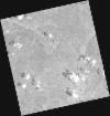
DE2_OPER_HRA_PM4_1C_20210921T111137_N39-127_W008-270_0001
Download Product | Product Info | Browse
Platform Short Name | GEOSAT |
Platform Serial Identifier | 2 |
Product Type | HRA_PM4_1C |
Start Date | 2021-09-21T11:11:37Z |
Stop Date | 2021-09-21T11:11:40Z |
Original Name | DE2_PM4_L1C_000000_20210921T111137_20210921T111140_DE2_39330_EBA3.zip |
Footprint | 39.071571759 -8.16347116552 39.2094010429 -8.1974368977 39.1843286731 -8.37639071008 39.0464569663 -8.34272925256 39.071571759 -8.16347116552 |
Orbit Direction | ASCENDING |
Scene Centre Longitude | W008 |
Scene Centre Latitude | N39 |
Cloud Cover Percentage | -1 |
DE2_OPER_HRA_PSH_1C_20210626T111523_N39-265_W008-148_0001
Download Product | Product Info | Browse
Platform Short Name | GEOSAT |
Platform Serial Identifier | 2 |
Product Type | HRA_PSH_1C |
Start Date | 2021-06-26T11:15:23Z |
Stop Date | 2021-06-26T11:15:26Z |
Original Name | DE2_PSH_L1C_000000_20210626T111523_20210626T111526_DE2_38039_2833.zip |
Footprint | 39.2077615506 -8.037248882 39.3485244107 -8.07139802424 39.32301105 -8.25963902647 39.1822653587 -8.22514196855 39.2077615506 -8.037248882 |
Orbit Direction | ASCENDING |
Scene Centre Longitude | W008 |
Scene Centre Latitude | N39 |
Cloud Cover Percentage | -1 |
DE2_OPER_HRA_PM4_1C_20210626T111523_N39-265_W008-148_0001
Download Product | Product Info | Browse
Platform Short Name | GEOSAT |
Platform Serial Identifier | 2 |
Product Type | HRA_PM4_1C |
Start Date | 2021-06-26T11:15:23Z |
Stop Date | 2021-06-26T11:15:26Z |
Original Name | DE2_PM4_L1C_000000_20210626T111523_20210626T111526_DE2_38039_2833.zip |
Footprint | 39.2077615506 -8.037248882 39.3485244107 -8.07139802424 39.32301105 -8.25963902647 39.1822653587 -8.22514196855 39.2077615506 -8.037248882 |
Orbit Direction | ASCENDING |
Scene Centre Longitude | W008 |
Scene Centre Latitude | N39 |
Cloud Cover Percentage | -1 |
DE2_OPER_HRA_PSH_1C_20210626T111521_N39-137_W008-117_0001
Download Product | Product Info | Browse
Platform Short Name | GEOSAT |
Platform Serial Identifier | 2 |
Product Type | HRA_PSH_1C |
Start Date | 2021-06-26T11:15:21Z |
Stop Date | 2021-06-26T11:15:24Z |
Original Name | DE2_PSH_L1C_000000_20210626T111521_20210626T111524_DE2_38039_ECB7.zip |
Footprint | 39.0799347828 -8.00707134637 39.2208358752 -8.04021541765 39.1953030714 -8.2283772843 39.0544984369 -8.19391460566 39.0799347828 -8.00707134637 |
Orbit Direction | ASCENDING |
Scene Centre Longitude | W008 |
Scene Centre Latitude | N39 |
Cloud Cover Percentage | -1 |
DE2_OPER_HRA_PM4_1C_20210626T111521_N39-137_W008-117_0001
Download Product | Product Info | Browse
Platform Short Name | GEOSAT |
Platform Serial Identifier | 2 |
Product Type | HRA_PM4_1C |
Start Date | 2021-06-26T11:15:21Z |
Stop Date | 2021-06-26T11:15:24Z |
Original Name | DE2_PM4_L1C_000000_20210626T111521_20210626T111524_DE2_38039_ECB7.zip |
Footprint | 39.0799347828 -8.00707134637 39.2208358752 -8.04021541765 39.1953030714 -8.2283772843 39.0544984369 -8.19391460566 39.0799347828 -8.00707134637 |
Orbit Direction | ASCENDING |
Scene Centre Longitude | W008 |
Scene Centre Latitude | N39 |
Cloud Cover Percentage | -1 |
DE2_OPER_HRA_PM4_1C_20210613T110647_N39-297_W008-055_0001
Download Product | Product Info | Browse
Platform Short Name | GEOSAT |
Platform Serial Identifier | 2 |
Product Type | HRA_PM4_1C |
Start Date | 2021-06-13T11:06:47Z |
Stop Date | 2021-06-13T11:06:50Z |
Original Name | DE2_PM4_L1C_000000_20210613T110647_20210613T110650_DE2_37846_D829.zip |
Footprint | 39.2461621598 -7.96339587116 39.3728658123 -7.99800672211 39.348490228 -8.14821112788 39.2217633618 -8.11376654849 39.2461621598 -7.96339587116 |
Orbit Direction | ASCENDING |
Scene Centre Longitude | W008 |
Scene Centre Latitude | N39 |
Cloud Cover Percentage | -1 |
DE2_OPER_HRA_PSH_1C_20210613T110647_N39-297_W008-055_0001
Download Product | Product Info | Browse
Platform Short Name | GEOSAT |
Platform Serial Identifier | 2 |
Product Type | HRA_PSH_1C |
Start Date | 2021-06-13T11:06:47Z |
Stop Date | 2021-06-13T11:06:50Z |
Original Name | DE2_PSH_L1C_000000_20210613T110647_20210613T110650_DE2_37846_D829.zip |
Footprint | 39.2461621598 -7.96339587116 39.3728658123 -7.99800672211 39.348490228 -8.14821112788 39.2217633618 -8.11376654849 39.2461621598 -7.96339587116 |
Orbit Direction | ASCENDING |
Scene Centre Longitude | W008 |
Scene Centre Latitude | N39 |
Cloud Cover Percentage | -1 |