ESA TPM Map Catalogue - Product List
back to previous node |
list of download URLs
Collection G2_Portugal_2021
GEOSAT-2 Portugal Coverage 2021 collection. More details here.
List of available products (latitude from 39.393 to 39.4714 dg, longitude from -7.75625 to -7.61188 dg)..
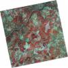
DE2_OPER_HRA_PSH_1C_20210727T111324_N39-429_W007-630_0001
Download Product | Product Info | Browse
Platform Short Name | GEOSAT |
Platform Serial Identifier | 2 |
Product Type | HRA_PSH_1C |
Start Date | 2021-07-27T11:13:24Z |
Stop Date | 2021-07-27T11:13:26Z |
Original Name | DE2_PSH_L1C_000000_20210727T111324_20210727T111326_DE2_38499_0861.zip |
Footprint | 39.3708740904 -7.51666687358 39.5143059708 -7.54953843992 39.4885878436 -7.74536601446 39.3452173228 -7.71145800331 39.3708740904 -7.51666687358 |
Orbit Direction | ASCENDING |
Scene Centre Longitude | W007 |
Scene Centre Latitude | N39 |
Cloud Cover Percentage | -1 |
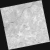
DE2_OPER_HRA_PM4_1C_20210727T111324_N39-429_W007-630_0001
Download Product | Product Info | Browse
Platform Short Name | GEOSAT |
Platform Serial Identifier | 2 |
Product Type | HRA_PM4_1C |
Start Date | 2021-07-27T11:13:24Z |
Stop Date | 2021-07-27T11:13:26Z |
Original Name | DE2_PM4_L1C_000000_20210727T111324_20210727T111326_DE2_38499_0861.zip |
Footprint | 39.3708740904 -7.51666687358 39.5143059708 -7.54953843992 39.4885878436 -7.74536601446 39.3452173228 -7.71145800331 39.3708740904 -7.51666687358 |
Orbit Direction | ASCENDING |
Scene Centre Longitude | W007 |
Scene Centre Latitude | N39 |
Cloud Cover Percentage | -1 |
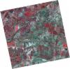
DE2_OPER_HRA_PSH_1C_20210720T110128_N39-427_W007-538_0001
Download Product | Product Info | Browse
Platform Short Name | GEOSAT |
Platform Serial Identifier | 2 |
Product Type | HRA_PSH_1C |
Start Date | 2021-07-20T11:01:28Z |
Stop Date | 2021-07-20T11:01:30Z |
Original Name | DE2_PSH_L1C_000000_20210720T110128_20210720T110130_DE2_38395_F7E9.zip |
Footprint | 39.3769817338 -7.44768164655 39.5019505565 -7.48263026993 39.4774746962 -7.62894709432 39.3525356417 -7.59354682059 39.3769817338 -7.44768164655 |
Orbit Direction | ASCENDING |
Scene Centre Longitude | W007 |
Scene Centre Latitude | N39 |
Cloud Cover Percentage | -1 |
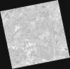
DE2_OPER_HRA_PM4_1C_20210720T110128_N39-427_W007-538_0001
Download Product | Product Info | Browse
Platform Short Name | GEOSAT |
Platform Serial Identifier | 2 |
Product Type | HRA_PM4_1C |
Start Date | 2021-07-20T11:01:28Z |
Stop Date | 2021-07-20T11:01:30Z |
Original Name | DE2_PM4_L1C_000000_20210720T110128_20210720T110130_DE2_38395_F7E9.zip |
Footprint | 39.3769817338 -7.44768164655 39.5019505565 -7.48263026993 39.4774746962 -7.62894709432 39.3525356417 -7.59354682059 39.3769817338 -7.44768164655 |
Orbit Direction | ASCENDING |
Scene Centre Longitude | W007 |
Scene Centre Latitude | N39 |
Cloud Cover Percentage | -1 |
DE2_OPER_HRA_PSH_1C_20210702T111158_N39-485_W007-819_0001
Download Product | Product Info | Browse
Platform Short Name | GEOSAT |
Platform Serial Identifier | 2 |
Product Type | HRA_PSH_1C |
Start Date | 2021-07-02T11:11:58Z |
Stop Date | 2021-07-02T11:12:01Z |
Original Name | DE2_PSH_L1C_000000_20210702T111158_20210702T111201_DE2_38128_C48E.zip |
Footprint | 39.4296683324 -7.71386849746 39.5670619864 -7.74770707677 39.5419389225 -7.92613064784 39.4045432948 -7.89182977134 39.4296683324 -7.71386849746 |
Orbit Direction | ASCENDING |
Scene Centre Longitude | W007 |
Scene Centre Latitude | N39 |
Cloud Cover Percentage | -1 |
DE2_OPER_HRA_PM4_1C_20210702T111158_N39-485_W007-819_0001
Download Product | Product Info | Browse
Platform Short Name | GEOSAT |
Platform Serial Identifier | 2 |
Product Type | HRA_PM4_1C |
Start Date | 2021-07-02T11:11:58Z |
Stop Date | 2021-07-02T11:12:01Z |
Original Name | DE2_PM4_L1C_000000_20210702T111158_20210702T111201_DE2_38128_C48E.zip |
Footprint | 39.4296683324 -7.71386849746 39.5670619864 -7.74770707677 39.5419389225 -7.92613064784 39.4045432948 -7.89182977134 39.4296683324 -7.71386849746 |
Orbit Direction | ASCENDING |
Scene Centre Longitude | W007 |
Scene Centre Latitude | N39 |
Cloud Cover Percentage | -1 |
DE2_OPER_HRA_PSH_1C_20210702T111156_N39-361_W007-788_0001
Download Product | Product Info | Browse
Platform Short Name | GEOSAT |
Platform Serial Identifier | 2 |
Product Type | HRA_PSH_1C |
Start Date | 2021-07-02T11:11:56Z |
Stop Date | 2021-07-02T11:11:59Z |
Original Name | DE2_PSH_L1C_000000_20210702T111156_20210702T111159_DE2_38128_E7F0.zip |
Footprint | 39.3048185999 -7.68302501825 39.4423553071 -7.7171823303 39.4172522329 -7.89512223094 39.2797531176 -7.8603912852 39.3048185999 -7.68302501825 |
Orbit Direction | ASCENDING |
Scene Centre Longitude | W007 |
Scene Centre Latitude | N39 |
Cloud Cover Percentage | -1 |
DE2_OPER_HRA_PM4_1C_20210702T111156_N39-361_W007-788_0001
Download Product | Product Info | Browse
Platform Short Name | GEOSAT |
Platform Serial Identifier | 2 |
Product Type | HRA_PM4_1C |
Start Date | 2021-07-02T11:11:56Z |
Stop Date | 2021-07-02T11:11:59Z |
Original Name | DE2_PM4_L1C_000000_20210702T111156_20210702T111159_DE2_38128_E7F0.zip |
Footprint | 39.3048185999 -7.68302501825 39.4423553071 -7.7171823303 39.4172522329 -7.89512223094 39.2797531176 -7.8603912852 39.3048185999 -7.68302501825 |
Orbit Direction | ASCENDING |
Scene Centre Longitude | W007 |
Scene Centre Latitude | N39 |
Cloud Cover Percentage | -1 |