ESA TPM Map Catalogue - Product List
back to previous node |
list of download URLs

Collection G2_Portugal_2021
GEOSAT-2 Portugal Coverage 2021 collection. More details here.
List of available products (latitude from 39.393 to 39.4714 dg, longitude from -8.18938 to -8.045 dg)..
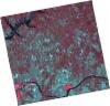
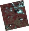
DE2_OPER_HRA_PSH_1C_20210626T111527_N39-520_W008-210_0001
Download Product | Product Info | Browse
Platform Short Name | GEOSAT |
Platform Serial Identifier | 2 |
Product Type | HRA_PSH_1C |
Start Date | 2021-06-26T11:15:27Z |
Stop Date | 2021-06-26T11:15:30Z |
Original Name | DE2_PSH_L1C_000000_20210626T111527_20210626T111530_DE2_38039_7B20.zip |
Footprint | 39.4633340433 -8.09890583298 39.603903528 -8.13379473596 39.5784215487 -8.32215388806 39.4378197558 -8.28739430892 39.4633340433 -8.09890583298 |
Orbit Direction | ASCENDING |
Scene Centre Longitude | W008 |
Scene Centre Latitude | N39 |
Cloud Cover Percentage | -1 |
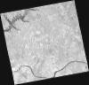
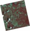
DE2_OPER_HRA_PM4_1C_20210626T111527_N39-520_W008-210_0001
Download Product | Product Info | Browse
Platform Short Name | GEOSAT |
Platform Serial Identifier | 2 |
Product Type | HRA_PM4_1C |
Start Date | 2021-06-26T11:15:27Z |
Stop Date | 2021-06-26T11:15:30Z |
Original Name | DE2_PM4_L1C_000000_20210626T111527_20210626T111530_DE2_38039_7B20.zip |
Footprint | 39.4633340433 -8.09890583298 39.603903528 -8.13379473596 39.5784215487 -8.32215388806 39.4378197558 -8.28739430892 39.4633340433 -8.09890583298 |
Orbit Direction | ASCENDING |
Scene Centre Longitude | W008 |
Scene Centre Latitude | N39 |
Cloud Cover Percentage | -1 |
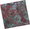
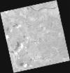
DE2_OPER_HRA_PSH_1C_20210626T111525_N39-393_W008-179_0001
Download Product | Product Info | Browse
Platform Short Name | GEOSAT |
Platform Serial Identifier | 2 |
Product Type | HRA_PSH_1C |
Start Date | 2021-06-26T11:15:25Z |
Stop Date | 2021-06-26T11:15:28Z |
Original Name | DE2_PSH_L1C_000000_20210626T111525_20210626T111528_DE2_38039_2055.zip |
Footprint | 39.3354511683 -8.06843816262 39.4764236619 -8.10149245399 39.4509180136 -8.28984097399 39.309974655 -8.25643590458 39.3354511683 -8.06843816262 |
Orbit Direction | ASCENDING |
Scene Centre Longitude | W008 |
Scene Centre Latitude | N39 |
Cloud Cover Percentage | -1 |
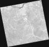
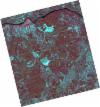
DE2_OPER_HRA_PM4_1C_20210626T111525_N39-393_W008-179_0001
Download Product | Product Info | Browse
Platform Short Name | GEOSAT |
Platform Serial Identifier | 2 |
Product Type | HRA_PM4_1C |
Start Date | 2021-06-26T11:15:25Z |
Stop Date | 2021-06-26T11:15:28Z |
Original Name | DE2_PM4_L1C_000000_20210626T111525_20210626T111528_DE2_38039_2055.zip |
Footprint | 39.3354511683 -8.06843816262 39.4764236619 -8.10149245399 39.4509180136 -8.28984097399 39.309974655 -8.25643590458 39.3354511683 -8.06843816262 |
Orbit Direction | ASCENDING |
Scene Centre Longitude | W008 |
Scene Centre Latitude | N39 |
Cloud Cover Percentage | -1 |
DE2_OPER_HRA_PSH_1C_20210613T110651_N39-527_W008-118_0001
Download Product | Product Info | Browse
Platform Short Name | GEOSAT |
Platform Serial Identifier | 2 |
Product Type | HRA_PSH_1C |
Start Date | 2021-06-13T11:06:51Z |
Stop Date | 2021-06-13T11:06:53Z |
Original Name | DE2_PSH_L1C_000000_20210613T110651_20210613T110653_DE2_37846_558F.zip |
Footprint | 39.4760671277 -8.02534665236 39.6025919553 -8.06066697597 39.5781691897 -8.21146921218 39.4516216463 -8.17621818816 39.4760671277 -8.02534665236 |
Orbit Direction | ASCENDING |
Scene Centre Longitude | W008 |
Scene Centre Latitude | N39 |
Cloud Cover Percentage | -1 |
DE2_OPER_HRA_PM4_1C_20210613T110651_N39-527_W008-118_0001
Download Product | Product Info | Browse
Platform Short Name | GEOSAT |
Platform Serial Identifier | 2 |
Product Type | HRA_PM4_1C |
Start Date | 2021-06-13T11:06:51Z |
Stop Date | 2021-06-13T11:06:53Z |
Original Name | DE2_PM4_L1C_000000_20210613T110651_20210613T110653_DE2_37846_558F.zip |
Footprint | 39.4760671277 -8.02534665236 39.6025919553 -8.06066697597 39.5781691897 -8.21146921218 39.4516216463 -8.17621818816 39.4760671277 -8.02534665236 |
Orbit Direction | ASCENDING |
Scene Centre Longitude | W008 |
Scene Centre Latitude | N39 |
Cloud Cover Percentage | -1 |
DE2_OPER_HRA_PSH_1C_20210613T110649_N39-412_W008-087_0001
Download Product | Product Info | Browse
Platform Short Name | GEOSAT |
Platform Serial Identifier | 2 |
Product Type | HRA_PSH_1C |
Start Date | 2021-06-13T11:06:49Z |
Stop Date | 2021-06-13T11:06:51Z |
Original Name | DE2_PSH_L1C_000000_20210613T110649_20210613T110651_DE2_37846_060A.zip |
Footprint | 39.3611406006 -7.99484007841 39.4877671493 -8.02885497965 39.4633556911 -8.17942769033 39.3367430974 -8.14520338862 39.3611406006 -7.99484007841 |
Orbit Direction | ASCENDING |
Scene Centre Longitude | W008 |
Scene Centre Latitude | N39 |
Cloud Cover Percentage | -1 |
DE2_OPER_HRA_PM4_1C_20210613T110649_N39-412_W008-087_0001
Download Product | Product Info | Browse
Platform Short Name | GEOSAT |
Platform Serial Identifier | 2 |
Product Type | HRA_PM4_1C |
Start Date | 2021-06-13T11:06:49Z |
Stop Date | 2021-06-13T11:06:51Z |
Original Name | DE2_PM4_L1C_000000_20210613T110649_20210613T110651_DE2_37846_060A.zip |
Footprint | 39.3611406006 -7.99484007841 39.4877671493 -8.02885497965 39.4633556911 -8.17942769033 39.3367430974 -8.14520338862 39.3611406006 -7.99484007841 |
Orbit Direction | ASCENDING |
Scene Centre Longitude | W008 |
Scene Centre Latitude | N39 |
Cloud Cover Percentage | -1 |
DE2_OPER_HRA_PSH_1C_20210525T110131_N39-429_W007-982_0001
Download Product | Product Info | Browse
Platform Short Name | GEOSAT |
Platform Serial Identifier | 2 |
Product Type | HRA_PSH_1C |
Start Date | 2021-05-25T11:01:31Z |
Stop Date | 2021-05-25T11:01:33Z |
Original Name | DE2_PSH_L1C_000000_20210525T110131_20210525T110133_DE2_37564_F281.zip |
Footprint | 39.38009778 -7.89369678224 39.5031700554 -7.9297894535 39.478046287 -8.07232899785 39.3549946929 -8.03602325763 39.38009778 -7.89369678224 |
Orbit Direction | ASCENDING |
Scene Centre Longitude | W007 |
Scene Centre Latitude | N39 |
Cloud Cover Percentage | -1 |
DE2_OPER_HRA_PM4_1C_20210525T110131_N39-429_W007-982_0001
Download Product | Product Info | Browse
Platform Short Name | GEOSAT |
Platform Serial Identifier | 2 |
Product Type | HRA_PM4_1C |
Start Date | 2021-05-25T11:01:31Z |
Stop Date | 2021-05-25T11:01:33Z |
Original Name | DE2_PM4_L1C_000000_20210525T110131_20210525T110133_DE2_37564_F281.zip |
Footprint | 39.38009778 -7.89369678224 39.5031700554 -7.9297894535 39.478046287 -8.07232899785 39.3549946929 -8.03602325763 39.38009778 -7.89369678224 |
Orbit Direction | ASCENDING |
Scene Centre Longitude | W007 |
Scene Centre Latitude | N39 |
Cloud Cover Percentage | -1 |