ESA TPM Map Catalogue - Product List
back to previous node |
list of download URLs
Collection G2_Portugal_2021
GEOSAT-2 Portugal Coverage 2021 collection. More details here.
List of available products (latitude from 39.393 to 39.4714 dg, longitude from -8.8325 to -8.68812 dg)..
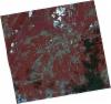
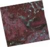
DE2_OPER_HRA_PSH_1C_20210815T111811_N39-403_W008-845_0001
Download Product | Product Info | Browse
Platform Short Name | GEOSAT |
Platform Serial Identifier | 2 |
Product Type | HRA_PSH_1C |
Start Date | 2021-08-15T11:18:11Z |
Stop Date | 2021-08-15T11:18:13Z |
Original Name | DE2_PSH_L1C_000000_20210815T111811_20210815T111813_DE2_38781_F7D7.zip |
Footprint | 39.3442956307 -8.72835571841 39.4885558333 -8.76403355534 39.4626967274 -8.96254284663 39.3183345485 -8.92725261257 39.3442956307 -8.72835571841 |
Orbit Direction | ASCENDING |
Scene Centre Longitude | W008 |
Scene Centre Latitude | N39 |
Cloud Cover Percentage | -1 |
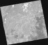
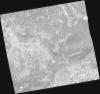
DE2_OPER_HRA_PM4_1C_20210815T111811_N39-403_W008-845_0001
Download Product | Product Info | Browse
Platform Short Name | GEOSAT |
Platform Serial Identifier | 2 |
Product Type | HRA_PM4_1C |
Start Date | 2021-08-15T11:18:11Z |
Stop Date | 2021-08-15T11:18:13Z |
Original Name | DE2_PM4_L1C_000000_20210815T111811_20210815T111813_DE2_38781_F7D7.zip |
Footprint | 39.3442956307 -8.72835571841 39.4885558333 -8.76403355534 39.4626967274 -8.96254284663 39.3183345485 -8.92725261257 39.3442956307 -8.72835571841 |
Orbit Direction | ASCENDING |
Scene Centre Longitude | W008 |
Scene Centre Latitude | N39 |
Cloud Cover Percentage | -1 |
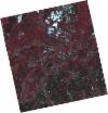
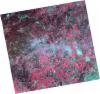
DE2_OPER_HRA_PSH_1C_20210507T111133_N39-416_W008-838_0001
Download Product | Product Info | Browse
Platform Short Name | GEOSAT |
Platform Serial Identifier | 2 |
Product Type | HRA_PSH_1C |
Start Date | 2021-05-07T11:11:33Z |
Stop Date | 2021-05-07T11:11:35Z |
Original Name | DE2_PSH_L1C_000000_20210507T111133_20210507T111135_DE2_37297_FEEB.zip |
Footprint | 39.3648445556 -8.74520969607 39.4915957425 -8.78069973456 39.4672784597 -8.93226812199 39.3404110556 -8.89728206651 39.3648445556 -8.74520969607 |
Orbit Direction | ASCENDING |
Scene Centre Longitude | W008 |
Scene Centre Latitude | N39 |
Cloud Cover Percentage | -1 |
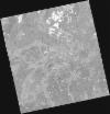
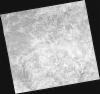
DE2_OPER_HRA_PM4_1C_20210507T111133_N39-416_W008-838_0001
Download Product | Product Info | Browse
Platform Short Name | GEOSAT |
Platform Serial Identifier | 2 |
Product Type | HRA_PM4_1C |
Start Date | 2021-05-07T11:11:33Z |
Stop Date | 2021-05-07T11:11:35Z |
Original Name | DE2_PM4_L1C_000000_20210507T111133_20210507T111135_DE2_37297_FEEB.zip |
Footprint | 39.3648445556 -8.74520969607 39.4915957425 -8.78069973456 39.4672784597 -8.93226812199 39.3404110556 -8.89728206651 39.3648445556 -8.74520969607 |
Orbit Direction | ASCENDING |
Scene Centre Longitude | W008 |
Scene Centre Latitude | N39 |
Cloud Cover Percentage | -1 |
DE2_OPER_HRA_PSH_1C_20210319T112155_N39-519_W008-702_0001
Download Product | Product Info | Browse
Platform Short Name | GEOSAT |
Platform Serial Identifier | 2 |
Product Type | HRA_PSH_1C |
Start Date | 2021-03-19T11:21:55Z |
Stop Date | 2021-03-19T11:21:58Z |
Original Name | DE2_PSH_L1C_000000_20210319T112155_20210319T112158_DE2_36570_7094.zip |
Footprint | 39.4607129504 -8.58524039653 39.6049594739 -8.62081974386 39.579128334 -8.81856097109 39.4347935163 -8.78350983496 39.4607129504 -8.58524039653 |
Orbit Direction | ASCENDING |
Scene Centre Longitude | W008 |
Scene Centre Latitude | N39 |
Cloud Cover Percentage | -1 |
DE2_OPER_HRA_PM4_1C_20210319T112155_N39-519_W008-702_0001
Download Product | Product Info | Browse
Platform Short Name | GEOSAT |
Platform Serial Identifier | 2 |
Product Type | HRA_PM4_1C |
Start Date | 2021-03-19T11:21:55Z |
Stop Date | 2021-03-19T11:21:58Z |
Original Name | DE2_PM4_L1C_000000_20210319T112155_20210319T112158_DE2_36570_7094.zip |
Footprint | 39.4607129504 -8.58524039653 39.6049594739 -8.62081974386 39.579128334 -8.81856097109 39.4347935163 -8.78350983496 39.4607129504 -8.58524039653 |
Orbit Direction | ASCENDING |
Scene Centre Longitude | W008 |
Scene Centre Latitude | N39 |
Cloud Cover Percentage | -1 |
DE2_OPER_HRA_PSH_1C_20210319T112153_N39-389_W008-670_0001
Download Product | Product Info | Browse
Platform Short Name | GEOSAT |
Platform Serial Identifier | 2 |
Product Type | HRA_PSH_1C |
Start Date | 2021-03-19T11:21:53Z |
Stop Date | 2021-03-19T11:21:56Z |
Original Name | DE2_PSH_L1C_000000_20210319T112153_20210319T112156_DE2_36570_5DC1.zip |
Footprint | 39.329964689 -8.55395628849 39.474017772 -8.58860571186 39.4480465532 -8.78750456995 39.3040165831 -8.75231972491 39.329964689 -8.55395628849 |
Orbit Direction | ASCENDING |
Scene Centre Longitude | W008 |
Scene Centre Latitude | N39 |
Cloud Cover Percentage | -1 |
DE2_OPER_HRA_PM4_1C_20210319T112153_N39-389_W008-670_0001
Download Product | Product Info | Browse
Platform Short Name | GEOSAT |
Platform Serial Identifier | 2 |
Product Type | HRA_PM4_1C |
Start Date | 2021-03-19T11:21:53Z |
Stop Date | 2021-03-19T11:21:56Z |
Original Name | DE2_PM4_L1C_000000_20210319T112153_20210319T112156_DE2_36570_5DC1.zip |
Footprint | 39.329964689 -8.55395628849 39.474017772 -8.58860571186 39.4480465532 -8.78750456995 39.3040165831 -8.75231972491 39.329964689 -8.55395628849 |
Orbit Direction | ASCENDING |
Scene Centre Longitude | W008 |
Scene Centre Latitude | N39 |
Cloud Cover Percentage | -1 |