ESA TPM Map Catalogue - Product List
back to previous node |
list of download URLs


Collection G2_Portugal_2021
GEOSAT-2 Portugal Coverage 2021 collection. More details here.
List of available products (latitude from 39.3145 to 39.393 dg, longitude from -7.61188 to -7.4675 dg)..
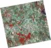
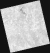
DE2_OPER_HRA_PSH_1C_20210727T111324_N39-429_W007-630_0001
Download Product | Product Info | Browse
Platform Short Name | GEOSAT |
Platform Serial Identifier | 2 |
Product Type | HRA_PSH_1C |
Start Date | 2021-07-27T11:13:24Z |
Stop Date | 2021-07-27T11:13:26Z |
Original Name | DE2_PSH_L1C_000000_20210727T111324_20210727T111326_DE2_38499_0861.zip |
Footprint | 39.3708740904 -7.51666687358 39.5143059708 -7.54953843992 39.4885878436 -7.74536601446 39.3452173228 -7.71145800331 39.3708740904 -7.51666687358 |
Orbit Direction | ASCENDING |
Scene Centre Longitude | W007 |
Scene Centre Latitude | N39 |
Cloud Cover Percentage | -1 |
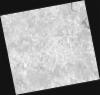
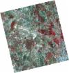
DE2_OPER_HRA_PM4_1C_20210727T111324_N39-429_W007-630_0001
Download Product | Product Info | Browse
Platform Short Name | GEOSAT |
Platform Serial Identifier | 2 |
Product Type | HRA_PM4_1C |
Start Date | 2021-07-27T11:13:24Z |
Stop Date | 2021-07-27T11:13:26Z |
Original Name | DE2_PM4_L1C_000000_20210727T111324_20210727T111326_DE2_38499_0861.zip |
Footprint | 39.3708740904 -7.51666687358 39.5143059708 -7.54953843992 39.4885878436 -7.74536601446 39.3452173228 -7.71145800331 39.3708740904 -7.51666687358 |
Orbit Direction | ASCENDING |
Scene Centre Longitude | W007 |
Scene Centre Latitude | N39 |
Cloud Cover Percentage | -1 |
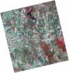
DE2_OPER_HRA_PSH_1C_20210727T111321_N39-299_W007-599_0001
Download Product | Product Info | Browse
Platform Short Name | GEOSAT |
Platform Serial Identifier | 2 |
Product Type | HRA_PSH_1C |
Start Date | 2021-07-27T11:13:21Z |
Stop Date | 2021-07-27T11:13:24Z |
Original Name | DE2_PSH_L1C_000000_20210727T111321_20210727T111324_DE2_38499_B7DA.zip |
Footprint | 39.2412272085 -7.48515317025 39.3841342487 -7.51998257763 39.3585099533 -7.71452168926 39.2155337898 -7.68003849501 39.2412272085 -7.48515317025 |
Orbit Direction | ASCENDING |
Scene Centre Longitude | W007 |
Scene Centre Latitude | N39 |
Cloud Cover Percentage | -1 |
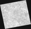
DE2_OPER_HRA_PM4_1C_20210727T111321_N39-299_W007-599_0001
Download Product | Product Info | Browse
Platform Short Name | GEOSAT |
Platform Serial Identifier | 2 |
Product Type | HRA_PM4_1C |
Start Date | 2021-07-27T11:13:21Z |
Stop Date | 2021-07-27T11:13:24Z |
Original Name | DE2_PM4_L1C_000000_20210727T111321_20210727T111324_DE2_38499_B7DA.zip |
Footprint | 39.2412272085 -7.48515317025 39.3841342487 -7.51998257763 39.3585099533 -7.71452168926 39.2155337898 -7.68003849501 39.2412272085 -7.48515317025 |
Orbit Direction | ASCENDING |
Scene Centre Longitude | W007 |
Scene Centre Latitude | N39 |
Cloud Cover Percentage | -1 |
DE2_OPER_HRA_PSH_1C_20210720T110128_N39-427_W007-538_0001
Download Product | Product Info | Browse
Platform Short Name | GEOSAT |
Platform Serial Identifier | 2 |
Product Type | HRA_PSH_1C |
Start Date | 2021-07-20T11:01:28Z |
Stop Date | 2021-07-20T11:01:30Z |
Original Name | DE2_PSH_L1C_000000_20210720T110128_20210720T110130_DE2_38395_F7E9.zip |
Footprint | 39.3769817338 -7.44768164655 39.5019505565 -7.48263026993 39.4774746962 -7.62894709432 39.3525356417 -7.59354682059 39.3769817338 -7.44768164655 |
Orbit Direction | ASCENDING |
Scene Centre Longitude | W007 |
Scene Centre Latitude | N39 |
Cloud Cover Percentage | -1 |
DE2_OPER_HRA_PM4_1C_20210720T110128_N39-427_W007-538_0001
Download Product | Product Info | Browse
Platform Short Name | GEOSAT |
Platform Serial Identifier | 2 |
Product Type | HRA_PM4_1C |
Start Date | 2021-07-20T11:01:28Z |
Stop Date | 2021-07-20T11:01:30Z |
Original Name | DE2_PM4_L1C_000000_20210720T110128_20210720T110130_DE2_38395_F7E9.zip |
Footprint | 39.3769817338 -7.44768164655 39.5019505565 -7.48263026993 39.4774746962 -7.62894709432 39.3525356417 -7.59354682059 39.3769817338 -7.44768164655 |
Orbit Direction | ASCENDING |
Scene Centre Longitude | W007 |
Scene Centre Latitude | N39 |
Cloud Cover Percentage | -1 |
DE2_OPER_HRA_PSH_1C_20210720T110126_N39-313_W007-506_0001
Download Product | Product Info | Browse
Platform Short Name | GEOSAT |
Platform Serial Identifier | 2 |
Product Type | HRA_PSH_1C |
Start Date | 2021-07-20T11:01:26Z |
Stop Date | 2021-07-20T11:01:28Z |
Original Name | DE2_PSH_L1C_000000_20210720T110126_20210720T110128_DE2_38395_9C61.zip |
Footprint | 39.2636587941 -7.41578660063 39.388521266 -7.45104869322 39.3640909498 -7.59687563472 39.2392149934 -7.56148674805 39.2636587941 -7.41578660063 |
Orbit Direction | ASCENDING |
Scene Centre Longitude | W007 |
Scene Centre Latitude | N39 |
Cloud Cover Percentage | -1 |
DE2_OPER_HRA_PM4_1C_20210720T110126_N39-313_W007-506_0001
Download Product | Product Info | Browse
Platform Short Name | GEOSAT |
Platform Serial Identifier | 2 |
Product Type | HRA_PM4_1C |
Start Date | 2021-07-20T11:01:26Z |
Stop Date | 2021-07-20T11:01:28Z |
Original Name | DE2_PM4_L1C_000000_20210720T110126_20210720T110128_DE2_38395_9C61.zip |
Footprint | 39.2636587941 -7.41578660063 39.388521266 -7.45104869322 39.3640909498 -7.59687563472 39.2392149934 -7.56148674805 39.2636587941 -7.41578660063 |
Orbit Direction | ASCENDING |
Scene Centre Longitude | W007 |
Scene Centre Latitude | N39 |
Cloud Cover Percentage | -1 |