ESA TPM Map Catalogue - Product List
back to previous node |
list of download URLs


Collection G2_Portugal_2021
GEOSAT-2 Portugal Coverage 2021 collection. More details here.
List of available products (latitude from 39.3145 to 39.393 dg, longitude from -9.385 to -9.23375 dg)..
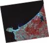
DE2_OPER_HRA_PSH_1C_20210803T112521_N39-398_W009-306_0001
Download Product | Product Info | Browse
Platform Short Name | GEOSAT |
Platform Serial Identifier | 2 |
Product Type | HRA_PSH_1C |
Start Date | 2021-08-03T11:25:21Z |
Stop Date | 2021-08-03T11:25:24Z |
Original Name | DE2_PSH_L1C_000000_20210803T112521_20210803T112524_DE2_38603_768E.zip |
Footprint | 39.333862994 -9.17117281792 39.490887141 -9.20390677807 39.4636159189 -9.44304501227 39.3058926235 -9.40915846434 39.333862994 -9.17117281792 |
Orbit Direction | ASCENDING |
Scene Centre Longitude | W009 |
Scene Centre Latitude | N39 |
Cloud Cover Percentage | -1 |
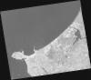
DE2_OPER_HRA_PM4_1C_20210803T112521_N39-398_W009-306_0001
Download Product | Product Info | Browse
Platform Short Name | GEOSAT |
Platform Serial Identifier | 2 |
Product Type | HRA_PM4_1C |
Start Date | 2021-08-03T11:25:21Z |
Stop Date | 2021-08-03T11:25:24Z |
Original Name | DE2_PM4_L1C_000000_20210803T112521_20210803T112524_DE2_38603_768E.zip |
Footprint | 39.333862994 -9.17117281792 39.490887141 -9.20390677807 39.4636159189 -9.44304501227 39.3058926235 -9.40915846434 39.333862994 -9.17117281792 |
Orbit Direction | ASCENDING |
Scene Centre Longitude | W009 |
Scene Centre Latitude | N39 |
Cloud Cover Percentage | -1 |
DE2_OPER_HRA_PSH_1C_20210803T112518_N39-255_W009-276_0001
Download Product | Product Info | Browse
Platform Short Name | GEOSAT |
Platform Serial Identifier | 2 |
Product Type | HRA_PSH_1C |
Start Date | 2021-08-03T11:25:18Z |
Stop Date | 2021-08-03T11:25:22Z |
Original Name | DE2_PSH_L1C_000000_20210803T112518_20210803T112522_DE2_38603_C44E.zip |
Footprint | 39.1900550446 -9.14093967962 39.3477200599 -9.17375691642 39.3204862138 -9.41219299991 39.1628991474 -9.37810943788 39.1900550446 -9.14093967962 |
Orbit Direction | ASCENDING |
Scene Centre Longitude | W009 |
Scene Centre Latitude | N39 |
Cloud Cover Percentage | -1 |
DE2_OPER_HRA_PM4_1C_20210803T112518_N39-255_W009-276_0001
Download Product | Product Info | Browse
Platform Short Name | GEOSAT |
Platform Serial Identifier | 2 |
Product Type | HRA_PM4_1C |
Start Date | 2021-08-03T11:25:18Z |
Stop Date | 2021-08-03T11:25:22Z |
Original Name | DE2_PM4_L1C_000000_20210803T112518_20210803T112522_DE2_38603_C44E.zip |
Footprint | 39.1900550446 -9.14093967962 39.3477200599 -9.17375691642 39.3204862138 -9.41219299991 39.1628991474 -9.37810943788 39.1900550446 -9.14093967962 |
Orbit Direction | ASCENDING |
Scene Centre Longitude | W009 |
Scene Centre Latitude | N39 |
Cloud Cover Percentage | -1 |
DE2_OPER_HRA_PSH_1C_20210419T112125_N39-400_W009-225_0001
Download Product | Product Info | Browse
Platform Short Name | GEOSAT |
Platform Serial Identifier | 2 |
Product Type | HRA_PSH_1C |
Start Date | 2021-04-19T11:21:25Z |
Stop Date | 2021-04-19T11:21:27Z |
Original Name | DE2_PSH_L1C_000000_20210419T112125_20210419T112127_DE2_37030_BFBE.zip |
Footprint | 39.3436562418 -9.11574615363 39.4833065338 -9.14932628221 39.4578261033 -9.33551840824 39.3182771529 -9.3017195999 39.3436562418 -9.11574615363 |
Orbit Direction | ASCENDING |
Scene Centre Longitude | W009 |
Scene Centre Latitude | N39 |
Cloud Cover Percentage | -1 |
DE2_OPER_HRA_PM4_1C_20210419T112125_N39-400_W009-225_0001
Download Product | Product Info | Browse
Platform Short Name | GEOSAT |
Platform Serial Identifier | 2 |
Product Type | HRA_PM4_1C |
Start Date | 2021-04-19T11:21:25Z |
Stop Date | 2021-04-19T11:21:27Z |
Original Name | DE2_PM4_L1C_000000_20210419T112125_20210419T112127_DE2_37030_BFBE.zip |
Footprint | 39.3436562418 -9.11574615363 39.4833065338 -9.14932628221 39.4578261033 -9.33551840824 39.3182771529 -9.3017195999 39.3436562418 -9.11574615363 |
Orbit Direction | ASCENDING |
Scene Centre Longitude | W009 |
Scene Centre Latitude | N39 |
Cloud Cover Percentage | -1 |
DE2_OPER_HRA_PSH_1C_20210418T110555_N39-347_W009-412_0001
Download Product | Product Info | Browse
Platform Short Name | GEOSAT |
Platform Serial Identifier | 2 |
Product Type | HRA_PSH_1C |
Start Date | 2021-04-18T11:05:55Z |
Stop Date | 2021-04-18T11:05:56Z |
Original Name | DE2_PSH_L1C_000000_20210418T110555_20210418T110556_DE2_37015_D7F2.zip |
Footprint | 39.336355531 -9.33375346189 39.3846526569 -9.34855295853 39.3586340014 -9.4909833096 39.3108406712 -9.47639071115 39.336355531 -9.33375346189 |
Orbit Direction | ASCENDING |
Scene Centre Longitude | W009 |
Scene Centre Latitude | N39 |
Cloud Cover Percentage | -1 |
DE2_OPER_HRA_PM4_1C_20210418T110555_N39-347_W009-412_0001
Download Product | Product Info | Browse
Platform Short Name | GEOSAT |
Platform Serial Identifier | 2 |
Product Type | HRA_PM4_1C |
Start Date | 2021-04-18T11:05:55Z |
Stop Date | 2021-04-18T11:05:56Z |
Original Name | DE2_PM4_L1C_000000_20210418T110555_20210418T110556_DE2_37015_D7F2.zip |
Footprint | 39.336355531 -9.33375346189 39.3846526569 -9.34855295853 39.3586340014 -9.4909833096 39.3108406712 -9.47639071115 39.336355531 -9.33375346189 |
Orbit Direction | ASCENDING |
Scene Centre Longitude | W009 |
Scene Centre Latitude | N39 |
Cloud Cover Percentage | -1 |
DE2_OPER_HRA_PSH_1C_20210418T110553_N39-273_W009-389_0001
Download Product | Product Info | Browse
Platform Short Name | GEOSAT |
Platform Serial Identifier | 2 |
Product Type | HRA_PSH_1C |
Start Date | 2021-04-18T11:05:53Z |
Stop Date | 2021-04-18T11:05:56Z |
Original Name | DE2_PSH_L1C_000000_20210418T110553_20210418T110556_DE2_37015_A0FF.zip |
Footprint | 39.2248029435 -9.2997897584 39.347759966 -9.33721969969 39.3220843466 -9.47683241014 39.1981242248 -9.44304904597 39.2248029435 -9.2997897584 |
Orbit Direction | ASCENDING |
Scene Centre Longitude | W009 |
Scene Centre Latitude | N39 |
Cloud Cover Percentage | -1 |
DE2_OPER_HRA_PM4_1C_20210418T110553_N39-273_W009-389_0001
Download Product | Product Info | Browse
Platform Short Name | GEOSAT |
Platform Serial Identifier | 2 |
Product Type | HRA_PM4_1C |
Start Date | 2021-04-18T11:05:53Z |
Stop Date | 2021-04-18T11:05:56Z |
Original Name | DE2_PM4_L1C_000000_20210418T110553_20210418T110556_DE2_37015_A0FF.zip |
Footprint | 39.2248029435 -9.2997897584 39.347759966 -9.33721969969 39.3220843466 -9.47683241014 39.1981242248 -9.44304904597 39.2248029435 -9.2997897584 |
Orbit Direction | ASCENDING |
Scene Centre Longitude | W009 |
Scene Centre Latitude | N39 |
Cloud Cover Percentage | -1 |