ESA TPM Map Catalogue - Product List
back to previous node |
list of download URLs

Collection G2_Portugal_2021
GEOSAT-2 Portugal Coverage 2021 collection. More details here.
List of available products (latitude from 39.2361 to 39.3145 dg, longitude from -7.90062 to -7.75625 dg)..
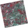
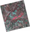
DE2_OPER_HRA_PSH_1C_20210702T111156_N39-361_W007-788_0001
Download Product | Product Info | Browse
Platform Short Name | GEOSAT |
Platform Serial Identifier | 2 |
Product Type | HRA_PSH_1C |
Start Date | 2021-07-02T11:11:56Z |
Stop Date | 2021-07-02T11:11:59Z |
Original Name | DE2_PSH_L1C_000000_20210702T111156_20210702T111159_DE2_38128_E7F0.zip |
Footprint | 39.3048185999 -7.68302501825 39.4423553071 -7.7171823303 39.4172522329 -7.89512223094 39.2797531176 -7.8603912852 39.3048185999 -7.68302501825 |
Orbit Direction | ASCENDING |
Scene Centre Longitude | W007 |
Scene Centre Latitude | N39 |
Cloud Cover Percentage | -1 |
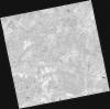
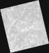
DE2_OPER_HRA_PM4_1C_20210702T111156_N39-361_W007-788_0001
Download Product | Product Info | Browse
Platform Short Name | GEOSAT |
Platform Serial Identifier | 2 |
Product Type | HRA_PM4_1C |
Start Date | 2021-07-02T11:11:56Z |
Stop Date | 2021-07-02T11:11:59Z |
Original Name | DE2_PM4_L1C_000000_20210702T111156_20210702T111159_DE2_38128_E7F0.zip |
Footprint | 39.3048185999 -7.68302501825 39.4423553071 -7.7171823303 39.4172522329 -7.89512223094 39.2797531176 -7.8603912852 39.3048185999 -7.68302501825 |
Orbit Direction | ASCENDING |
Scene Centre Longitude | W007 |
Scene Centre Latitude | N39 |
Cloud Cover Percentage | -1 |
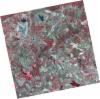
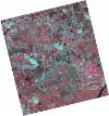
DE2_OPER_HRA_PSH_1C_20210702T111154_N39-236_W007-757_0001
Download Product | Product Info | Browse
Platform Short Name | GEOSAT |
Platform Serial Identifier | 2 |
Product Type | HRA_PSH_1C |
Start Date | 2021-07-02T11:11:54Z |
Stop Date | 2021-07-02T11:11:57Z |
Original Name | DE2_PSH_L1C_000000_20210702T111154_20210702T111157_DE2_38128_8FBF.zip |
Footprint | 39.1803467847 -7.65242521403 39.317526894 -7.68633629115 39.2924824674 -7.8635854359 39.1553264244 -7.82918303829 39.1803467847 -7.65242521403 |
Orbit Direction | ASCENDING |
Scene Centre Longitude | W007 |
Scene Centre Latitude | N39 |
Cloud Cover Percentage | -1 |
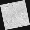
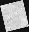
DE2_OPER_HRA_PM4_1C_20210702T111154_N39-236_W007-757_0001
Download Product | Product Info | Browse
Platform Short Name | GEOSAT |
Platform Serial Identifier | 2 |
Product Type | HRA_PM4_1C |
Start Date | 2021-07-02T11:11:54Z |
Stop Date | 2021-07-02T11:11:57Z |
Original Name | DE2_PM4_L1C_000000_20210702T111154_20210702T111157_DE2_38128_8FBF.zip |
Footprint | 39.1803467847 -7.65242521403 39.317526894 -7.68633629115 39.2924824674 -7.8635854359 39.1553264244 -7.82918303829 39.1803467847 -7.65242521403 |
Orbit Direction | ASCENDING |
Scene Centre Longitude | W007 |
Scene Centre Latitude | N39 |
Cloud Cover Percentage | -1 |
DE2_OPER_HRA_PSH_1C_20210525T110129_N39-317_W007-950_0001
Download Product | Product Info | Browse
Platform Short Name | GEOSAT |
Platform Serial Identifier | 2 |
Product Type | HRA_PSH_1C |
Start Date | 2021-05-25T11:01:29Z |
Stop Date | 2021-05-25T11:01:31Z |
Original Name | DE2_PSH_L1C_000000_20210525T110129_20210525T110131_DE2_37564_4662.zip |
Footprint | 39.2684067813 -7.86110542693 39.3914962987 -7.89705271798 39.3663961165 -8.0393925149 39.2433399025 -8.00317223435 39.2684067813 -7.86110542693 |
Orbit Direction | ASCENDING |
Scene Centre Longitude | W007 |
Scene Centre Latitude | N39 |
Cloud Cover Percentage | -1 |
DE2_OPER_HRA_PM4_1C_20210525T110129_N39-317_W007-950_0001
Download Product | Product Info | Browse
Platform Short Name | GEOSAT |
Platform Serial Identifier | 2 |
Product Type | HRA_PM4_1C |
Start Date | 2021-05-25T11:01:29Z |
Stop Date | 2021-05-25T11:01:31Z |
Original Name | DE2_PM4_L1C_000000_20210525T110129_20210525T110131_DE2_37564_4662.zip |
Footprint | 39.2684067813 -7.86110542693 39.3914962987 -7.89705271798 39.3663961165 -8.0393925149 39.2433399025 -8.00317223435 39.2684067813 -7.86110542693 |
Orbit Direction | ASCENDING |
Scene Centre Longitude | W007 |
Scene Centre Latitude | N39 |
Cloud Cover Percentage | -1 |
DE2_OPER_HRA_PSH_1C_20210525T110127_N39-205_W007-917_0001
Download Product | Product Info | Browse
Platform Short Name | GEOSAT |
Platform Serial Identifier | 2 |
Product Type | HRA_PSH_1C |
Start Date | 2021-05-25T11:01:27Z |
Stop Date | 2021-05-25T11:01:30Z |
Original Name | DE2_PSH_L1C_000000_20210525T110127_20210525T110130_DE2_37564_2F03.zip |
Footprint | 39.156812726 -7.82846398999 39.2797996286 -7.86445995096 39.2547287689 -8.00652267117 39.1317624065 -7.9703596546 39.156812726 -7.82846398999 |
Orbit Direction | ASCENDING |
Scene Centre Longitude | W007 |
Scene Centre Latitude | N39 |
Cloud Cover Percentage | -1 |
DE2_OPER_HRA_PM4_1C_20210525T110127_N39-205_W007-917_0001
Download Product | Product Info | Browse
Platform Short Name | GEOSAT |
Platform Serial Identifier | 2 |
Product Type | HRA_PM4_1C |
Start Date | 2021-05-25T11:01:27Z |
Stop Date | 2021-05-25T11:01:30Z |
Original Name | DE2_PM4_L1C_000000_20210525T110127_20210525T110130_DE2_37564_2F03.zip |
Footprint | 39.156812726 -7.82846398999 39.2797996286 -7.86445995096 39.2547287689 -8.00652267117 39.1317624065 -7.9703596546 39.156812726 -7.82846398999 |
Orbit Direction | ASCENDING |
Scene Centre Longitude | W007 |
Scene Centre Latitude | N39 |
Cloud Cover Percentage | -1 |
DE2_OPER_HRA_PSH_1C_20210318T110619_N39-310_W007-810_0001
Download Product | Product Info | Browse
Platform Short Name | GEOSAT |
Platform Serial Identifier | 2 |
Product Type | HRA_PSH_1C |
Start Date | 2021-03-18T11:06:19Z |
Stop Date | 2021-03-18T11:06:21Z |
Original Name | DE2_PSH_L1C_000000_20210318T110619_20210318T110621_DE2_36555_C434.zip |
Footprint | 39.260603401 -7.71949362934 39.3855180872 -7.75466823384 39.3609718247 -7.90069305769 39.2360511465 -7.86540889867 39.260603401 -7.71949362934 |
Orbit Direction | ASCENDING |
Scene Centre Longitude | W007 |
Scene Centre Latitude | N39 |
Cloud Cover Percentage | -1 |
DE2_OPER_HRA_PM4_1C_20210318T110619_N39-310_W007-810_0001
Download Product | Product Info | Browse
Platform Short Name | GEOSAT |
Platform Serial Identifier | 2 |
Product Type | HRA_PM4_1C |
Start Date | 2021-03-18T11:06:19Z |
Stop Date | 2021-03-18T11:06:21Z |
Original Name | DE2_PM4_L1C_000000_20210318T110619_20210318T110621_DE2_36555_C434.zip |
Footprint | 39.260603401 -7.71949362934 39.3855180872 -7.75466823384 39.3609718247 -7.90069305769 39.2360511465 -7.86540889867 39.260603401 -7.71949362934 |
Orbit Direction | ASCENDING |
Scene Centre Longitude | W007 |
Scene Centre Latitude | N39 |
Cloud Cover Percentage | -1 |
DE2_OPER_HRA_PSH_1C_20210318T110617_N39-207_W007-845_0001
Download Product | Product Info | Browse
Platform Short Name | GEOSAT |
Platform Serial Identifier | 2 |
Product Type | HRA_PSH_1C |
Start Date | 2021-03-18T11:06:17Z |
Stop Date | 2021-03-18T11:06:19Z |
Original Name | DE2_PSH_L1C_000000_20210318T110617_20210318T110619_DE2_36555_3D04.zip |
Footprint | 39.173144 -7.827956 39.242325 -7.826805 39.242678 -7.862385 39.173496 -7.863501 39.173144 -7.827956 |
Orbit Direction | ASCENDING |
Scene Centre Longitude | W007 |
Scene Centre Latitude | N39 |
Cloud Cover Percentage | -1 |
DE2_OPER_HRA_PM4_1C_20210318T110617_N39-207_W007-845_0001
Download Product | Product Info | Browse
Platform Short Name | GEOSAT |
Platform Serial Identifier | 2 |
Product Type | HRA_PM4_1C |
Start Date | 2021-03-18T11:06:17Z |
Stop Date | 2021-03-18T11:06:19Z |
Original Name | DE2_PM4_L1C_000000_20210318T110617_20210318T110619_DE2_36555_3D04.zip |
Footprint | 39.173144 -7.827956 39.242325 -7.826805 39.242678 -7.862385 39.173496 -7.863501 39.173144 -7.827956 |
Orbit Direction | ASCENDING |
Scene Centre Longitude | W007 |
Scene Centre Latitude | N39 |
Cloud Cover Percentage | -1 |