ESA TPM Map Catalogue - Product List
back to previous node |
list of download URLs

Collection G2_Portugal_2021
GEOSAT-2 Portugal Coverage 2021 collection. More details here.
List of available products (latitude from 39.1577 to 39.2361 dg, longitude from -7.75625 to -7.61188 dg)..
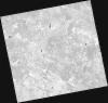
DE2_OPER_HRA_PSH_1C_20210727T111321_N39-299_W007-599_0001
Download Product | Product Info | Browse
Platform Short Name | GEOSAT |
Platform Serial Identifier | 2 |
Product Type | HRA_PSH_1C |
Start Date | 2021-07-27T11:13:21Z |
Stop Date | 2021-07-27T11:13:24Z |
Original Name | DE2_PSH_L1C_000000_20210727T111321_20210727T111324_DE2_38499_B7DA.zip |
Footprint | 39.2412272085 -7.48515317025 39.3841342487 -7.51998257763 39.3585099533 -7.71452168926 39.2155337898 -7.68003849501 39.2412272085 -7.48515317025 |
Orbit Direction | ASCENDING |
Scene Centre Longitude | W007 |
Scene Centre Latitude | N39 |
Cloud Cover Percentage | -1 |
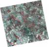
DE2_OPER_HRA_PM4_1C_20210727T111321_N39-299_W007-599_0001
Download Product | Product Info | Browse
Platform Short Name | GEOSAT |
Platform Serial Identifier | 2 |
Product Type | HRA_PM4_1C |
Start Date | 2021-07-27T11:13:21Z |
Stop Date | 2021-07-27T11:13:24Z |
Original Name | DE2_PM4_L1C_000000_20210727T111321_20210727T111324_DE2_38499_B7DA.zip |
Footprint | 39.2412272085 -7.48515317025 39.3841342487 -7.51998257763 39.3585099533 -7.71452168926 39.2155337898 -7.68003849501 39.2412272085 -7.48515317025 |
Orbit Direction | ASCENDING |
Scene Centre Longitude | W007 |
Scene Centre Latitude | N39 |
Cloud Cover Percentage | -1 |
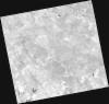
DE2_OPER_HRA_PSH_1C_20210727T111319_N39-170_W007-568_0001
Download Product | Product Info | Browse
Platform Short Name | GEOSAT |
Platform Serial Identifier | 2 |
Product Type | HRA_PSH_1C |
Start Date | 2021-07-27T11:13:19Z |
Stop Date | 2021-07-27T11:13:22Z |
Original Name | DE2_PSH_L1C_000000_20210727T111319_20210727T111322_DE2_38499_7B87.zip |
Footprint | 39.1113132538 -7.45467300255 39.254463888 -7.48865800312 39.2288012972 -7.68317863083 39.0856171676 -7.64924380463 39.1113132538 -7.45467300255 |
Orbit Direction | ASCENDING |
Scene Centre Longitude | W007 |
Scene Centre Latitude | N39 |
Cloud Cover Percentage | -1 |
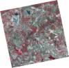
DE2_OPER_HRA_PM4_1C_20210727T111319_N39-170_W007-568_0001
Download Product | Product Info | Browse
Platform Short Name | GEOSAT |
Platform Serial Identifier | 2 |
Product Type | HRA_PM4_1C |
Start Date | 2021-07-27T11:13:19Z |
Stop Date | 2021-07-27T11:13:22Z |
Original Name | DE2_PM4_L1C_000000_20210727T111319_20210727T111322_DE2_38499_7B87.zip |
Footprint | 39.1113132538 -7.45467300255 39.254463888 -7.48865800312 39.2288012972 -7.68317863083 39.0856171676 -7.64924380463 39.1113132538 -7.45467300255 |
Orbit Direction | ASCENDING |
Scene Centre Longitude | W007 |
Scene Centre Latitude | N39 |
Cloud Cover Percentage | -1 |
DE2_OPER_HRA_PSH_1C_20210702T111154_N39-236_W007-757_0001
Download Product | Product Info | Browse
Platform Short Name | GEOSAT |
Platform Serial Identifier | 2 |
Product Type | HRA_PSH_1C |
Start Date | 2021-07-02T11:11:54Z |
Stop Date | 2021-07-02T11:11:57Z |
Original Name | DE2_PSH_L1C_000000_20210702T111154_20210702T111157_DE2_38128_8FBF.zip |
Footprint | 39.1803467847 -7.65242521403 39.317526894 -7.68633629115 39.2924824674 -7.8635854359 39.1553264244 -7.82918303829 39.1803467847 -7.65242521403 |
Orbit Direction | ASCENDING |
Scene Centre Longitude | W007 |
Scene Centre Latitude | N39 |
Cloud Cover Percentage | -1 |
DE2_OPER_HRA_PM4_1C_20210702T111154_N39-236_W007-757_0001
Download Product | Product Info | Browse
Platform Short Name | GEOSAT |
Platform Serial Identifier | 2 |
Product Type | HRA_PM4_1C |
Start Date | 2021-07-02T11:11:54Z |
Stop Date | 2021-07-02T11:11:57Z |
Original Name | DE2_PM4_L1C_000000_20210702T111154_20210702T111157_DE2_38128_8FBF.zip |
Footprint | 39.1803467847 -7.65242521403 39.317526894 -7.68633629115 39.2924824674 -7.8635854359 39.1553264244 -7.82918303829 39.1803467847 -7.65242521403 |
Orbit Direction | ASCENDING |
Scene Centre Longitude | W007 |
Scene Centre Latitude | N39 |
Cloud Cover Percentage | -1 |
DE2_OPER_HRA_PSH_1C_20210702T111152_N39-112_W007-726_0001
Download Product | Product Info | Browse
Platform Short Name | GEOSAT |
Platform Serial Identifier | 2 |
Product Type | HRA_PSH_1C |
Start Date | 2021-07-02T11:11:52Z |
Stop Date | 2021-07-02T11:11:55Z |
Original Name | DE2_PSH_L1C_000000_20210702T111152_20210702T111155_DE2_38128_9635.zip |
Footprint | 39.0560116138 -7.62164689721 39.193086994 -7.65548197288 39.1680690239 -7.83224470668 39.0309623154 -7.79849396603 39.0560116138 -7.62164689721 |
Orbit Direction | ASCENDING |
Scene Centre Longitude | W007 |
Scene Centre Latitude | N39 |
Cloud Cover Percentage | -1 |
DE2_OPER_HRA_PM4_1C_20210702T111152_N39-112_W007-726_0001
Download Product | Product Info | Browse
Platform Short Name | GEOSAT |
Platform Serial Identifier | 2 |
Product Type | HRA_PM4_1C |
Start Date | 2021-07-02T11:11:52Z |
Stop Date | 2021-07-02T11:11:55Z |
Original Name | DE2_PM4_L1C_000000_20210702T111152_20210702T111155_DE2_38128_9635.zip |
Footprint | 39.0560116138 -7.62164689721 39.193086994 -7.65548197288 39.1680690239 -7.83224470668 39.0309623154 -7.79849396603 39.0560116138 -7.62164689721 |
Orbit Direction | ASCENDING |
Scene Centre Longitude | W007 |
Scene Centre Latitude | N39 |
Cloud Cover Percentage | -1 |