ESA TPM Map Catalogue - Product List
back to previous node |
list of download URLs

Collection G2_Portugal_2021
GEOSAT-2 Portugal Coverage 2021 collection. More details here.
List of available products (latitude from 39.1577 to 39.2361 dg, longitude from -8.8325 to -8.68812 dg)..
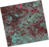
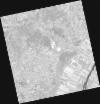
DE2_OPER_HRA_PSH_1C_20210721T111655_N39-228_W008-879_0001
Download Product | Product Info | Browse
Platform Short Name | GEOSAT |
Platform Serial Identifier | 2 |
Product Type | HRA_PSH_1C |
Start Date | 2021-07-21T11:16:55Z |
Stop Date | 2021-07-21T11:16:57Z |
Original Name | DE2_PSH_L1C_000000_20210721T111655_20210721T111657_DE2_38410_747E.zip |
Footprint | 39.1715173206 -8.77006299093 39.3104067916 -8.80393718481 39.2850456984 -8.98843097788 39.1462087454 -8.95368477139 39.1715173206 -8.77006299093 |
Orbit Direction | ASCENDING |
Scene Centre Longitude | W008 |
Scene Centre Latitude | N39 |
Cloud Cover Percentage | -1 |
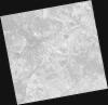
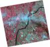
DE2_OPER_HRA_PM4_1C_20210721T111655_N39-228_W008-879_0001
Download Product | Product Info | Browse
Platform Short Name | GEOSAT |
Platform Serial Identifier | 2 |
Product Type | HRA_PM4_1C |
Start Date | 2021-07-21T11:16:55Z |
Stop Date | 2021-07-21T11:16:57Z |
Original Name | DE2_PM4_L1C_000000_20210721T111655_20210721T111657_DE2_38410_747E.zip |
Footprint | 39.1715173206 -8.77006299093 39.3104067916 -8.80393718481 39.2850456984 -8.98843097788 39.1462087454 -8.95368477139 39.1715173206 -8.77006299093 |
Orbit Direction | ASCENDING |
Scene Centre Longitude | W008 |
Scene Centre Latitude | N39 |
Cloud Cover Percentage | -1 |
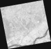
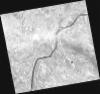
DE2_OPER_HRA_PSH_1C_20210721T111652_N39-102_W008-848_0001
Download Product | Product Info | Browse
Platform Short Name | GEOSAT |
Platform Serial Identifier | 2 |
Product Type | HRA_PSH_1C |
Start Date | 2021-07-21T11:16:52Z |
Stop Date | 2021-07-21T11:16:55Z |
Original Name | DE2_PSH_L1C_000000_20210721T111652_20210721T111655_DE2_38410_6159.zip |
Footprint | 39.0452470587 -8.73949762188 39.1843914228 -8.77327751587 39.1590644014 -8.95706185652 39.0199383534 -8.92282896279 39.0452470587 -8.73949762188 |
Orbit Direction | ASCENDING |
Scene Centre Longitude | W008 |
Scene Centre Latitude | N39 |
Cloud Cover Percentage | -1 |
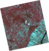
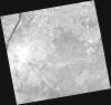
DE2_OPER_HRA_PM4_1C_20210721T111652_N39-102_W008-848_0001
Download Product | Product Info | Browse
Platform Short Name | GEOSAT |
Platform Serial Identifier | 2 |
Product Type | HRA_PM4_1C |
Start Date | 2021-07-21T11:16:52Z |
Stop Date | 2021-07-21T11:16:55Z |
Original Name | DE2_PM4_L1C_000000_20210721T111652_20210721T111655_DE2_38410_6159.zip |
Footprint | 39.0452470587 -8.73949762188 39.1843914228 -8.77327751587 39.1590644014 -8.95706185652 39.0199383534 -8.92282896279 39.0452470587 -8.73949762188 |
Orbit Direction | ASCENDING |
Scene Centre Longitude | W008 |
Scene Centre Latitude | N39 |
Cloud Cover Percentage | -1 |
DE2_OPER_HRA_PSH_1C_20210507T111129_N39-185_W008-775_0001
Download Product | Product Info | Browse
Platform Short Name | GEOSAT |
Platform Serial Identifier | 2 |
Product Type | HRA_PSH_1C |
Start Date | 2021-05-07T11:11:29Z |
Stop Date | 2021-05-07T11:11:32Z |
Original Name | DE2_PSH_L1C_000000_20210507T111129_20210507T111132_DE2_37297_1196.zip |
Footprint | 39.1347223983 -8.68260642156 39.2615288072 -8.71710453053 39.2371243988 -8.86895436961 39.1103549574 -8.83414319214 39.1347223983 -8.68260642156 |
Orbit Direction | ASCENDING |
Scene Centre Longitude | W008 |
Scene Centre Latitude | N39 |
Cloud Cover Percentage | -1 |
DE2_OPER_HRA_PM4_1C_20210507T111129_N39-185_W008-775_0001
Download Product | Product Info | Browse
Platform Short Name | GEOSAT |
Platform Serial Identifier | 2 |
Product Type | HRA_PM4_1C |
Start Date | 2021-05-07T11:11:29Z |
Stop Date | 2021-05-07T11:11:32Z |
Original Name | DE2_PM4_L1C_000000_20210507T111129_20210507T111132_DE2_37297_1196.zip |
Footprint | 39.1347223983 -8.68260642156 39.2615288072 -8.71710453053 39.2371243988 -8.86895436961 39.1103549574 -8.83414319214 39.1347223983 -8.68260642156 |
Orbit Direction | ASCENDING |
Scene Centre Longitude | W008 |
Scene Centre Latitude | N39 |
Cloud Cover Percentage | -1 |
DE2_OPER_HRA_PSH_1C_20210319T112151_N39-258_W008-639_0001
Download Product | Product Info | Browse
Platform Short Name | GEOSAT |
Platform Serial Identifier | 2 |
Product Type | HRA_PSH_1C |
Start Date | 2021-03-19T11:21:51Z |
Stop Date | 2021-03-19T11:21:54Z |
Original Name | DE2_PSH_L1C_000000_20210319T112151_20210319T112154_DE2_36570_0B3D.zip |
Footprint | 39.1990956898 -8.52395957179 39.343391494 -8.55709995778 39.3174180028 -8.75552639684 39.1733279396 -8.72033219535 39.1990956898 -8.52395957179 |
Orbit Direction | ASCENDING |
Scene Centre Longitude | W008 |
Scene Centre Latitude | N39 |
Cloud Cover Percentage | -1 |
DE2_OPER_HRA_PM4_1C_20210319T112151_N39-258_W008-639_0001
Download Product | Product Info | Browse
Platform Short Name | GEOSAT |
Platform Serial Identifier | 2 |
Product Type | HRA_PM4_1C |
Start Date | 2021-03-19T11:21:51Z |
Stop Date | 2021-03-19T11:21:54Z |
Original Name | DE2_PM4_L1C_000000_20210319T112151_20210319T112154_DE2_36570_0B3D.zip |
Footprint | 39.1990956898 -8.52395957179 39.343391494 -8.55709995778 39.3174180028 -8.75552639684 39.1733279396 -8.72033219535 39.1990956898 -8.52395957179 |
Orbit Direction | ASCENDING |
Scene Centre Longitude | W008 |
Scene Centre Latitude | N39 |
Cloud Cover Percentage | -1 |
DE2_OPER_HRA_PM4_1C_20210319T112149_N39-127_W008-608_0001
Download Product | Product Info | Browse
Platform Short Name | GEOSAT |
Platform Serial Identifier | 2 |
Product Type | HRA_PM4_1C |
Start Date | 2021-03-19T11:21:49Z |
Stop Date | 2021-03-19T11:21:52Z |
Original Name | DE2_PM4_L1C_000000_20210319T112149_20210319T112152_DE2_36570_51B5.zip |
Footprint | 39.0681036413 -8.49292799548 39.2124419815 -8.52697952687 39.1866426833 -8.72354468526 39.042272689 -8.68952901538 39.0681036413 -8.49292799548 |
Orbit Direction | ASCENDING |
Scene Centre Longitude | W008 |
Scene Centre Latitude | N39 |
Cloud Cover Percentage | -1 |
DE2_OPER_HRA_PSH_1C_20210319T112149_N39-127_W008-608_0001
Download Product | Product Info | Browse
Platform Short Name | GEOSAT |
Platform Serial Identifier | 2 |
Product Type | HRA_PSH_1C |
Start Date | 2021-03-19T11:21:49Z |
Stop Date | 2021-03-19T11:21:52Z |
Original Name | DE2_PSH_L1C_000000_20210319T112149_20210319T112152_DE2_36570_51B5.zip |
Footprint | 39.0681036413 -8.49292799548 39.2124419815 -8.52697952687 39.1866426833 -8.72354468526 39.042272689 -8.68952901538 39.0681036413 -8.49292799548 |
Orbit Direction | ASCENDING |
Scene Centre Longitude | W008 |
Scene Centre Latitude | N39 |
Cloud Cover Percentage | -1 |