ESA TPM Map Catalogue - Product List
back to previous node |
list of download URLs


Collection G2_Portugal_2021
GEOSAT-2 Portugal Coverage 2021 collection. More details here.
List of available products (latitude from 39.1577 to 39.2361 dg, longitude from -9.18688 to -9.0425 dg)..
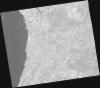
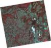
DE2_OPER_HRA_PSH_1C_20210803T112518_N39-255_W009-276_0001
Download Product | Product Info | Browse
Platform Short Name | GEOSAT |
Platform Serial Identifier | 2 |
Product Type | HRA_PSH_1C |
Start Date | 2021-08-03T11:25:18Z |
Stop Date | 2021-08-03T11:25:22Z |
Original Name | DE2_PSH_L1C_000000_20210803T112518_20210803T112522_DE2_38603_C44E.zip |
Footprint | 39.1900550446 -9.14093967962 39.3477200599 -9.17375691642 39.3204862138 -9.41219299991 39.1628991474 -9.37810943788 39.1900550446 -9.14093967962 |
Orbit Direction | ASCENDING |
Scene Centre Longitude | W009 |
Scene Centre Latitude | N39 |
Cloud Cover Percentage | -1 |
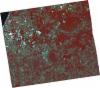
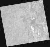
DE2_OPER_HRA_PM4_1C_20210803T112518_N39-255_W009-276_0001
Download Product | Product Info | Browse
Platform Short Name | GEOSAT |
Platform Serial Identifier | 2 |
Product Type | HRA_PM4_1C |
Start Date | 2021-08-03T11:25:18Z |
Stop Date | 2021-08-03T11:25:22Z |
Original Name | DE2_PM4_L1C_000000_20210803T112518_20210803T112522_DE2_38603_C44E.zip |
Footprint | 39.1900550446 -9.14093967962 39.3477200599 -9.17375691642 39.3204862138 -9.41219299991 39.1628991474 -9.37810943788 39.1900550446 -9.14093967962 |
Orbit Direction | ASCENDING |
Scene Centre Longitude | W009 |
Scene Centre Latitude | N39 |
Cloud Cover Percentage | -1 |
DE2_OPER_HRA_PSH_1C_20210803T112516_N39-112_W009-246_0001
Download Product | Product Info | Browse
Platform Short Name | GEOSAT |
Platform Serial Identifier | 2 |
Product Type | HRA_PSH_1C |
Start Date | 2021-08-03T11:25:16Z |
Stop Date | 2021-08-03T11:25:19Z |
Original Name | DE2_PSH_L1C_000000_20210803T112516_20210803T112519_DE2_38603_F673.zip |
Footprint | 39.0470323437 -9.1115163334 39.2046285235 -9.14432175116 39.177466566 -9.38124387814 39.0198850247 -9.34769928112 39.0470323437 -9.1115163334 |
Orbit Direction | ASCENDING |
Scene Centre Longitude | W009 |
Scene Centre Latitude | N39 |
Cloud Cover Percentage | -1 |
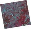
DE2_OPER_HRA_PM4_1C_20210803T112516_N39-112_W009-246_0001
Download Product | Product Info | Browse
Platform Short Name | GEOSAT |
Platform Serial Identifier | 2 |
Product Type | HRA_PM4_1C |
Start Date | 2021-08-03T11:25:16Z |
Stop Date | 2021-08-03T11:25:19Z |
Original Name | DE2_PM4_L1C_000000_20210803T112516_20210803T112519_DE2_38603_F673.zip |
Footprint | 39.0470323437 -9.1115163334 39.2046285235 -9.14432175116 39.177466566 -9.38124387814 39.0198850247 -9.34769928112 39.0470323437 -9.1115163334 |
Orbit Direction | ASCENDING |
Scene Centre Longitude | W009 |
Scene Centre Latitude | N39 |
Cloud Cover Percentage | -1 |
DE2_OPER_HRA_PSH_1C_20210715T112026_N39-238_W009-075_0001
Download Product | Product Info | Browse
Platform Short Name | GEOSAT |
Platform Serial Identifier | 2 |
Product Type | HRA_PSH_1C |
Start Date | 2021-07-15T11:20:26Z |
Stop Date | 2021-07-15T11:20:29Z |
Original Name | DE2_PSH_L1C_000000_20210715T112026_20210715T112029_DE2_38321_DFBB.zip |
Footprint | 39.1791979542 -8.95848235299 39.324114973 -8.9924531856 39.2981866273 -9.19286556971 39.1532603394 -9.15861702347 39.1791979542 -8.95848235299 |
Orbit Direction | ASCENDING |
Scene Centre Longitude | W009 |
Scene Centre Latitude | N39 |
Cloud Cover Percentage | -1 |
DE2_OPER_HRA_PM4_1C_20210715T112026_N39-238_W009-075_0001
Download Product | Product Info | Browse
Platform Short Name | GEOSAT |
Platform Serial Identifier | 2 |
Product Type | HRA_PM4_1C |
Start Date | 2021-07-15T11:20:26Z |
Stop Date | 2021-07-15T11:20:29Z |
Original Name | DE2_PM4_L1C_000000_20210715T112026_20210715T112029_DE2_38321_DFBB.zip |
Footprint | 39.1791979542 -8.95848235299 39.324114973 -8.9924531856 39.2981866273 -9.19286556971 39.1532603394 -9.15861702347 39.1791979542 -8.95848235299 |
Orbit Direction | ASCENDING |
Scene Centre Longitude | W009 |
Scene Centre Latitude | N39 |
Cloud Cover Percentage | -1 |
DE2_OPER_HRA_PSH_1C_20210715T112024_N39-107_W009-045_0001
Download Product | Product Info | Browse
Platform Short Name | GEOSAT |
Platform Serial Identifier | 2 |
Product Type | HRA_PSH_1C |
Start Date | 2021-07-15T11:20:24Z |
Stop Date | 2021-07-15T11:20:27Z |
Original Name | DE2_PSH_L1C_000000_20210715T112024_20210715T112027_DE2_38321_A2EE.zip |
Footprint | 39.0475771112 -8.92805985074 39.1926075025 -8.96162709215 39.1666438973 -9.16202427148 39.0215144355 -9.12914203624 39.0475771112 -8.92805985074 |
Orbit Direction | ASCENDING |
Scene Centre Longitude | W009 |
Scene Centre Latitude | N39 |
Cloud Cover Percentage | -1 |
DE2_OPER_HRA_PM4_1C_20210715T112024_N39-107_W009-045_0001
Download Product | Product Info | Browse
Platform Short Name | GEOSAT |
Platform Serial Identifier | 2 |
Product Type | HRA_PM4_1C |
Start Date | 2021-07-15T11:20:24Z |
Stop Date | 2021-07-15T11:20:27Z |
Original Name | DE2_PM4_L1C_000000_20210715T112024_20210715T112027_DE2_38321_A2EE.zip |
Footprint | 39.0475771112 -8.92805985074 39.1926075025 -8.96162709215 39.1666438973 -9.16202427148 39.0215144355 -9.12914203624 39.0475771112 -8.92805985074 |
Orbit Direction | ASCENDING |
Scene Centre Longitude | W009 |
Scene Centre Latitude | N39 |
Cloud Cover Percentage | -1 |