ESA TPM Map Catalogue - Product List
back to previous node |
list of download URLs
Collection G2_Portugal_2021
GEOSAT-2 Portugal Coverage 2021 collection. More details here.
List of available products (latitude from 39.0793 to 39.1577 dg, longitude from -8.045 to -7.90062 dg)..
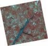
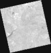
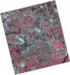
DE2_OPER_HRA_PSH_1C_20210626T111521_N39-137_W008-117_0001
Download Product | Product Info | Browse
Platform Short Name | GEOSAT |
Platform Serial Identifier | 2 |
Product Type | HRA_PSH_1C |
Start Date | 2021-06-26T11:15:21Z |
Stop Date | 2021-06-26T11:15:24Z |
Original Name | DE2_PSH_L1C_000000_20210626T111521_20210626T111524_DE2_38039_ECB7.zip |
Footprint | 39.0799347828 -8.00707134637 39.2208358752 -8.04021541765 39.1953030714 -8.2283772843 39.0544984369 -8.19391460566 39.0799347828 -8.00707134637 |
Orbit Direction | ASCENDING |
Scene Centre Longitude | W008 |
Scene Centre Latitude | N39 |
Cloud Cover Percentage | -1 |
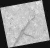
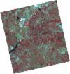
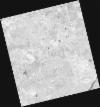
DE2_OPER_HRA_PM4_1C_20210626T111521_N39-137_W008-117_0001
Download Product | Product Info | Browse
Platform Short Name | GEOSAT |
Platform Serial Identifier | 2 |
Product Type | HRA_PM4_1C |
Start Date | 2021-06-26T11:15:21Z |
Stop Date | 2021-06-26T11:15:24Z |
Original Name | DE2_PM4_L1C_000000_20210626T111521_20210626T111524_DE2_38039_ECB7.zip |
Footprint | 39.0799347828 -8.00707134637 39.2208358752 -8.04021541765 39.1953030714 -8.2283772843 39.0544984369 -8.19391460566 39.0799347828 -8.00707134637 |
Orbit Direction | ASCENDING |
Scene Centre Longitude | W008 |
Scene Centre Latitude | N39 |
Cloud Cover Percentage | -1 |
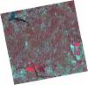
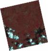
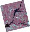
DE2_OPER_HRA_PSH_1C_20210626T111519_N39-009_W008-086_0001
Download Product | Product Info | Browse
Platform Short Name | GEOSAT |
Platform Serial Identifier | 2 |
Product Type | HRA_PSH_1C |
Start Date | 2021-06-26T11:15:19Z |
Stop Date | 2021-06-26T11:15:22Z |
Original Name | DE2_PSH_L1C_000000_20210626T111519_20210626T111522_DE2_38039_6E29.zip |
Footprint | 38.9522555125 -7.9763637154 39.0930089145 -8.00989734619 39.0674797012 -8.19762484923 38.9267400026 -8.16347906803 38.9522555125 -7.9763637154 |
Orbit Direction | ASCENDING |
Scene Centre Longitude | W008 |
Scene Centre Latitude | N39 |
Cloud Cover Percentage | -1 |
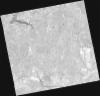
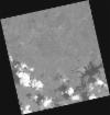
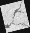
DE2_OPER_HRA_PM4_1C_20210626T111519_N39-009_W008-086_0001
Download Product | Product Info | Browse
Platform Short Name | GEOSAT |
Platform Serial Identifier | 2 |
Product Type | HRA_PM4_1C |
Start Date | 2021-06-26T11:15:19Z |
Stop Date | 2021-06-26T11:15:22Z |
Original Name | DE2_PM4_L1C_000000_20210626T111519_20210626T111522_DE2_38039_6E29.zip |
Footprint | 38.9522555125 -7.9763637154 39.0930089145 -8.00989734619 39.0674797012 -8.19762484923 38.9267400026 -8.16347906803 38.9522555125 -7.9763637154 |
Orbit Direction | ASCENDING |
Scene Centre Longitude | W008 |
Scene Centre Latitude | N39 |
Cloud Cover Percentage | -1 |
DE2_OPER_HRA_PM4_1C_20210613T110645_N39-182_W008-024_0001
Download Product | Product Info | Browse
Platform Short Name | GEOSAT |
Platform Serial Identifier | 2 |
Product Type | HRA_PM4_1C |
Start Date | 2021-06-13T11:06:45Z |
Stop Date | 2021-06-13T11:06:48Z |
Original Name | DE2_PM4_L1C_000000_20210613T110645_20210613T110648_DE2_37846_34C7.zip |
Footprint | 39.1311630996 -7.9322933673 39.257887932 -7.96650903103 39.2334655669 -8.11695621463 39.1067859014 -8.08221173386 39.1311630996 -7.9322933673 |
Orbit Direction | ASCENDING |
Scene Centre Longitude | W008 |
Scene Centre Latitude | N39 |
Cloud Cover Percentage | -1 |
DE2_OPER_HRA_PSH_1C_20210613T110645_N39-182_W008-024_0001
Download Product | Product Info | Browse
Platform Short Name | GEOSAT |
Platform Serial Identifier | 2 |
Product Type | HRA_PSH_1C |
Start Date | 2021-06-13T11:06:45Z |
Stop Date | 2021-06-13T11:06:48Z |
Original Name | DE2_PSH_L1C_000000_20210613T110645_20210613T110648_DE2_37846_34C7.zip |
Footprint | 39.1311630996 -7.9322933673 39.257887932 -7.96650903103 39.2334655669 -8.11695621463 39.1067859014 -8.08221173386 39.1311630996 -7.9322933673 |
Orbit Direction | ASCENDING |
Scene Centre Longitude | W008 |
Scene Centre Latitude | N39 |
Cloud Cover Percentage | -1 |
DE2_OPER_HRA_PSH_1C_20210613T110643_N39-067_W007-993_0001
Download Product | Product Info | Browse
Platform Short Name | GEOSAT |
Platform Serial Identifier | 2 |
Product Type | HRA_PSH_1C |
Start Date | 2021-06-13T11:06:43Z |
Stop Date | 2021-06-13T11:06:46Z |
Original Name | DE2_PSH_L1C_000000_20210613T110643_20210613T110646_DE2_37846_B7F3.zip |
Footprint | 39.0161740616 -7.90116622634 39.1428916929 -7.93560495478 39.1185042925 -8.08560802638 38.9918071423 -8.05093754712 39.0161740616 -7.90116622634 |
Orbit Direction | ASCENDING |
Scene Centre Longitude | W007 |
Scene Centre Latitude | N39 |
Cloud Cover Percentage | -1 |
DE2_OPER_HRA_PM4_1C_20210613T110643_N39-067_W007-993_0001
Download Product | Product Info | Browse
Platform Short Name | GEOSAT |
Platform Serial Identifier | 2 |
Product Type | HRA_PM4_1C |
Start Date | 2021-06-13T11:06:43Z |
Stop Date | 2021-06-13T11:06:46Z |
Original Name | DE2_PM4_L1C_000000_20210613T110643_20210613T110646_DE2_37846_B7F3.zip |
Footprint | 39.0161740616 -7.90116622634 39.1428916929 -7.93560495478 39.1185042925 -8.08560802638 38.9918071423 -8.05093754712 39.0161740616 -7.90116622634 |
Orbit Direction | ASCENDING |
Scene Centre Longitude | W007 |
Scene Centre Latitude | N39 |
Cloud Cover Percentage | -1 |
DE2_OPER_HRA_PSH_1C_20210525T110127_N39-205_W007-917_0001
Download Product | Product Info | Browse
Platform Short Name | GEOSAT |
Platform Serial Identifier | 2 |
Product Type | HRA_PSH_1C |
Start Date | 2021-05-25T11:01:27Z |
Stop Date | 2021-05-25T11:01:30Z |
Original Name | DE2_PSH_L1C_000000_20210525T110127_20210525T110130_DE2_37564_2F03.zip |
Footprint | 39.156812726 -7.82846398999 39.2797996286 -7.86445995096 39.2547287689 -8.00652267117 39.1317624065 -7.9703596546 39.156812726 -7.82846398999 |
Orbit Direction | ASCENDING |
Scene Centre Longitude | W007 |
Scene Centre Latitude | N39 |
Cloud Cover Percentage | -1 |
DE2_OPER_HRA_PM4_1C_20210525T110127_N39-205_W007-917_0001
Download Product | Product Info | Browse
Platform Short Name | GEOSAT |
Platform Serial Identifier | 2 |
Product Type | HRA_PM4_1C |
Start Date | 2021-05-25T11:01:27Z |
Stop Date | 2021-05-25T11:01:30Z |
Original Name | DE2_PM4_L1C_000000_20210525T110127_20210525T110130_DE2_37564_2F03.zip |
Footprint | 39.156812726 -7.82846398999 39.2797996286 -7.86445995096 39.2547287689 -8.00652267117 39.1317624065 -7.9703596546 39.156812726 -7.82846398999 |
Orbit Direction | ASCENDING |
Scene Centre Longitude | W007 |
Scene Centre Latitude | N39 |
Cloud Cover Percentage | -1 |
DE2_OPER_HRA_PSH_1C_20210525T110125_N39-094_W007-884_0001
Download Product | Product Info | Browse
Platform Short Name | GEOSAT |
Platform Serial Identifier | 2 |
Product Type | HRA_PSH_1C |
Start Date | 2021-05-25T11:01:25Z |
Stop Date | 2021-05-25T11:01:28Z |
Original Name | DE2_PSH_L1C_000000_20210525T110125_20210525T110128_DE2_37564_1903.zip |
Footprint | 39.0452611103 -7.79572980759 39.1681996378 -7.83179110552 39.1431388536 -7.97370874443 39.0202135495 -7.93742964868 39.0452611103 -7.79572980759 |
Orbit Direction | ASCENDING |
Scene Centre Longitude | W007 |
Scene Centre Latitude | N39 |
Cloud Cover Percentage | -1 |
DE2_OPER_HRA_PM4_1C_20210525T110125_N39-094_W007-884_0001
Download Product | Product Info | Browse
Platform Short Name | GEOSAT |
Platform Serial Identifier | 2 |
Product Type | HRA_PM4_1C |
Start Date | 2021-05-25T11:01:25Z |
Stop Date | 2021-05-25T11:01:28Z |
Original Name | DE2_PM4_L1C_000000_20210525T110125_20210525T110128_DE2_37564_1903.zip |
Footprint | 39.0452611103 -7.79572980759 39.1681996378 -7.83179110552 39.1431388536 -7.97370874443 39.0202135495 -7.93742964868 39.0452611103 -7.79572980759 |
Orbit Direction | ASCENDING |
Scene Centre Longitude | W007 |
Scene Centre Latitude | N39 |
Cloud Cover Percentage | -1 |