ESA TPM Map Catalogue - Product List
back to previous node |
list of download URLs


Collection G2_Portugal_2021
GEOSAT-2 Portugal Coverage 2021 collection. More details here.
List of available products (latitude from 39.0793 to 39.1577 dg, longitude from -9.0425 to -8.89813 dg)..
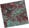
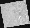
DE2_OPER_HRA_PSH_1C_20210721T111655_N39-228_W008-879_0001
Download Product | Product Info | Browse
Platform Short Name | GEOSAT |
Platform Serial Identifier | 2 |
Product Type | HRA_PSH_1C |
Start Date | 2021-07-21T11:16:55Z |
Stop Date | 2021-07-21T11:16:57Z |
Original Name | DE2_PSH_L1C_000000_20210721T111655_20210721T111657_DE2_38410_747E.zip |
Footprint | 39.1715173206 -8.77006299093 39.3104067916 -8.80393718481 39.2850456984 -8.98843097788 39.1462087454 -8.95368477139 39.1715173206 -8.77006299093 |
Orbit Direction | ASCENDING |
Scene Centre Longitude | W008 |
Scene Centre Latitude | N39 |
Cloud Cover Percentage | -1 |
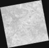
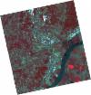
DE2_OPER_HRA_PM4_1C_20210721T111655_N39-228_W008-879_0001
Download Product | Product Info | Browse
Platform Short Name | GEOSAT |
Platform Serial Identifier | 2 |
Product Type | HRA_PM4_1C |
Start Date | 2021-07-21T11:16:55Z |
Stop Date | 2021-07-21T11:16:57Z |
Original Name | DE2_PM4_L1C_000000_20210721T111655_20210721T111657_DE2_38410_747E.zip |
Footprint | 39.1715173206 -8.77006299093 39.3104067916 -8.80393718481 39.2850456984 -8.98843097788 39.1462087454 -8.95368477139 39.1715173206 -8.77006299093 |
Orbit Direction | ASCENDING |
Scene Centre Longitude | W008 |
Scene Centre Latitude | N39 |
Cloud Cover Percentage | -1 |
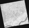
DE2_OPER_HRA_PSH_1C_20210721T111652_N39-102_W008-848_0001
Download Product | Product Info | Browse
Platform Short Name | GEOSAT |
Platform Serial Identifier | 2 |
Product Type | HRA_PSH_1C |
Start Date | 2021-07-21T11:16:52Z |
Stop Date | 2021-07-21T11:16:55Z |
Original Name | DE2_PSH_L1C_000000_20210721T111652_20210721T111655_DE2_38410_6159.zip |
Footprint | 39.0452470587 -8.73949762188 39.1843914228 -8.77327751587 39.1590644014 -8.95706185652 39.0199383534 -8.92282896279 39.0452470587 -8.73949762188 |
Orbit Direction | ASCENDING |
Scene Centre Longitude | W008 |
Scene Centre Latitude | N39 |
Cloud Cover Percentage | -1 |
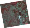
DE2_OPER_HRA_PM4_1C_20210721T111652_N39-102_W008-848_0001
Download Product | Product Info | Browse
Platform Short Name | GEOSAT |
Platform Serial Identifier | 2 |
Product Type | HRA_PM4_1C |
Start Date | 2021-07-21T11:16:52Z |
Stop Date | 2021-07-21T11:16:55Z |
Original Name | DE2_PM4_L1C_000000_20210721T111652_20210721T111655_DE2_38410_6159.zip |
Footprint | 39.0452470587 -8.73949762188 39.1843914228 -8.77327751587 39.1590644014 -8.95706185652 39.0199383534 -8.92282896279 39.0452470587 -8.73949762188 |
Orbit Direction | ASCENDING |
Scene Centre Longitude | W008 |
Scene Centre Latitude | N39 |
Cloud Cover Percentage | -1 |
DE2_OPER_HRA_PSH_1C_20210715T112024_N39-107_W009-045_0001
Download Product | Product Info | Browse
Platform Short Name | GEOSAT |
Platform Serial Identifier | 2 |
Product Type | HRA_PSH_1C |
Start Date | 2021-07-15T11:20:24Z |
Stop Date | 2021-07-15T11:20:27Z |
Original Name | DE2_PSH_L1C_000000_20210715T112024_20210715T112027_DE2_38321_A2EE.zip |
Footprint | 39.0475771112 -8.92805985074 39.1926075025 -8.96162709215 39.1666438973 -9.16202427148 39.0215144355 -9.12914203624 39.0475771112 -8.92805985074 |
Orbit Direction | ASCENDING |
Scene Centre Longitude | W009 |
Scene Centre Latitude | N39 |
Cloud Cover Percentage | -1 |
DE2_OPER_HRA_PM4_1C_20210715T112024_N39-107_W009-045_0001
Download Product | Product Info | Browse
Platform Short Name | GEOSAT |
Platform Serial Identifier | 2 |
Product Type | HRA_PM4_1C |
Start Date | 2021-07-15T11:20:24Z |
Stop Date | 2021-07-15T11:20:27Z |
Original Name | DE2_PM4_L1C_000000_20210715T112024_20210715T112027_DE2_38321_A2EE.zip |
Footprint | 39.0475771112 -8.92805985074 39.1926075025 -8.96162709215 39.1666438973 -9.16202427148 39.0215144355 -9.12914203624 39.0475771112 -8.92805985074 |
Orbit Direction | ASCENDING |
Scene Centre Longitude | W009 |
Scene Centre Latitude | N39 |
Cloud Cover Percentage | -1 |
DE2_OPER_HRA_PSH_1C_20210607T111009_N39-022_W008-978_0001
Download Product | Product Info | Browse
Platform Short Name | GEOSAT |
Platform Serial Identifier | 2 |
Product Type | HRA_PSH_1C |
Start Date | 2021-06-07T11:10:09Z |
Stop Date | 2021-06-07T11:10:11Z |
Original Name | DE2_PSH_L1C_000000_20210607T111009_20210607T111011_DE2_37757_3FD6.zip |
Footprint | 38.9722684726 -8.88713203791 39.0977342583 -8.92193761626 39.0733075986 -9.07016573683 38.947838156 -9.03543060953 38.9722684726 -8.88713203791 |
Orbit Direction | ASCENDING |
Scene Centre Longitude | W008 |
Scene Centre Latitude | N39 |
Cloud Cover Percentage | -1 |
DE2_OPER_HRA_PM4_1C_20210607T111009_N39-022_W008-978_0001
Download Product | Product Info | Browse
Platform Short Name | GEOSAT |
Platform Serial Identifier | 2 |
Product Type | HRA_PM4_1C |
Start Date | 2021-06-07T11:10:09Z |
Stop Date | 2021-06-07T11:10:11Z |
Original Name | DE2_PM4_L1C_000000_20210607T111009_20210607T111011_DE2_37757_3FD6.zip |
Footprint | 38.9722684726 -8.88713203791 39.0977342583 -8.92193761626 39.0733075986 -9.07016573683 38.947838156 -9.03543060953 38.9722684726 -8.88713203791 |
Orbit Direction | ASCENDING |
Scene Centre Longitude | W008 |
Scene Centre Latitude | N39 |
Cloud Cover Percentage | -1 |