ESA TPM Map Catalogue - Product List
back to previous node |
list of download URLs

Collection G2_Portugal_2021
GEOSAT-2 Portugal Coverage 2021 collection. More details here.
List of available products (latitude from 39.0793 to 39.1577 dg, longitude from -9.385 to -9.23375 dg)..
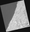
DE2_OPER_HRA_PSH_1C_20210803T112516_N39-112_W009-246_0001
Download Product | Product Info | Browse
Platform Short Name | GEOSAT |
Platform Serial Identifier | 2 |
Product Type | HRA_PSH_1C |
Start Date | 2021-08-03T11:25:16Z |
Stop Date | 2021-08-03T11:25:19Z |
Original Name | DE2_PSH_L1C_000000_20210803T112516_20210803T112519_DE2_38603_F673.zip |
Footprint | 39.0470323437 -9.1115163334 39.2046285235 -9.14432175116 39.177466566 -9.38124387814 39.0198850247 -9.34769928112 39.0470323437 -9.1115163334 |
Orbit Direction | ASCENDING |
Scene Centre Longitude | W009 |
Scene Centre Latitude | N39 |
Cloud Cover Percentage | -1 |
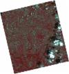
DE2_OPER_HRA_PM4_1C_20210803T112516_N39-112_W009-246_0001
Download Product | Product Info | Browse
Platform Short Name | GEOSAT |
Platform Serial Identifier | 2 |
Product Type | HRA_PM4_1C |
Start Date | 2021-08-03T11:25:16Z |
Stop Date | 2021-08-03T11:25:19Z |
Original Name | DE2_PM4_L1C_000000_20210803T112516_20210803T112519_DE2_38603_F673.zip |
Footprint | 39.0470323437 -9.1115163334 39.2046285235 -9.14432175116 39.177466566 -9.38124387814 39.0198850247 -9.34769928112 39.0470323437 -9.1115163334 |
Orbit Direction | ASCENDING |
Scene Centre Longitude | W009 |
Scene Centre Latitude | N39 |
Cloud Cover Percentage | -1 |
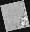
DE2_OPER_HRA_PSH_1C_20210508T112658_N39-068_W009-358_0001
Download Product | Product Info | Browse
Platform Short Name | GEOSAT |
Platform Serial Identifier | 2 |
Product Type | HRA_PSH_1C |
Start Date | 2021-05-08T11:26:58Z |
Stop Date | 2021-05-08T11:27:01Z |
Original Name | DE2_PSH_L1C_000000_20210508T112658_20210508T112701_DE2_37312_49DC.zip |
Footprint | 39.004853656 -9.2306553744 39.1579963405 -9.26388933068 39.1312350002 -9.48768230108 38.978093124 -9.45327714956 39.004853656 -9.2306553744 |
Orbit Direction | ASCENDING |
Scene Centre Longitude | W009 |
Scene Centre Latitude | N39 |
Cloud Cover Percentage | -1 |
DE2_OPER_HRA_PM4_1C_20210508T112658_N39-068_W009-358_0001
Download Product | Product Info | Browse
Platform Short Name | GEOSAT |
Platform Serial Identifier | 2 |
Product Type | HRA_PM4_1C |
Start Date | 2021-05-08T11:26:58Z |
Stop Date | 2021-05-08T11:27:01Z |
Original Name | DE2_PM4_L1C_000000_20210508T112658_20210508T112701_DE2_37312_49DC.zip |
Footprint | 39.004853656 -9.2306553744 39.1579963405 -9.26388933068 39.1312350002 -9.48768230108 38.978093124 -9.45327714956 39.004853656 -9.2306553744 |
Orbit Direction | ASCENDING |
Scene Centre Longitude | W009 |
Scene Centre Latitude | N39 |
Cloud Cover Percentage | -1 |
DE2_OPER_HRA_PSH_1C_20210418T110551_N39-161_W009-355_0001
Download Product | Product Info | Browse
Platform Short Name | GEOSAT |
Platform Serial Identifier | 2 |
Product Type | HRA_PSH_1C |
Start Date | 2021-04-18T11:05:51Z |
Stop Date | 2021-04-18T11:05:54Z |
Original Name | DE2_PSH_L1C_000000_20210418T110551_20210418T110554_DE2_37015_C39B.zip |
Footprint | 39.1132104403 -9.26613390763 39.2362084936 -9.30330571171 39.2102862792 -9.44554914532 39.0874024244 -9.40797120139 39.1132104403 -9.26613390763 |
Orbit Direction | ASCENDING |
Scene Centre Longitude | W009 |
Scene Centre Latitude | N39 |
Cloud Cover Percentage | -1 |
DE2_OPER_HRA_PM4_1C_20210418T110551_N39-161_W009-355_0001
Download Product | Product Info | Browse
Platform Short Name | GEOSAT |
Platform Serial Identifier | 2 |
Product Type | HRA_PM4_1C |
Start Date | 2021-04-18T11:05:51Z |
Stop Date | 2021-04-18T11:05:54Z |
Original Name | DE2_PM4_L1C_000000_20210418T110551_20210418T110554_DE2_37015_C39B.zip |
Footprint | 39.1132104403 -9.26613390763 39.2362084936 -9.30330571171 39.2102862792 -9.44554914532 39.0874024244 -9.40797120139 39.1132104403 -9.26613390763 |
Orbit Direction | ASCENDING |
Scene Centre Longitude | W009 |
Scene Centre Latitude | N39 |
Cloud Cover Percentage | -1 |
DE2_OPER_HRA_PSH_1C_20210418T110549_N39-050_W009-321_0001
Download Product | Product Info | Browse
Platform Short Name | GEOSAT |
Platform Serial Identifier | 2 |
Product Type | HRA_PSH_1C |
Start Date | 2021-04-18T11:05:49Z |
Stop Date | 2021-04-18T11:05:52Z |
Original Name | DE2_PSH_L1C_000000_20210418T110549_20210418T110552_DE2_37015_DB72.zip |
Footprint | 39.0015587627 -9.23242028489 39.1246174244 -9.26956935817 39.0987914706 -9.41148015368 38.9757584388 -9.37404719181 39.0015587627 -9.23242028489 |
Orbit Direction | ASCENDING |
Scene Centre Longitude | W009 |
Scene Centre Latitude | N39 |
Cloud Cover Percentage | -1 |
DE2_OPER_HRA_PM4_1C_20210418T110549_N39-050_W009-321_0001
Download Product | Product Info | Browse
Platform Short Name | GEOSAT |
Platform Serial Identifier | 2 |
Product Type | HRA_PM4_1C |
Start Date | 2021-04-18T11:05:49Z |
Stop Date | 2021-04-18T11:05:52Z |
Original Name | DE2_PM4_L1C_000000_20210418T110549_20210418T110552_DE2_37015_DB72.zip |
Footprint | 39.0015587627 -9.23242028489 39.1246174244 -9.26956935817 39.0987914706 -9.41148015368 38.9757584388 -9.37404719181 39.0015587627 -9.23242028489 |
Orbit Direction | ASCENDING |
Scene Centre Longitude | W009 |
Scene Centre Latitude | N39 |
Cloud Cover Percentage | -1 |