ESA TPM Map Catalogue - Product List
back to previous node |
list of download URLs
Collection G2_Portugal_2021
GEOSAT-2 Portugal Coverage 2021 collection. More details here.
List of available products (latitude from 39.0008 to 39.0793 dg, longitude from -7.90062 to -7.75625 dg)..
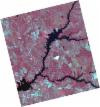
DE2_OPER_HRA_PSH_1C_20210702T111152_N39-112_W007-726_0001
Download Product | Product Info | Browse
Platform Short Name | GEOSAT |
Platform Serial Identifier | 2 |
Product Type | HRA_PSH_1C |
Start Date | 2021-07-02T11:11:52Z |
Stop Date | 2021-07-02T11:11:55Z |
Original Name | DE2_PSH_L1C_000000_20210702T111152_20210702T111155_DE2_38128_9635.zip |
Footprint | 39.0560116138 -7.62164689721 39.193086994 -7.65548197288 39.1680690239 -7.83224470668 39.0309623154 -7.79849396603 39.0560116138 -7.62164689721 |
Orbit Direction | ASCENDING |
Scene Centre Longitude | W007 |
Scene Centre Latitude | N39 |
Cloud Cover Percentage | -1 |
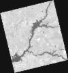
DE2_OPER_HRA_PM4_1C_20210702T111152_N39-112_W007-726_0001
Download Product | Product Info | Browse
Platform Short Name | GEOSAT |
Platform Serial Identifier | 2 |
Product Type | HRA_PM4_1C |
Start Date | 2021-07-02T11:11:52Z |
Stop Date | 2021-07-02T11:11:55Z |
Original Name | DE2_PM4_L1C_000000_20210702T111152_20210702T111155_DE2_38128_9635.zip |
Footprint | 39.0560116138 -7.62164689721 39.193086994 -7.65548197288 39.1680690239 -7.83224470668 39.0309623154 -7.79849396603 39.0560116138 -7.62164689721 |
Orbit Direction | ASCENDING |
Scene Centre Longitude | W007 |
Scene Centre Latitude | N39 |
Cloud Cover Percentage | -1 |
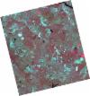
DE2_OPER_HRA_PSH_1C_20210702T111150_N38-987_W007-696_0001
Download Product | Product Info | Browse
Platform Short Name | GEOSAT |
Platform Serial Identifier | 2 |
Product Type | HRA_PSH_1C |
Start Date | 2021-07-02T11:11:50Z |
Stop Date | 2021-07-02T11:11:53Z |
Original Name | DE2_PSH_L1C_000000_20210702T111150_20210702T111153_DE2_38128_9D78.zip |
Footprint | 38.9313969518 -7.59149467289 39.0687182026 -7.62463335825 39.0436843007 -7.80142432152 38.906355761 -7.76819635389 38.9313969518 -7.59149467289 |
Orbit Direction | ASCENDING |
Scene Centre Longitude | W007 |
Scene Centre Latitude | N38 |
Cloud Cover Percentage | -1 |
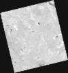
DE2_OPER_HRA_PM4_1C_20210702T111150_N38-987_W007-696_0001
Download Product | Product Info | Browse
Platform Short Name | GEOSAT |
Platform Serial Identifier | 2 |
Product Type | HRA_PM4_1C |
Start Date | 2021-07-02T11:11:50Z |
Stop Date | 2021-07-02T11:11:53Z |
Original Name | DE2_PM4_L1C_000000_20210702T111150_20210702T111153_DE2_38128_9D78.zip |
Footprint | 38.9313969518 -7.59149467289 39.0687182026 -7.62463335825 39.0436843007 -7.80142432152 38.906355761 -7.76819635389 38.9313969518 -7.59149467289 |
Orbit Direction | ASCENDING |
Scene Centre Longitude | W007 |
Scene Centre Latitude | N38 |
Cloud Cover Percentage | -1 |
DE2_OPER_HRA_PSH_1C_20210525T110125_N39-094_W007-884_0001
Download Product | Product Info | Browse
Platform Short Name | GEOSAT |
Platform Serial Identifier | 2 |
Product Type | HRA_PSH_1C |
Start Date | 2021-05-25T11:01:25Z |
Stop Date | 2021-05-25T11:01:28Z |
Original Name | DE2_PSH_L1C_000000_20210525T110125_20210525T110128_DE2_37564_1903.zip |
Footprint | 39.0452611103 -7.79572980759 39.1681996378 -7.83179110552 39.1431388536 -7.97370874443 39.0202135495 -7.93742964868 39.0452611103 -7.79572980759 |
Orbit Direction | ASCENDING |
Scene Centre Longitude | W007 |
Scene Centre Latitude | N39 |
Cloud Cover Percentage | -1 |
DE2_OPER_HRA_PM4_1C_20210525T110125_N39-094_W007-884_0001
Download Product | Product Info | Browse
Platform Short Name | GEOSAT |
Platform Serial Identifier | 2 |
Product Type | HRA_PM4_1C |
Start Date | 2021-05-25T11:01:25Z |
Stop Date | 2021-05-25T11:01:28Z |
Original Name | DE2_PM4_L1C_000000_20210525T110125_20210525T110128_DE2_37564_1903.zip |
Footprint | 39.0452611103 -7.79572980759 39.1681996378 -7.83179110552 39.1431388536 -7.97370874443 39.0202135495 -7.93742964868 39.0452611103 -7.79572980759 |
Orbit Direction | ASCENDING |
Scene Centre Longitude | W007 |
Scene Centre Latitude | N39 |
Cloud Cover Percentage | -1 |
DE2_OPER_HRA_PSH_1C_20210525T110124_N38-982_W007-851_0001
Download Product | Product Info | Browse
Platform Short Name | GEOSAT |
Platform Serial Identifier | 2 |
Product Type | HRA_PSH_1C |
Start Date | 2021-05-25T11:01:24Z |
Stop Date | 2021-05-25T11:01:26Z |
Original Name | DE2_PSH_L1C_000000_20210525T110124_20210525T110126_DE2_37564_40FE.zip |
Footprint | 38.9336003389 -7.76326894445 39.0566563883 -7.79910739951 39.03162472 -7.94075939342 38.9085881598 -7.90470402199 38.9336003389 -7.76326894445 |
Orbit Direction | ASCENDING |
Scene Centre Longitude | W007 |
Scene Centre Latitude | N38 |
Cloud Cover Percentage | -1 |
DE2_OPER_HRA_PM4_1C_20210525T110124_N38-982_W007-851_0001
Download Product | Product Info | Browse
Platform Short Name | GEOSAT |
Platform Serial Identifier | 2 |
Product Type | HRA_PM4_1C |
Start Date | 2021-05-25T11:01:24Z |
Stop Date | 2021-05-25T11:01:26Z |
Original Name | DE2_PM4_L1C_000000_20210525T110124_20210525T110126_DE2_37564_40FE.zip |
Footprint | 38.9336003389 -7.76326894445 39.0566563883 -7.79910739951 39.03162472 -7.94075939342 38.9085881598 -7.90470402199 38.9336003389 -7.76326894445 |
Orbit Direction | ASCENDING |
Scene Centre Longitude | W007 |
Scene Centre Latitude | N38 |
Cloud Cover Percentage | -1 |