ESA TPM Map Catalogue - Product List
back to previous node |
list of download URLs

Collection G2_Portugal_2021
GEOSAT-2 Portugal Coverage 2021 collection. More details here.
List of available products (latitude from 39.0008 to 39.0793 dg, longitude from -8.255 to -8.11063 dg)..
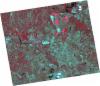
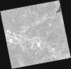
DE2_OPER_HRA_PSH_1C_20211004T111930_N38-943_W008-021_0001
Download Product | Product Info | Browse
Platform Short Name | GEOSAT |
Platform Serial Identifier | 2 |
Product Type | HRA_PSH_1C |
Start Date | 2021-10-04T11:19:30Z |
Stop Date | 2021-10-04T11:19:33Z |
Original Name | DE2_PSH_L1C_000000_20211004T111930_20211004T111933_DE2_39523_BDBF.zip |
Footprint | 38.8764944349 -7.8799592744 39.0375856458 -7.91431829573 39.0100157853 -8.16330456437 38.8488519279 -8.12883573822 38.8764944349 -7.8799592744 |
Orbit Direction | ASCENDING |
Scene Centre Longitude | W008 |
Scene Centre Latitude | N38 |
Cloud Cover Percentage | -1 |
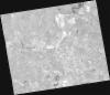
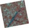
DE2_OPER_HRA_PM4_1C_20211004T111930_N38-943_W008-021_0001
Download Product | Product Info | Browse
Platform Short Name | GEOSAT |
Platform Serial Identifier | 2 |
Product Type | HRA_PM4_1C |
Start Date | 2021-10-04T11:19:30Z |
Stop Date | 2021-10-04T11:19:33Z |
Original Name | DE2_PM4_L1C_000000_20211004T111930_20211004T111933_DE2_39523_BDBF.zip |
Footprint | 38.8764944349 -7.8799592744 39.0375856458 -7.91431829573 39.0100157853 -8.16330456437 38.8488519279 -8.12883573822 38.8764944349 -7.8799592744 |
Orbit Direction | ASCENDING |
Scene Centre Longitude | W008 |
Scene Centre Latitude | N38 |
Cloud Cover Percentage | -1 |
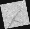
DE2_OPER_HRA_PSH_1C_20210921T111137_N39-127_W008-270_0001
Download Product | Product Info | Browse
Platform Short Name | GEOSAT |
Platform Serial Identifier | 2 |
Product Type | HRA_PSH_1C |
Start Date | 2021-09-21T11:11:37Z |
Stop Date | 2021-09-21T11:11:40Z |
Original Name | DE2_PSH_L1C_000000_20210921T111137_20210921T111140_DE2_39330_EBA3.zip |
Footprint | 39.071571759 -8.16347116552 39.2094010429 -8.1974368977 39.1843286731 -8.37639071008 39.0464569663 -8.34272925256 39.071571759 -8.16347116552 |
Orbit Direction | ASCENDING |
Scene Centre Longitude | W008 |
Scene Centre Latitude | N39 |
Cloud Cover Percentage | -1 |
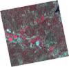
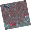
DE2_OPER_HRA_PM4_1C_20210921T111137_N39-127_W008-270_0001
Download Product | Product Info | Browse
Platform Short Name | GEOSAT |
Platform Serial Identifier | 2 |
Product Type | HRA_PM4_1C |
Start Date | 2021-09-21T11:11:37Z |
Stop Date | 2021-09-21T11:11:40Z |
Original Name | DE2_PM4_L1C_000000_20210921T111137_20210921T111140_DE2_39330_EBA3.zip |
Footprint | 39.071571759 -8.16347116552 39.2094010429 -8.1974368977 39.1843286731 -8.37639071008 39.0464569663 -8.34272925256 39.071571759 -8.16347116552 |
Orbit Direction | ASCENDING |
Scene Centre Longitude | W008 |
Scene Centre Latitude | N39 |
Cloud Cover Percentage | -1 |
DE2_OPER_HRA_PSH_1C_20210921T111135_N39-002_W008-239_0001
Download Product | Product Info | Browse
Platform Short Name | GEOSAT |
Platform Serial Identifier | 2 |
Product Type | HRA_PSH_1C |
Start Date | 2021-09-21T11:11:35Z |
Stop Date | 2021-09-21T11:11:38Z |
Original Name | DE2_PSH_L1C_000000_20210921T111135_20210921T111138_DE2_39330_B2C2.zip |
Footprint | 38.9465785293 -8.13325767263 39.0843222214 -8.16691056201 39.0592479813 -8.34587867763 38.9214850746 -8.31196789622 38.9465785293 -8.13325767263 |
Orbit Direction | ASCENDING |
Scene Centre Longitude | W008 |
Scene Centre Latitude | N39 |
Cloud Cover Percentage | -1 |
DE2_OPER_HRA_PM4_1C_20210921T111135_N39-002_W008-239_0001
Download Product | Product Info | Browse
Platform Short Name | GEOSAT |
Platform Serial Identifier | 2 |
Product Type | HRA_PM4_1C |
Start Date | 2021-09-21T11:11:35Z |
Stop Date | 2021-09-21T11:11:38Z |
Original Name | DE2_PM4_L1C_000000_20210921T111135_20210921T111138_DE2_39330_B2C2.zip |
Footprint | 38.9465785293 -8.13325767263 39.0843222214 -8.16691056201 39.0592479813 -8.34587867763 38.9214850746 -8.31196789622 38.9465785293 -8.13325767263 |
Orbit Direction | ASCENDING |
Scene Centre Longitude | W008 |
Scene Centre Latitude | N39 |
Cloud Cover Percentage | -1 |
DE2_OPER_HRA_PSH_1C_20210626T111521_N39-137_W008-117_0001
Download Product | Product Info | Browse
Platform Short Name | GEOSAT |
Platform Serial Identifier | 2 |
Product Type | HRA_PSH_1C |
Start Date | 2021-06-26T11:15:21Z |
Stop Date | 2021-06-26T11:15:24Z |
Original Name | DE2_PSH_L1C_000000_20210626T111521_20210626T111524_DE2_38039_ECB7.zip |
Footprint | 39.0799347828 -8.00707134637 39.2208358752 -8.04021541765 39.1953030714 -8.2283772843 39.0544984369 -8.19391460566 39.0799347828 -8.00707134637 |
Orbit Direction | ASCENDING |
Scene Centre Longitude | W008 |
Scene Centre Latitude | N39 |
Cloud Cover Percentage | -1 |
DE2_OPER_HRA_PM4_1C_20210626T111521_N39-137_W008-117_0001
Download Product | Product Info | Browse
Platform Short Name | GEOSAT |
Platform Serial Identifier | 2 |
Product Type | HRA_PM4_1C |
Start Date | 2021-06-26T11:15:21Z |
Stop Date | 2021-06-26T11:15:24Z |
Original Name | DE2_PM4_L1C_000000_20210626T111521_20210626T111524_DE2_38039_ECB7.zip |
Footprint | 39.0799347828 -8.00707134637 39.2208358752 -8.04021541765 39.1953030714 -8.2283772843 39.0544984369 -8.19391460566 39.0799347828 -8.00707134637 |
Orbit Direction | ASCENDING |
Scene Centre Longitude | W008 |
Scene Centre Latitude | N39 |
Cloud Cover Percentage | -1 |
DE2_OPER_HRA_PSH_1C_20210626T111519_N39-009_W008-086_0001
Download Product | Product Info | Browse
Platform Short Name | GEOSAT |
Platform Serial Identifier | 2 |
Product Type | HRA_PSH_1C |
Start Date | 2021-06-26T11:15:19Z |
Stop Date | 2021-06-26T11:15:22Z |
Original Name | DE2_PSH_L1C_000000_20210626T111519_20210626T111522_DE2_38039_6E29.zip |
Footprint | 38.9522555125 -7.9763637154 39.0930089145 -8.00989734619 39.0674797012 -8.19762484923 38.9267400026 -8.16347906803 38.9522555125 -7.9763637154 |
Orbit Direction | ASCENDING |
Scene Centre Longitude | W008 |
Scene Centre Latitude | N39 |
Cloud Cover Percentage | -1 |
DE2_OPER_HRA_PM4_1C_20210626T111519_N39-009_W008-086_0001
Download Product | Product Info | Browse
Platform Short Name | GEOSAT |
Platform Serial Identifier | 2 |
Product Type | HRA_PM4_1C |
Start Date | 2021-06-26T11:15:19Z |
Stop Date | 2021-06-26T11:15:22Z |
Original Name | DE2_PM4_L1C_000000_20210626T111519_20210626T111522_DE2_38039_6E29.zip |
Footprint | 38.9522555125 -7.9763637154 39.0930089145 -8.00989734619 39.0674797012 -8.19762484923 38.9267400026 -8.16347906803 38.9522555125 -7.9763637154 |
Orbit Direction | ASCENDING |
Scene Centre Longitude | W008 |
Scene Centre Latitude | N39 |
Cloud Cover Percentage | -1 |