ESA TPM Map Catalogue - Product List
back to previous node |
list of download URLs


Collection G2_Portugal_2021
GEOSAT-2 Portugal Coverage 2021 collection. More details here.
List of available products (latitude from 39.0008 to 39.0793 dg, longitude from -8.39938 to -8.255 dg)..
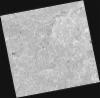
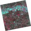
DE2_OPER_HRA_PSH_1C_20210921T111137_N39-127_W008-270_0001
Download Product | Product Info | Browse
Platform Short Name | GEOSAT |
Platform Serial Identifier | 2 |
Product Type | HRA_PSH_1C |
Start Date | 2021-09-21T11:11:37Z |
Stop Date | 2021-09-21T11:11:40Z |
Original Name | DE2_PSH_L1C_000000_20210921T111137_20210921T111140_DE2_39330_EBA3.zip |
Footprint | 39.071571759 -8.16347116552 39.2094010429 -8.1974368977 39.1843286731 -8.37639071008 39.0464569663 -8.34272925256 39.071571759 -8.16347116552 |
Orbit Direction | ASCENDING |
Scene Centre Longitude | W008 |
Scene Centre Latitude | N39 |
Cloud Cover Percentage | -1 |
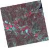
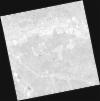
DE2_OPER_HRA_PM4_1C_20210921T111137_N39-127_W008-270_0001
Download Product | Product Info | Browse
Platform Short Name | GEOSAT |
Platform Serial Identifier | 2 |
Product Type | HRA_PM4_1C |
Start Date | 2021-09-21T11:11:37Z |
Stop Date | 2021-09-21T11:11:40Z |
Original Name | DE2_PM4_L1C_000000_20210921T111137_20210921T111140_DE2_39330_EBA3.zip |
Footprint | 39.071571759 -8.16347116552 39.2094010429 -8.1974368977 39.1843286731 -8.37639071008 39.0464569663 -8.34272925256 39.071571759 -8.16347116552 |
Orbit Direction | ASCENDING |
Scene Centre Longitude | W008 |
Scene Centre Latitude | N39 |
Cloud Cover Percentage | -1 |
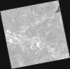
DE2_OPER_HRA_PSH_1C_20210921T111135_N39-002_W008-239_0001
Download Product | Product Info | Browse
Platform Short Name | GEOSAT |
Platform Serial Identifier | 2 |
Product Type | HRA_PSH_1C |
Start Date | 2021-09-21T11:11:35Z |
Stop Date | 2021-09-21T11:11:38Z |
Original Name | DE2_PSH_L1C_000000_20210921T111135_20210921T111138_DE2_39330_B2C2.zip |
Footprint | 38.9465785293 -8.13325767263 39.0843222214 -8.16691056201 39.0592479813 -8.34587867763 38.9214850746 -8.31196789622 38.9465785293 -8.13325767263 |
Orbit Direction | ASCENDING |
Scene Centre Longitude | W008 |
Scene Centre Latitude | N39 |
Cloud Cover Percentage | -1 |
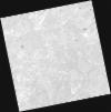
DE2_OPER_HRA_PM4_1C_20210921T111135_N39-002_W008-239_0001
Download Product | Product Info | Browse
Platform Short Name | GEOSAT |
Platform Serial Identifier | 2 |
Product Type | HRA_PM4_1C |
Start Date | 2021-09-21T11:11:35Z |
Stop Date | 2021-09-21T11:11:38Z |
Original Name | DE2_PM4_L1C_000000_20210921T111135_20210921T111138_DE2_39330_B2C2.zip |
Footprint | 38.9465785293 -8.13325767263 39.0843222214 -8.16691056201 39.0592479813 -8.34587867763 38.9214850746 -8.31196789622 38.9465785293 -8.13325767263 |
Orbit Direction | ASCENDING |
Scene Centre Longitude | W008 |
Scene Centre Latitude | N39 |
Cloud Cover Percentage | -1 |
DE2_OPER_HRA_PSH_1C_20210331T111527_N39-082_W008-401_0001
Download Product | Product Info | Browse
Platform Short Name | GEOSAT |
Platform Serial Identifier | 2 |
Product Type | HRA_PSH_1C |
Start Date | 2021-03-31T11:15:27Z |
Stop Date | 2021-03-31T11:15:30Z |
Original Name | DE2_PSH_L1C_000000_20210331T111527_20210331T111530_DE2_36748_57D1.zip |
Footprint | 39.0286369655 -8.3011911285 39.1618454508 -8.33508525487 39.137132545 -8.50214395506 39.0038897624 -8.46816375914 39.0286369655 -8.3011911285 |
Orbit Direction | ASCENDING |
Scene Centre Longitude | W008 |
Scene Centre Latitude | N39 |
Cloud Cover Percentage | -1 |
DE2_OPER_HRA_PM4_1C_20210331T111527_N39-082_W008-401_0001
Download Product | Product Info | Browse
Platform Short Name | GEOSAT |
Platform Serial Identifier | 2 |
Product Type | HRA_PM4_1C |
Start Date | 2021-03-31T11:15:27Z |
Stop Date | 2021-03-31T11:15:30Z |
Original Name | DE2_PM4_L1C_000000_20210331T111527_20210331T111530_DE2_36748_57D1.zip |
Footprint | 39.0286369655 -8.3011911285 39.1618454508 -8.33508525487 39.137132545 -8.50214395506 39.0038897624 -8.46816375914 39.0286369655 -8.3011911285 |
Orbit Direction | ASCENDING |
Scene Centre Longitude | W008 |
Scene Centre Latitude | N39 |
Cloud Cover Percentage | -1 |
DE2_OPER_HRA_PSH_1C_20210331T111525_N38-962_W008-370_0001
Download Product | Product Info | Browse
Platform Short Name | GEOSAT |
Platform Serial Identifier | 2 |
Product Type | HRA_PSH_1C |
Start Date | 2021-03-31T11:15:25Z |
Stop Date | 2021-03-31T11:15:28Z |
Original Name | DE2_PSH_L1C_000000_20210331T111525_20210331T111528_DE2_36748_EB2D.zip |
Footprint | 38.9078245619 -8.27051933412 39.0409762308 -8.30432807635 39.0162252255 -8.47142404122 38.8830655622 -8.43742620738 38.9078245619 -8.27051933412 |
Orbit Direction | ASCENDING |
Scene Centre Longitude | W008 |
Scene Centre Latitude | N38 |
Cloud Cover Percentage | -1 |
DE2_OPER_HRA_PM4_1C_20210331T111525_N38-962_W008-370_0001
Download Product | Product Info | Browse
Platform Short Name | GEOSAT |
Platform Serial Identifier | 2 |
Product Type | HRA_PM4_1C |
Start Date | 2021-03-31T11:15:25Z |
Stop Date | 2021-03-31T11:15:28Z |
Original Name | DE2_PM4_L1C_000000_20210331T111525_20210331T111528_DE2_36748_EB2D.zip |
Footprint | 38.9078245619 -8.27051933412 39.0409762308 -8.30432807635 39.0162252255 -8.47142404122 38.8830655622 -8.43742620738 38.9078245619 -8.27051933412 |
Orbit Direction | ASCENDING |
Scene Centre Longitude | W008 |
Scene Centre Latitude | N38 |
Cloud Cover Percentage | -1 |