ESA TPM Map Catalogue - Product List
back to previous node |
list of download URLs


Collection G2_Portugal_2021
GEOSAT-2 Portugal Coverage 2021 collection. More details here.
List of available products (latitude from 39.0008 to 39.0793 dg, longitude from -8.54375 to -8.39938 dg)..
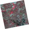
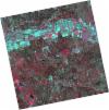
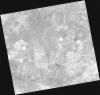
DE2_OPER_HRA_PSH_1C_20210827T111052_N39-085_W008-528_0001
Download Product | Product Info | Browse
Platform Short Name | GEOSAT |
Platform Serial Identifier | 2 |
Product Type | HRA_PSH_1C |
Start Date | 2021-08-27T11:10:52Z |
Stop Date | 2021-08-27T11:10:54Z |
Original Name | DE2_PSH_L1C_000000_20210827T111052_20210827T111054_DE2_38959_0603.zip |
Footprint | 39.0316441991 -8.42904079707 39.1643284126 -8.46269510972 39.1397509702 -8.62789257865 39.0070654212 -8.5940873952 39.0316441991 -8.42904079707 |
Orbit Direction | ASCENDING |
Scene Centre Longitude | W008 |
Scene Centre Latitude | N39 |
Cloud Cover Percentage | -1 |
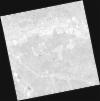
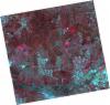
DE2_OPER_HRA_PM4_1C_20210827T111052_N39-085_W008-528_0001
Download Product | Product Info | Browse
Platform Short Name | GEOSAT |
Platform Serial Identifier | 2 |
Product Type | HRA_PM4_1C |
Start Date | 2021-08-27T11:10:52Z |
Stop Date | 2021-08-27T11:10:54Z |
Original Name | DE2_PM4_L1C_000000_20210827T111052_20210827T111054_DE2_38959_0603.zip |
Footprint | 39.0316441991 -8.42904079707 39.1643284126 -8.46269510972 39.1397509702 -8.62789257865 39.0070654212 -8.5940873952 39.0316441991 -8.42904079707 |
Orbit Direction | ASCENDING |
Scene Centre Longitude | W008 |
Scene Centre Latitude | N39 |
Cloud Cover Percentage | -1 |
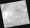
DE2_OPER_HRA_PSH_1C_20210827T111050_N38-965_W008-497_0001
Download Product | Product Info | Browse
Platform Short Name | GEOSAT |
Platform Serial Identifier | 2 |
Product Type | HRA_PSH_1C |
Start Date | 2021-08-27T11:10:50Z |
Stop Date | 2021-08-27T11:10:53Z |
Original Name | DE2_PSH_L1C_000000_20210827T111050_20210827T111053_DE2_38959_9B0A.zip |
Footprint | 38.9109929849 -8.39832222508 39.0439465705 -8.43223508938 39.0193566022 -8.59727465889 38.8864159986 -8.56337588325 38.9109929849 -8.39832222508 |
Orbit Direction | ASCENDING |
Scene Centre Longitude | W008 |
Scene Centre Latitude | N38 |
Cloud Cover Percentage | -1 |
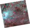
DE2_OPER_HRA_PM4_1C_20210827T111050_N38-965_W008-497_0001
Download Product | Product Info | Browse
Platform Short Name | GEOSAT |
Platform Serial Identifier | 2 |
Product Type | HRA_PM4_1C |
Start Date | 2021-08-27T11:10:50Z |
Stop Date | 2021-08-27T11:10:53Z |
Original Name | DE2_PM4_L1C_000000_20210827T111050_20210827T111053_DE2_38959_9B0A.zip |
Footprint | 38.9109929849 -8.39832222508 39.0439465705 -8.43223508938 39.0193566022 -8.59727465889 38.8864159986 -8.56337588325 38.9109929849 -8.39832222508 |
Orbit Direction | ASCENDING |
Scene Centre Longitude | W008 |
Scene Centre Latitude | N38 |
Cloud Cover Percentage | -1 |
DE2_OPER_HRA_PSH_1C_20210331T111527_N39-082_W008-401_0001
Download Product | Product Info | Browse
Platform Short Name | GEOSAT |
Platform Serial Identifier | 2 |
Product Type | HRA_PSH_1C |
Start Date | 2021-03-31T11:15:27Z |
Stop Date | 2021-03-31T11:15:30Z |
Original Name | DE2_PSH_L1C_000000_20210331T111527_20210331T111530_DE2_36748_57D1.zip |
Footprint | 39.0286369655 -8.3011911285 39.1618454508 -8.33508525487 39.137132545 -8.50214395506 39.0038897624 -8.46816375914 39.0286369655 -8.3011911285 |
Orbit Direction | ASCENDING |
Scene Centre Longitude | W008 |
Scene Centre Latitude | N39 |
Cloud Cover Percentage | -1 |
DE2_OPER_HRA_PM4_1C_20210331T111527_N39-082_W008-401_0001
Download Product | Product Info | Browse
Platform Short Name | GEOSAT |
Platform Serial Identifier | 2 |
Product Type | HRA_PM4_1C |
Start Date | 2021-03-31T11:15:27Z |
Stop Date | 2021-03-31T11:15:30Z |
Original Name | DE2_PM4_L1C_000000_20210331T111527_20210331T111530_DE2_36748_57D1.zip |
Footprint | 39.0286369655 -8.3011911285 39.1618454508 -8.33508525487 39.137132545 -8.50214395506 39.0038897624 -8.46816375914 39.0286369655 -8.3011911285 |
Orbit Direction | ASCENDING |
Scene Centre Longitude | W008 |
Scene Centre Latitude | N39 |
Cloud Cover Percentage | -1 |
DE2_OPER_HRA_PSH_1C_20210331T111525_N38-962_W008-370_0001
Download Product | Product Info | Browse
Platform Short Name | GEOSAT |
Platform Serial Identifier | 2 |
Product Type | HRA_PSH_1C |
Start Date | 2021-03-31T11:15:25Z |
Stop Date | 2021-03-31T11:15:28Z |
Original Name | DE2_PSH_L1C_000000_20210331T111525_20210331T111528_DE2_36748_EB2D.zip |
Footprint | 38.9078245619 -8.27051933412 39.0409762308 -8.30432807635 39.0162252255 -8.47142404122 38.8830655622 -8.43742620738 38.9078245619 -8.27051933412 |
Orbit Direction | ASCENDING |
Scene Centre Longitude | W008 |
Scene Centre Latitude | N38 |
Cloud Cover Percentage | -1 |
DE2_OPER_HRA_PM4_1C_20210331T111525_N38-962_W008-370_0001
Download Product | Product Info | Browse
Platform Short Name | GEOSAT |
Platform Serial Identifier | 2 |
Product Type | HRA_PM4_1C |
Start Date | 2021-03-31T11:15:25Z |
Stop Date | 2021-03-31T11:15:28Z |
Original Name | DE2_PM4_L1C_000000_20210331T111525_20210331T111528_DE2_36748_EB2D.zip |
Footprint | 38.9078245619 -8.27051933412 39.0409762308 -8.30432807635 39.0162252255 -8.47142404122 38.8830655622 -8.43742620738 38.9078245619 -8.27051933412 |
Orbit Direction | ASCENDING |
Scene Centre Longitude | W008 |
Scene Centre Latitude | N38 |
Cloud Cover Percentage | -1 |
DE2_OPER_HRA_PM4_1C_20210319T112149_N39-127_W008-608_0001
Download Product | Product Info | Browse
Platform Short Name | GEOSAT |
Platform Serial Identifier | 2 |
Product Type | HRA_PM4_1C |
Start Date | 2021-03-19T11:21:49Z |
Stop Date | 2021-03-19T11:21:52Z |
Original Name | DE2_PM4_L1C_000000_20210319T112149_20210319T112152_DE2_36570_51B5.zip |
Footprint | 39.0681036413 -8.49292799548 39.2124419815 -8.52697952687 39.1866426833 -8.72354468526 39.042272689 -8.68952901538 39.0681036413 -8.49292799548 |
Orbit Direction | ASCENDING |
Scene Centre Longitude | W008 |
Scene Centre Latitude | N39 |
Cloud Cover Percentage | -1 |
DE2_OPER_HRA_PSH_1C_20210319T112149_N39-127_W008-608_0001
Download Product | Product Info | Browse
Platform Short Name | GEOSAT |
Platform Serial Identifier | 2 |
Product Type | HRA_PSH_1C |
Start Date | 2021-03-19T11:21:49Z |
Stop Date | 2021-03-19T11:21:52Z |
Original Name | DE2_PSH_L1C_000000_20210319T112149_20210319T112152_DE2_36570_51B5.zip |
Footprint | 39.0681036413 -8.49292799548 39.2124419815 -8.52697952687 39.1866426833 -8.72354468526 39.042272689 -8.68952901538 39.0681036413 -8.49292799548 |
Orbit Direction | ASCENDING |
Scene Centre Longitude | W008 |
Scene Centre Latitude | N39 |
Cloud Cover Percentage | -1 |
DE2_OPER_HRA_PM4_1C_20210319T112147_N38-996_W008-577_0001
Download Product | Product Info | Browse
Platform Short Name | GEOSAT |
Platform Serial Identifier | 2 |
Product Type | HRA_PM4_1C |
Start Date | 2021-03-19T11:21:47Z |
Stop Date | 2021-03-19T11:21:49Z |
Original Name | DE2_PM4_L1C_000000_20210319T112147_20210319T112149_DE2_36570_840C.zip |
Footprint | 38.9372712579 -8.46224940329 39.0814593693 -8.49631822884 39.0556559131 -8.69265161227 38.9114230167 -8.65880225478 38.9372712579 -8.46224940329 |
Orbit Direction | ASCENDING |
Scene Centre Longitude | W008 |
Scene Centre Latitude | N38 |
Cloud Cover Percentage | -1 |
DE2_OPER_HRA_PSH_1C_20210319T112147_N38-996_W008-577_0001
Download Product | Product Info | Browse
Platform Short Name | GEOSAT |
Platform Serial Identifier | 2 |
Product Type | HRA_PSH_1C |
Start Date | 2021-03-19T11:21:47Z |
Stop Date | 2021-03-19T11:21:49Z |
Original Name | DE2_PSH_L1C_000000_20210319T112147_20210319T112149_DE2_36570_840C.zip |
Footprint | 38.9372712579 -8.46224940329 39.0814593693 -8.49631822884 39.0556559131 -8.69265161227 38.9114230167 -8.65880225478 38.9372712579 -8.46224940329 |
Orbit Direction | ASCENDING |
Scene Centre Longitude | W008 |
Scene Centre Latitude | N38 |
Cloud Cover Percentage | -1 |