ESA TPM Map Catalogue - Product List
back to previous node |
list of download URLs

Collection G2_Portugal_2021
GEOSAT-2 Portugal Coverage 2021 collection. More details here.
List of available products (latitude from 38.9652 to 39.0436 dg, longitude from -7.61188 to -7.4675 dg)..
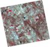
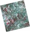
DE2_OPER_HRA_PSH_1C_20210727T111317_N39-040_W007-538_0001
Download Product | Product Info | Browse
Platform Short Name | GEOSAT |
Platform Serial Identifier | 2 |
Product Type | HRA_PSH_1C |
Start Date | 2021-07-27T11:13:17Z |
Stop Date | 2021-07-27T11:13:20Z |
Original Name | DE2_PSH_L1C_000000_20210727T111317_20210727T111320_DE2_38499_3A91.zip |
Footprint | 38.9813932606 -7.42447874108 39.124484826 -7.45828066656 39.098844251 -7.65230446473 38.955682495 -7.61892761469 38.9813932606 -7.42447874108 |
Orbit Direction | ASCENDING |
Scene Centre Longitude | W007 |
Scene Centre Latitude | N39 |
Cloud Cover Percentage | -1 |
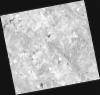
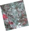
DE2_OPER_HRA_PM4_1C_20210727T111317_N39-040_W007-538_0001
Download Product | Product Info | Browse
Platform Short Name | GEOSAT |
Platform Serial Identifier | 2 |
Product Type | HRA_PM4_1C |
Start Date | 2021-07-27T11:13:17Z |
Stop Date | 2021-07-27T11:13:20Z |
Original Name | DE2_PM4_L1C_000000_20210727T111317_20210727T111320_DE2_38499_3A91.zip |
Footprint | 38.9813932606 -7.42447874108 39.124484826 -7.45828066656 39.098844251 -7.65230446473 38.955682495 -7.61892761469 38.9813932606 -7.42447874108 |
Orbit Direction | ASCENDING |
Scene Centre Longitude | W007 |
Scene Centre Latitude | N39 |
Cloud Cover Percentage | -1 |
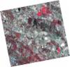
DE2_OPER_HRA_PSH_1C_20210727T111315_N38-910_W007-508_0001
Download Product | Product Info | Browse
Platform Short Name | GEOSAT |
Platform Serial Identifier | 2 |
Product Type | HRA_PSH_1C |
Start Date | 2021-07-27T11:13:15Z |
Stop Date | 2021-07-27T11:13:18Z |
Original Name | DE2_PSH_L1C_000000_20210727T111315_20210727T111318_DE2_38499_093A.zip |
Footprint | 38.8515930941 -7.39436674019 38.9946893802 -7.42771717329 38.9690117057 -7.62196709506 38.8258423927 -7.58886863253 38.8515930941 -7.39436674019 |
Orbit Direction | ASCENDING |
Scene Centre Longitude | W007 |
Scene Centre Latitude | N38 |
Cloud Cover Percentage | -1 |
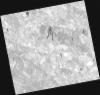
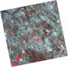
DE2_OPER_HRA_PM4_1C_20210727T111315_N38-910_W007-508_0001
Download Product | Product Info | Browse
Platform Short Name | GEOSAT |
Platform Serial Identifier | 2 |
Product Type | HRA_PM4_1C |
Start Date | 2021-07-27T11:13:15Z |
Stop Date | 2021-07-27T11:13:18Z |
Original Name | DE2_PM4_L1C_000000_20210727T111315_20210727T111318_DE2_38499_093A.zip |
Footprint | 38.8515930941 -7.39436674019 38.9946893802 -7.42771717329 38.9690117057 -7.62196709506 38.8258423927 -7.58886863253 38.8515930941 -7.39436674019 |
Orbit Direction | ASCENDING |
Scene Centre Longitude | W007 |
Scene Centre Latitude | N38 |
Cloud Cover Percentage | -1 |
DE2_OPER_HRA_PSH_1C_20210720T110122_N39-087_W007-442_0001
Download Product | Product Info | Browse
Platform Short Name | GEOSAT |
Platform Serial Identifier | 2 |
Product Type | HRA_PSH_1C |
Start Date | 2021-07-20T11:01:22Z |
Stop Date | 2021-07-20T11:01:24Z |
Original Name | DE2_PSH_L1C_000000_20210720T110122_20210720T110124_DE2_38395_686F.zip |
Footprint | 39.0370550567 -7.35281287012 39.1619750083 -7.38721998054 39.1375250969 -7.53295285977 39.0126412432 -7.49817662909 39.0370550567 -7.35281287012 |
Orbit Direction | ASCENDING |
Scene Centre Longitude | W007 |
Scene Centre Latitude | N39 |
Cloud Cover Percentage | -1 |
DE2_OPER_HRA_PM4_1C_20210720T110122_N39-087_W007-442_0001
Download Product | Product Info | Browse
Platform Short Name | GEOSAT |
Platform Serial Identifier | 2 |
Product Type | HRA_PM4_1C |
Start Date | 2021-07-20T11:01:22Z |
Stop Date | 2021-07-20T11:01:24Z |
Original Name | DE2_PM4_L1C_000000_20210720T110122_20210720T110124_DE2_38395_686F.zip |
Footprint | 39.0370550567 -7.35281287012 39.1619750083 -7.38721998054 39.1375250969 -7.53295285977 39.0126412432 -7.49817662909 39.0370550567 -7.35281287012 |
Orbit Direction | ASCENDING |
Scene Centre Longitude | W007 |
Scene Centre Latitude | N39 |
Cloud Cover Percentage | -1 |
DE2_OPER_HRA_PSH_1C_20210720T110120_N38-973_W007-411_0001
Download Product | Product Info | Browse
Platform Short Name | GEOSAT |
Platform Serial Identifier | 2 |
Product Type | HRA_PSH_1C |
Start Date | 2021-07-20T11:01:20Z |
Stop Date | 2021-07-20T11:01:23Z |
Original Name | DE2_PSH_L1C_000000_20210720T110120_20210720T110123_DE2_38395_759E.zip |
Footprint | 38.9235221069 -7.32202222632 39.0486162372 -7.3560542464 39.0241922346 -7.5014496527 38.8990882086 -7.46720639004 38.9235221069 -7.32202222632 |
Orbit Direction | ASCENDING |
Scene Centre Longitude | W007 |
Scene Centre Latitude | N38 |
Cloud Cover Percentage | -1 |
DE2_OPER_HRA_PM4_1C_20210720T110120_N38-973_W007-411_0001
Download Product | Product Info | Browse
Platform Short Name | GEOSAT |
Platform Serial Identifier | 2 |
Product Type | HRA_PM4_1C |
Start Date | 2021-07-20T11:01:20Z |
Stop Date | 2021-07-20T11:01:23Z |
Original Name | DE2_PM4_L1C_000000_20210720T110120_20210720T110123_DE2_38395_759E.zip |
Footprint | 38.9235221069 -7.32202222632 39.0486162372 -7.3560542464 39.0241922346 -7.5014496527 38.8990882086 -7.46720639004 38.9235221069 -7.32202222632 |
Orbit Direction | ASCENDING |
Scene Centre Longitude | W007 |
Scene Centre Latitude | N38 |
Cloud Cover Percentage | -1 |
DE2_OPER_HRA_PSH_1C_20210702T111150_N38-987_W007-696_0001
Download Product | Product Info | Browse
Platform Short Name | GEOSAT |
Platform Serial Identifier | 2 |
Product Type | HRA_PSH_1C |
Start Date | 2021-07-02T11:11:50Z |
Stop Date | 2021-07-02T11:11:53Z |
Original Name | DE2_PSH_L1C_000000_20210702T111150_20210702T111153_DE2_38128_9D78.zip |
Footprint | 38.9313969518 -7.59149467289 39.0687182026 -7.62463335825 39.0436843007 -7.80142432152 38.906355761 -7.76819635389 38.9313969518 -7.59149467289 |
Orbit Direction | ASCENDING |
Scene Centre Longitude | W007 |
Scene Centre Latitude | N38 |
Cloud Cover Percentage | -1 |
DE2_OPER_HRA_PM4_1C_20210702T111150_N38-987_W007-696_0001
Download Product | Product Info | Browse
Platform Short Name | GEOSAT |
Platform Serial Identifier | 2 |
Product Type | HRA_PM4_1C |
Start Date | 2021-07-02T11:11:50Z |
Stop Date | 2021-07-02T11:11:53Z |
Original Name | DE2_PM4_L1C_000000_20210702T111150_20210702T111153_DE2_38128_9D78.zip |
Footprint | 38.9313969518 -7.59149467289 39.0687182026 -7.62463335825 39.0436843007 -7.80142432152 38.906355761 -7.76819635389 38.9313969518 -7.59149467289 |
Orbit Direction | ASCENDING |
Scene Centre Longitude | W007 |
Scene Centre Latitude | N38 |
Cloud Cover Percentage | -1 |