ESA TPM Map Catalogue - Product List
back to previous node |
list of download URLs


Collection G2_Portugal_2021
GEOSAT-2 Portugal Coverage 2021 collection. More details here.
List of available products (latitude from 38.8868 to 38.9652 dg, longitude from -7.2575 to -7.11312 dg)..
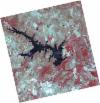
DE2_OPER_HRA_PSH_1C_20210714T110451_N39-019_W007-164_0001
Download Product | Product Info | Browse
Platform Short Name | GEOSAT |
Platform Serial Identifier | 2 |
Product Type | HRA_PSH_1C |
Start Date | 2021-07-14T11:04:51Z |
Stop Date | 2021-07-14T11:04:53Z |
Original Name | DE2_PSH_L1C_000000_20210714T110451_20210714T110453_DE2_38306_B370.zip |
Footprint | 38.9674203659 -7.06854724798 39.0963872905 -7.10290353819 39.0719324831 -7.26023732793 38.9429251745 -7.22613347797 38.9674203659 -7.06854724798 |
Orbit Direction | ASCENDING |
Scene Centre Longitude | W007 |
Scene Centre Latitude | N39 |
Cloud Cover Percentage | -1 |
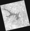
DE2_OPER_HRA_PM4_1C_20210714T110451_N39-019_W007-164_0001
Download Product | Product Info | Browse
Platform Short Name | GEOSAT |
Platform Serial Identifier | 2 |
Product Type | HRA_PM4_1C |
Start Date | 2021-07-14T11:04:51Z |
Stop Date | 2021-07-14T11:04:53Z |
Original Name | DE2_PM4_L1C_000000_20210714T110451_20210714T110453_DE2_38306_B370.zip |
Footprint | 38.9674203659 -7.06854724798 39.0963872905 -7.10290353819 39.0719324831 -7.26023732793 38.9429251745 -7.22613347797 38.9674203659 -7.06854724798 |
Orbit Direction | ASCENDING |
Scene Centre Longitude | W007 |
Scene Centre Latitude | N39 |
Cloud Cover Percentage | -1 |
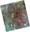
DE2_OPER_HRA_PSH_1C_20210519T110443_N38-960_W007-275_0001
Download Product | Product Info | Browse
Platform Short Name | GEOSAT |
Platform Serial Identifier | 2 |
Product Type | HRA_PSH_1C |
Start Date | 2021-05-19T11:04:43Z |
Stop Date | 2021-05-19T11:04:46Z |
Original Name | DE2_PSH_L1C_000000_20210519T110443_20210519T110446_DE2_37475_1402.zip |
Footprint | 38.90930886 -7.18422538588 39.0354438355 -7.21795595256 39.0111052079 -7.36775063448 38.8849918091 -7.33361634145 38.90930886 -7.18422538588 |
Orbit Direction | ASCENDING |
Scene Centre Longitude | W007 |
Scene Centre Latitude | N38 |
Cloud Cover Percentage | -1 |
DE2_OPER_HRA_PM4_1C_20210519T110443_N38-960_W007-275_0001
Download Product | Product Info | Browse
Platform Short Name | GEOSAT |
Platform Serial Identifier | 2 |
Product Type | HRA_PM4_1C |
Start Date | 2021-05-19T11:04:43Z |
Stop Date | 2021-05-19T11:04:46Z |
Original Name | DE2_PM4_L1C_000000_20210519T110443_20210519T110446_DE2_37475_1402.zip |
Footprint | 38.90930886 -7.18422538588 39.0354438355 -7.21795595256 39.0111052079 -7.36775063448 38.8849918091 -7.33361634145 38.90930886 -7.18422538588 |
Orbit Direction | ASCENDING |
Scene Centre Longitude | W007 |
Scene Centre Latitude | N38 |
Cloud Cover Percentage | -1 |
DE2_OPER_HRA_PSH_1C_20210519T110441_N38-845_W007-244_0001
Download Product | Product Info | Browse
Platform Short Name | GEOSAT |
Platform Serial Identifier | 2 |
Product Type | HRA_PSH_1C |
Start Date | 2021-05-19T11:04:41Z |
Stop Date | 2021-05-19T11:04:44Z |
Original Name | DE2_PSH_L1C_000000_20210519T110441_20210519T110444_DE2_37475_8F89.zip |
Footprint | 38.7948744872 -7.15264324552 38.9209951124 -7.18738779645 38.8966872309 -7.33674164154 38.7705362827 -7.30214078555 38.7948744872 -7.15264324552 |
Orbit Direction | ASCENDING |
Scene Centre Longitude | W007 |
Scene Centre Latitude | N38 |
Cloud Cover Percentage | -1 |
DE2_OPER_HRA_PM4_1C_20210519T110441_N38-845_W007-244_0001
Download Product | Product Info | Browse
Platform Short Name | GEOSAT |
Platform Serial Identifier | 2 |
Product Type | HRA_PM4_1C |
Start Date | 2021-05-19T11:04:41Z |
Stop Date | 2021-05-19T11:04:44Z |
Original Name | DE2_PM4_L1C_000000_20210519T110441_20210519T110444_DE2_37475_8F89.zip |
Footprint | 38.7948744872 -7.15264324552 38.9209951124 -7.18738779645 38.8966872309 -7.33674164154 38.7705362827 -7.30214078555 38.7948744872 -7.15264324552 |
Orbit Direction | ASCENDING |
Scene Centre Longitude | W007 |
Scene Centre Latitude | N38 |
Cloud Cover Percentage | -1 |