ESA TPM Map Catalogue - Product List
back to previous node |
list of download URLs
Collection G2_Portugal_2021
GEOSAT-2 Portugal Coverage 2021 collection. More details here.
List of available products (latitude from 38.8868 to 38.9652 dg, longitude from -8.045 to -7.90062 dg)..
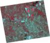
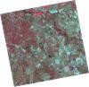
DE2_OPER_HRA_PSH_1C_20211004T111930_N38-943_W008-021_0001
Download Product | Product Info | Browse
Platform Short Name | GEOSAT |
Platform Serial Identifier | 2 |
Product Type | HRA_PSH_1C |
Start Date | 2021-10-04T11:19:30Z |
Stop Date | 2021-10-04T11:19:33Z |
Original Name | DE2_PSH_L1C_000000_20211004T111930_20211004T111933_DE2_39523_BDBF.zip |
Footprint | 38.8764944349 -7.8799592744 39.0375856458 -7.91431829573 39.0100157853 -8.16330456437 38.8488519279 -8.12883573822 38.8764944349 -7.8799592744 |
Orbit Direction | ASCENDING |
Scene Centre Longitude | W008 |
Scene Centre Latitude | N38 |
Cloud Cover Percentage | -1 |
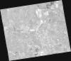
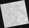
DE2_OPER_HRA_PM4_1C_20211004T111930_N38-943_W008-021_0001
Download Product | Product Info | Browse
Platform Short Name | GEOSAT |
Platform Serial Identifier | 2 |
Product Type | HRA_PM4_1C |
Start Date | 2021-10-04T11:19:30Z |
Stop Date | 2021-10-04T11:19:33Z |
Original Name | DE2_PM4_L1C_000000_20211004T111930_20211004T111933_DE2_39523_BDBF.zip |
Footprint | 38.8764944349 -7.8799592744 39.0375856458 -7.91431829573 39.0100157853 -8.16330456437 38.8488519279 -8.12883573822 38.8764944349 -7.8799592744 |
Orbit Direction | ASCENDING |
Scene Centre Longitude | W008 |
Scene Centre Latitude | N38 |
Cloud Cover Percentage | -1 |
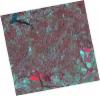
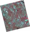
DE2_OPER_HRA_PSH_1C_20210626T111519_N39-009_W008-086_0001
Download Product | Product Info | Browse
Platform Short Name | GEOSAT |
Platform Serial Identifier | 2 |
Product Type | HRA_PSH_1C |
Start Date | 2021-06-26T11:15:19Z |
Stop Date | 2021-06-26T11:15:22Z |
Original Name | DE2_PSH_L1C_000000_20210626T111519_20210626T111522_DE2_38039_6E29.zip |
Footprint | 38.9522555125 -7.9763637154 39.0930089145 -8.00989734619 39.0674797012 -8.19762484923 38.9267400026 -8.16347906803 38.9522555125 -7.9763637154 |
Orbit Direction | ASCENDING |
Scene Centre Longitude | W008 |
Scene Centre Latitude | N39 |
Cloud Cover Percentage | -1 |
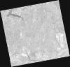
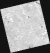
DE2_OPER_HRA_PM4_1C_20210626T111519_N39-009_W008-086_0001
Download Product | Product Info | Browse
Platform Short Name | GEOSAT |
Platform Serial Identifier | 2 |
Product Type | HRA_PM4_1C |
Start Date | 2021-06-26T11:15:19Z |
Stop Date | 2021-06-26T11:15:22Z |
Original Name | DE2_PM4_L1C_000000_20210626T111519_20210626T111522_DE2_38039_6E29.zip |
Footprint | 38.9522555125 -7.9763637154 39.0930089145 -8.00989734619 39.0674797012 -8.19762484923 38.9267400026 -8.16347906803 38.9522555125 -7.9763637154 |
Orbit Direction | ASCENDING |
Scene Centre Longitude | W008 |
Scene Centre Latitude | N39 |
Cloud Cover Percentage | -1 |
DE2_OPER_HRA_PSH_1C_20210626T111517_N38-882_W008-056_0001
Download Product | Product Info | Browse
Platform Short Name | GEOSAT |
Platform Serial Identifier | 2 |
Product Type | HRA_PSH_1C |
Start Date | 2021-06-26T11:15:17Z |
Stop Date | 2021-06-26T11:15:19Z |
Original Name | DE2_PSH_L1C_000000_20210626T111517_20210626T111519_DE2_38039_96B9.zip |
Footprint | 38.8244611534 -7.94677363086 38.9652993146 -7.97947425596 38.9398062219 -8.16661400381 38.7989867568 -8.13330382449 38.8244611534 -7.94677363086 |
Orbit Direction | ASCENDING |
Scene Centre Longitude | W008 |
Scene Centre Latitude | N38 |
Cloud Cover Percentage | -1 |
DE2_OPER_HRA_PM4_1C_20210626T111517_N38-882_W008-056_0001
Download Product | Product Info | Browse
Platform Short Name | GEOSAT |
Platform Serial Identifier | 2 |
Product Type | HRA_PM4_1C |
Start Date | 2021-06-26T11:15:17Z |
Stop Date | 2021-06-26T11:15:19Z |
Original Name | DE2_PM4_L1C_000000_20210626T111517_20210626T111519_DE2_38039_96B9.zip |
Footprint | 38.8244611534 -7.94677363086 38.9652993146 -7.97947425596 38.9398062219 -8.16661400381 38.7989867568 -8.13330382449 38.8244611534 -7.94677363086 |
Orbit Direction | ASCENDING |
Scene Centre Longitude | W008 |
Scene Centre Latitude | N38 |
Cloud Cover Percentage | -1 |
DE2_OPER_HRA_PSH_1C_20210525T110124_N38-982_W007-851_0001
Download Product | Product Info | Browse
Platform Short Name | GEOSAT |
Platform Serial Identifier | 2 |
Product Type | HRA_PSH_1C |
Start Date | 2021-05-25T11:01:24Z |
Stop Date | 2021-05-25T11:01:26Z |
Original Name | DE2_PSH_L1C_000000_20210525T110124_20210525T110126_DE2_37564_40FE.zip |
Footprint | 38.9336003389 -7.76326894445 39.0566563883 -7.79910739951 39.03162472 -7.94075939342 38.9085881598 -7.90470402199 38.9336003389 -7.76326894445 |
Orbit Direction | ASCENDING |
Scene Centre Longitude | W007 |
Scene Centre Latitude | N38 |
Cloud Cover Percentage | -1 |
DE2_OPER_HRA_PM4_1C_20210525T110124_N38-982_W007-851_0001
Download Product | Product Info | Browse
Platform Short Name | GEOSAT |
Platform Serial Identifier | 2 |
Product Type | HRA_PM4_1C |
Start Date | 2021-05-25T11:01:24Z |
Stop Date | 2021-05-25T11:01:26Z |
Original Name | DE2_PM4_L1C_000000_20210525T110124_20210525T110126_DE2_37564_40FE.zip |
Footprint | 38.9336003389 -7.76326894445 39.0566563883 -7.79910739951 39.03162472 -7.94075939342 38.9085881598 -7.90470402199 38.9336003389 -7.76326894445 |
Orbit Direction | ASCENDING |
Scene Centre Longitude | W007 |
Scene Centre Latitude | N38 |
Cloud Cover Percentage | -1 |