ESA TPM Map Catalogue - Product List
back to previous node |
list of download URLs


Collection G2_Portugal_2021
GEOSAT-2 Portugal Coverage 2021 collection. More details here.
List of available products (latitude from 38.8868 to 38.9652 dg, longitude from -9.0425 to -8.89813 dg)..
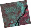
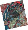
DE2_OPER_HRA_PSH_1C_20210721T111650_N38-975_W008-817_0001
Download Product | Product Info | Browse
Platform Short Name | GEOSAT |
Platform Serial Identifier | 2 |
Product Type | HRA_PSH_1C |
Start Date | 2021-07-21T11:16:50Z |
Stop Date | 2021-07-21T11:16:53Z |
Original Name | DE2_PSH_L1C_000000_20210721T111650_20210721T111653_DE2_38410_45D2.zip |
Footprint | 38.9189335805 -8.70941182797 39.0581220929 -8.74263162568 39.0328220628 -8.9259691355 38.8936506319 -8.89228994081 38.9189335805 -8.70941182797 |
Orbit Direction | ASCENDING |
Scene Centre Longitude | W008 |
Scene Centre Latitude | N38 |
Cloud Cover Percentage | -1 |
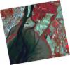
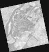
DE2_OPER_HRA_PM4_1C_20210721T111650_N38-975_W008-817_0001
Download Product | Product Info | Browse
Platform Short Name | GEOSAT |
Platform Serial Identifier | 2 |
Product Type | HRA_PM4_1C |
Start Date | 2021-07-21T11:16:50Z |
Stop Date | 2021-07-21T11:16:53Z |
Original Name | DE2_PM4_L1C_000000_20210721T111650_20210721T111653_DE2_38410_45D2.zip |
Footprint | 38.9189335805 -8.70941182797 39.0581220929 -8.74263162568 39.0328220628 -8.9259691355 38.8936506319 -8.89228994081 38.9189335805 -8.70941182797 |
Orbit Direction | ASCENDING |
Scene Centre Longitude | W008 |
Scene Centre Latitude | N38 |
Cloud Cover Percentage | -1 |
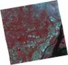
DE2_OPER_HRA_PSH_1C_20210715T112022_N38-975_W009-014_0001
Download Product | Product Info | Browse
Platform Short Name | GEOSAT |
Platform Serial Identifier | 2 |
Product Type | HRA_PSH_1C |
Start Date | 2021-07-15T11:20:22Z |
Stop Date | 2021-07-15T11:20:24Z |
Original Name | DE2_PSH_L1C_000000_20210715T112022_20210715T112024_DE2_38321_D2B7.zip |
Footprint | 38.9161071947 -8.89717849301 39.0610417392 -8.93101958135 39.0349938566 -9.13248549066 38.8900025237 -9.09828116035 38.9161071947 -8.89717849301 |
Orbit Direction | ASCENDING |
Scene Centre Longitude | W009 |
Scene Centre Latitude | N38 |
Cloud Cover Percentage | -1 |
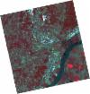
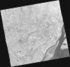
DE2_OPER_HRA_PM4_1C_20210715T112022_N38-975_W009-014_0001
Download Product | Product Info | Browse
Platform Short Name | GEOSAT |
Platform Serial Identifier | 2 |
Product Type | HRA_PM4_1C |
Start Date | 2021-07-15T11:20:22Z |
Stop Date | 2021-07-15T11:20:24Z |
Original Name | DE2_PM4_L1C_000000_20210715T112022_20210715T112024_DE2_38321_D2B7.zip |
Footprint | 38.9161071947 -8.89717849301 39.0610417392 -8.93101958135 39.0349938566 -9.13248549066 38.8900025237 -9.09828116035 38.9161071947 -8.89717849301 |
Orbit Direction | ASCENDING |
Scene Centre Longitude | W009 |
Scene Centre Latitude | N38 |
Cloud Cover Percentage | -1 |
DE2_OPER_HRA_PSH_1C_20210715T112019_N38-844_W008-983_0001
Download Product | Product Info | Browse
Platform Short Name | GEOSAT |
Platform Serial Identifier | 2 |
Product Type | HRA_PSH_1C |
Start Date | 2021-07-15T11:20:19Z |
Stop Date | 2021-07-15T11:20:22Z |
Original Name | DE2_PSH_L1C_000000_20210715T112019_20210715T112022_DE2_38321_69F5.zip |
Footprint | 38.7846469564 -8.86672119379 38.9295121723 -8.90024817559 38.903524623 -9.10054869481 38.7587574975 -9.06574780454 38.7846469564 -8.86672119379 |
Orbit Direction | ASCENDING |
Scene Centre Longitude | W008 |
Scene Centre Latitude | N38 |
Cloud Cover Percentage | -1 |
DE2_OPER_HRA_PM4_1C_20210715T112019_N38-844_W008-983_0001
Download Product | Product Info | Browse
Platform Short Name | GEOSAT |
Platform Serial Identifier | 2 |
Product Type | HRA_PM4_1C |
Start Date | 2021-07-15T11:20:19Z |
Stop Date | 2021-07-15T11:20:22Z |
Original Name | DE2_PM4_L1C_000000_20210715T112019_20210715T112022_DE2_38321_69F5.zip |
Footprint | 38.7846469564 -8.86672119379 38.9295121723 -8.90024817559 38.903524623 -9.10054869481 38.7587574975 -9.06574780454 38.7846469564 -8.86672119379 |
Orbit Direction | ASCENDING |
Scene Centre Longitude | W008 |
Scene Centre Latitude | N38 |
Cloud Cover Percentage | -1 |
DE2_OPER_HRA_PSH_1C_20210607T111009_N39-022_W008-978_0001
Download Product | Product Info | Browse
Platform Short Name | GEOSAT |
Platform Serial Identifier | 2 |
Product Type | HRA_PSH_1C |
Start Date | 2021-06-07T11:10:09Z |
Stop Date | 2021-06-07T11:10:11Z |
Original Name | DE2_PSH_L1C_000000_20210607T111009_20210607T111011_DE2_37757_3FD6.zip |
Footprint | 38.9722684726 -8.88713203791 39.0977342583 -8.92193761626 39.0733075986 -9.07016573683 38.947838156 -9.03543060953 38.9722684726 -8.88713203791 |
Orbit Direction | ASCENDING |
Scene Centre Longitude | W008 |
Scene Centre Latitude | N39 |
Cloud Cover Percentage | -1 |
DE2_OPER_HRA_PM4_1C_20210607T111009_N39-022_W008-978_0001
Download Product | Product Info | Browse
Platform Short Name | GEOSAT |
Platform Serial Identifier | 2 |
Product Type | HRA_PM4_1C |
Start Date | 2021-06-07T11:10:09Z |
Stop Date | 2021-06-07T11:10:11Z |
Original Name | DE2_PM4_L1C_000000_20210607T111009_20210607T111011_DE2_37757_3FD6.zip |
Footprint | 38.9722684726 -8.88713203791 39.0977342583 -8.92193761626 39.0733075986 -9.07016573683 38.947838156 -9.03543060953 38.9722684726 -8.88713203791 |
Orbit Direction | ASCENDING |
Scene Centre Longitude | W008 |
Scene Centre Latitude | N39 |
Cloud Cover Percentage | -1 |
DE2_OPER_HRA_PSH_1C_20210607T111007_N38-908_W008-947_0001
Download Product | Product Info | Browse
Platform Short Name | GEOSAT |
Platform Serial Identifier | 2 |
Product Type | HRA_PSH_1C |
Start Date | 2021-06-07T11:10:07Z |
Stop Date | 2021-06-07T11:10:10Z |
Original Name | DE2_PSH_L1C_000000_20210607T111007_20210607T111010_DE2_37757_4689.zip |
Footprint | 38.8582296733 -8.85577882853 38.9838692149 -8.89036954098 38.959414525 -9.03877774016 38.8338656964 -9.00353135479 38.8582296733 -8.85577882853 |
Orbit Direction | ASCENDING |
Scene Centre Longitude | W008 |
Scene Centre Latitude | N38 |
Cloud Cover Percentage | -1 |
DE2_OPER_HRA_PM4_1C_20210607T111007_N38-908_W008-947_0001
Download Product | Product Info | Browse
Platform Short Name | GEOSAT |
Platform Serial Identifier | 2 |
Product Type | HRA_PM4_1C |
Start Date | 2021-06-07T11:10:07Z |
Stop Date | 2021-06-07T11:10:10Z |
Original Name | DE2_PM4_L1C_000000_20210607T111007_20210607T111010_DE2_37757_4689.zip |
Footprint | 38.8582296733 -8.85577882853 38.9838692149 -8.89036954098 38.959414525 -9.03877774016 38.8338656964 -9.00353135479 38.8582296733 -8.85577882853 |
Orbit Direction | ASCENDING |
Scene Centre Longitude | W008 |
Scene Centre Latitude | N38 |
Cloud Cover Percentage | -1 |
DE2_OPER_HRA_PSH_1C_20210419T112116_N38-893_W009-102_0001
Download Product | Product Info | Browse
Platform Short Name | GEOSAT |
Platform Serial Identifier | 2 |
Product Type | HRA_PSH_1C |
Start Date | 2021-04-19T11:21:16Z |
Stop Date | 2021-04-19T11:21:19Z |
Original Name | DE2_PSH_L1C_000000_20210419T112116_20210419T112119_DE2_37030_E870.zip |
Footprint | 38.8368258311 -8.99261726163 38.9765236976 -9.02721069229 38.9510830637 -9.21271153916 38.8113514737 -9.17836358974 38.8368258311 -8.99261726163 |
Orbit Direction | ASCENDING |
Scene Centre Longitude | W009 |
Scene Centre Latitude | N38 |
Cloud Cover Percentage | -1 |
DE2_OPER_HRA_PM4_1C_20210419T112116_N38-893_W009-102_0001
Download Product | Product Info | Browse
Platform Short Name | GEOSAT |
Platform Serial Identifier | 2 |
Product Type | HRA_PM4_1C |
Start Date | 2021-04-19T11:21:16Z |
Stop Date | 2021-04-19T11:21:19Z |
Original Name | DE2_PM4_L1C_000000_20210419T112116_20210419T112119_DE2_37030_E870.zip |
Footprint | 38.8368258311 -8.99261726163 38.9765236976 -9.02721069229 38.9510830637 -9.21271153916 38.8113514737 -9.17836358974 38.8368258311 -8.99261726163 |
Orbit Direction | ASCENDING |
Scene Centre Longitude | W009 |
Scene Centre Latitude | N38 |
Cloud Cover Percentage | -1 |