ESA TPM Map Catalogue - Product List
back to previous node |
list of download URLs
Collection G2_Portugal_2021
GEOSAT-2 Portugal Coverage 2021 collection. More details here.
List of available products (latitude from 38.8083 to 38.8868 dg, longitude from -7.75625 to -7.61188 dg)..
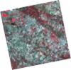
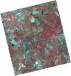
DE2_OPER_HRA_PSH_1C_20210702T111148_N38-862_W007-666_0001
Download Product | Product Info | Browse
Platform Short Name | GEOSAT |
Platform Serial Identifier | 2 |
Product Type | HRA_PSH_1C |
Start Date | 2021-07-02T11:11:48Z |
Stop Date | 2021-07-02T11:11:51Z |
Original Name | DE2_PSH_L1C_000000_20210702T111148_20210702T111151_DE2_38128_19E4.zip |
Footprint | 38.8065478896 -7.56174828849 38.9441402482 -7.59464352306 38.9190666377 -7.77126399725 38.7815411691 -7.7376916088 38.8065478896 -7.56174828849 |
Orbit Direction | ASCENDING |
Scene Centre Longitude | W007 |
Scene Centre Latitude | N38 |
Cloud Cover Percentage | -1 |
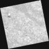
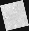
DE2_OPER_HRA_PM4_1C_20210702T111148_N38-862_W007-666_0001
Download Product | Product Info | Browse
Platform Short Name | GEOSAT |
Platform Serial Identifier | 2 |
Product Type | HRA_PM4_1C |
Start Date | 2021-07-02T11:11:48Z |
Stop Date | 2021-07-02T11:11:51Z |
Original Name | DE2_PM4_L1C_000000_20210702T111148_20210702T111151_DE2_38128_19E4.zip |
Footprint | 38.8065478896 -7.56174828849 38.9441402482 -7.59464352306 38.9190666377 -7.77126399725 38.7815411691 -7.7376916088 38.8065478896 -7.56174828849 |
Orbit Direction | ASCENDING |
Scene Centre Longitude | W007 |
Scene Centre Latitude | N38 |
Cloud Cover Percentage | -1 |
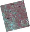
DE2_OPER_HRA_PSH_1C_20210525T110122_N38-870_W007-819_0001
Download Product | Product Info | Browse
Platform Short Name | GEOSAT |
Platform Serial Identifier | 2 |
Product Type | HRA_PSH_1C |
Start Date | 2021-05-25T11:01:22Z |
Stop Date | 2021-05-25T11:01:24Z |
Original Name | DE2_PSH_L1C_000000_20210525T110122_20210525T110124_DE2_37564_5B5C.zip |
Footprint | 38.8218909013 -7.73102696871 38.9450093837 -7.76656701733 38.9199864913 -7.90798929587 38.7968869275 -7.87223334427 38.8218909013 -7.73102696871 |
Orbit Direction | ASCENDING |
Scene Centre Longitude | W007 |
Scene Centre Latitude | N38 |
Cloud Cover Percentage | -1 |
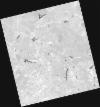
DE2_OPER_HRA_PM4_1C_20210525T110122_N38-870_W007-819_0001
Download Product | Product Info | Browse
Platform Short Name | GEOSAT |
Platform Serial Identifier | 2 |
Product Type | HRA_PM4_1C |
Start Date | 2021-05-25T11:01:22Z |
Stop Date | 2021-05-25T11:01:24Z |
Original Name | DE2_PM4_L1C_000000_20210525T110122_20210525T110124_DE2_37564_5B5C.zip |
Footprint | 38.8218909013 -7.73102696871 38.9450093837 -7.76656701733 38.9199864913 -7.90798929587 38.7968869275 -7.87223334427 38.8218909013 -7.73102696871 |
Orbit Direction | ASCENDING |
Scene Centre Longitude | W007 |
Scene Centre Latitude | N38 |
Cloud Cover Percentage | -1 |
DE2_OPER_HRA_PSH_1C_20210525T110120_N38-759_W007-787_0001
Download Product | Product Info | Browse
Platform Short Name | GEOSAT |
Platform Serial Identifier | 2 |
Product Type | HRA_PSH_1C |
Start Date | 2021-05-25T11:01:20Z |
Stop Date | 2021-05-25T11:01:22Z |
Original Name | DE2_PSH_L1C_000000_20210525T110120_20210525T110122_DE2_37564_3B58.zip |
Footprint | 38.7101052955 -7.69894266215 38.833301086 -7.73433246171 38.808320437 -7.87555135741 38.6851225683 -7.83991246445 38.7101052955 -7.69894266215 |
Orbit Direction | ASCENDING |
Scene Centre Longitude | W007 |
Scene Centre Latitude | N38 |
Cloud Cover Percentage | -1 |
DE2_OPER_HRA_PM4_1C_20210525T110120_N38-759_W007-787_0001
Download Product | Product Info | Browse
Platform Short Name | GEOSAT |
Platform Serial Identifier | 2 |
Product Type | HRA_PM4_1C |
Start Date | 2021-05-25T11:01:20Z |
Stop Date | 2021-05-25T11:01:22Z |
Original Name | DE2_PM4_L1C_000000_20210525T110120_20210525T110122_DE2_37564_3B58.zip |
Footprint | 38.7101052955 -7.69894266215 38.833301086 -7.73433246171 38.808320437 -7.87555135741 38.6851225683 -7.83991246445 38.7101052955 -7.69894266215 |
Orbit Direction | ASCENDING |
Scene Centre Longitude | W007 |
Scene Centre Latitude | N38 |
Cloud Cover Percentage | -1 |