ESA TPM Map Catalogue - Product List
back to previous node |
list of download URLs

Collection G2_Portugal_2021
GEOSAT-2 Portugal Coverage 2021 collection. More details here.
List of available products (latitude from 38.8083 to 38.8868 dg, longitude from -8.68812 to -8.54375 dg)..
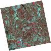
DE2_OPER_HRA_PSH_1C_20210827T111048_N38-844_W008-467_0001
Download Product | Product Info | Browse
Platform Short Name | GEOSAT |
Platform Serial Identifier | 2 |
Product Type | HRA_PSH_1C |
Start Date | 2021-08-27T11:10:48Z |
Stop Date | 2021-08-27T11:10:51Z |
Original Name | DE2_PSH_L1C_000000_20210827T111048_20210827T111051_DE2_38959_5405.zip |
Footprint | 38.7903876608 -8.36798943702 38.9233497678 -8.40137581427 38.8987549432 -8.5663966619 38.76586394 -8.53255835522 38.7903876608 -8.36798943702 |
Orbit Direction | ASCENDING |
Scene Centre Longitude | W008 |
Scene Centre Latitude | N38 |
Cloud Cover Percentage | -1 |
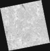
DE2_OPER_HRA_PM4_1C_20210827T111048_N38-844_W008-467_0001
Download Product | Product Info | Browse
Platform Short Name | GEOSAT |
Platform Serial Identifier | 2 |
Product Type | HRA_PM4_1C |
Start Date | 2021-08-27T11:10:48Z |
Stop Date | 2021-08-27T11:10:51Z |
Original Name | DE2_PM4_L1C_000000_20210827T111048_20210827T111051_DE2_38959_5405.zip |
Footprint | 38.7903876608 -8.36798943702 38.9233497678 -8.40137581427 38.8987549432 -8.5663966619 38.76586394 -8.53255835522 38.7903876608 -8.36798943702 |
Orbit Direction | ASCENDING |
Scene Centre Longitude | W008 |
Scene Centre Latitude | N38 |
Cloud Cover Percentage | -1 |
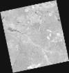
DE2_OPER_HRA_PSH_1C_20210507T111124_N38-840_W008-682_0001
Download Product | Product Info | Browse
Platform Short Name | GEOSAT |
Platform Serial Identifier | 2 |
Product Type | HRA_PSH_1C |
Start Date | 2021-05-07T11:11:24Z |
Stop Date | 2021-05-07T11:11:26Z |
Original Name | DE2_PSH_L1C_000000_20210507T111124_20210507T111126_DE2_37297_BCED.zip |
Footprint | 38.7895272392 -8.59046202041 38.9163516913 -8.62413092085 38.8920303381 -8.7749536552 38.7652209803 -8.74108873041 38.7895272392 -8.59046202041 |
Orbit Direction | ASCENDING |
Scene Centre Longitude | W008 |
Scene Centre Latitude | N38 |
Cloud Cover Percentage | -1 |
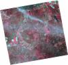
DE2_OPER_HRA_PM4_1C_20210507T111124_N38-840_W008-682_0001
Download Product | Product Info | Browse
Platform Short Name | GEOSAT |
Platform Serial Identifier | 2 |
Product Type | HRA_PM4_1C |
Start Date | 2021-05-07T11:11:24Z |
Stop Date | 2021-05-07T11:11:26Z |
Original Name | DE2_PM4_L1C_000000_20210507T111124_20210507T111126_DE2_37297_BCED.zip |
Footprint | 38.7895272392 -8.59046202041 38.9163516913 -8.62413092085 38.8920303381 -8.7749536552 38.7652209803 -8.74108873041 38.7895272392 -8.59046202041 |
Orbit Direction | ASCENDING |
Scene Centre Longitude | W008 |
Scene Centre Latitude | N38 |
Cloud Cover Percentage | -1 |
DE2_OPER_HRA_PSH_1C_20210319T112144_N38-865_W008-546_0001
Download Product | Product Info | Browse
Platform Short Name | GEOSAT |
Platform Serial Identifier | 2 |
Product Type | HRA_PSH_1C |
Start Date | 2021-03-19T11:21:44Z |
Stop Date | 2021-03-19T11:21:47Z |
Original Name | DE2_PSH_L1C_000000_20210319T112144_20210319T112147_DE2_36570_B6C2.zip |
Footprint | 38.8063020218 -8.43203581674 38.9506336624 -8.46536819755 38.9248005547 -8.66191352625 38.7805407952 -8.62762527473 38.8063020218 -8.43203581674 |
Orbit Direction | ASCENDING |
Scene Centre Longitude | W008 |
Scene Centre Latitude | N38 |
Cloud Cover Percentage | -1 |
DE2_OPER_HRA_PM4_1C_20210319T112144_N38-865_W008-546_0001
Download Product | Product Info | Browse
Platform Short Name | GEOSAT |
Platform Serial Identifier | 2 |
Product Type | HRA_PM4_1C |
Start Date | 2021-03-19T11:21:44Z |
Stop Date | 2021-03-19T11:21:47Z |
Original Name | DE2_PM4_L1C_000000_20210319T112144_20210319T112147_DE2_36570_B6C2.zip |
Footprint | 38.8063020218 -8.43203581674 38.9506336624 -8.46536819755 38.9248005547 -8.66191352625 38.7805407952 -8.62762527473 38.8063020218 -8.43203581674 |
Orbit Direction | ASCENDING |
Scene Centre Longitude | W008 |
Scene Centre Latitude | N38 |
Cloud Cover Percentage | -1 |