ESA TPM Map Catalogue - Product List
back to previous node |
list of download URLs

Collection G2_Portugal_2021
GEOSAT-2 Portugal Coverage 2021 collection. More details here.
List of available products (latitude from 38.8083 to 38.8868 dg, longitude from -9.53625 to -9.385 dg)..
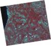
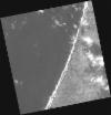
DE2_OPER_HRA_PSH_1C_20210508T112656_N38-929_W009-328_0001
Download Product | Product Info | Browse
Platform Short Name | GEOSAT |
Platform Serial Identifier | 2 |
Product Type | HRA_PSH_1C |
Start Date | 2021-05-08T11:26:56Z |
Stop Date | 2021-05-08T11:26:59Z |
Original Name | DE2_PSH_L1C_000000_20210508T112656_20210508T112659_DE2_37312_881F.zip |
Footprint | 38.8658380007 -9.20049258307 39.0190192715 -9.23414085502 38.9923482289 -9.45637320431 38.8390522242 -9.42357357454 38.8658380007 -9.20049258307 |
Orbit Direction | ASCENDING |
Scene Centre Longitude | W009 |
Scene Centre Latitude | N38 |
Cloud Cover Percentage | -1 |
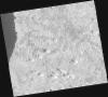
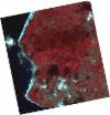
DE2_OPER_HRA_PM4_1C_20210508T112656_N38-929_W009-328_0001
Download Product | Product Info | Browse
Platform Short Name | GEOSAT |
Platform Serial Identifier | 2 |
Product Type | HRA_PM4_1C |
Start Date | 2021-05-08T11:26:56Z |
Stop Date | 2021-05-08T11:26:59Z |
Original Name | DE2_PM4_L1C_000000_20210508T112656_20210508T112659_DE2_37312_881F.zip |
Footprint | 38.8658380007 -9.20049258307 39.0190192715 -9.23414085502 38.9923482289 -9.45637320431 38.8390522242 -9.42357357454 38.8658380007 -9.20049258307 |
Orbit Direction | ASCENDING |
Scene Centre Longitude | W009 |
Scene Centre Latitude | N38 |
Cloud Cover Percentage | -1 |
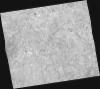
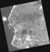
DE2_OPER_HRA_PSH_1C_20210508T112654_N38-790_W009-297_0001
Download Product | Product Info | Browse
Platform Short Name | GEOSAT |
Platform Serial Identifier | 2 |
Product Type | HRA_PSH_1C |
Start Date | 2021-05-08T11:26:54Z |
Stop Date | 2021-05-08T11:26:57Z |
Original Name | DE2_PSH_L1C_000000_20210508T112654_20210508T112657_DE2_37312_86B8.zip |
Footprint | 38.7271170716 -9.1690942753 38.8800059156 -9.20337716566 38.8529311846 -9.4263439815 38.7003057134 -9.3914623419 38.7271170716 -9.1690942753 |
Orbit Direction | ASCENDING |
Scene Centre Longitude | W009 |
Scene Centre Latitude | N38 |
Cloud Cover Percentage | -1 |
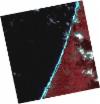
DE2_OPER_HRA_PM4_1C_20210508T112654_N38-790_W009-297_0001
Download Product | Product Info | Browse
Platform Short Name | GEOSAT |
Platform Serial Identifier | 2 |
Product Type | HRA_PM4_1C |
Start Date | 2021-05-08T11:26:54Z |
Stop Date | 2021-05-08T11:26:57Z |
Original Name | DE2_PM4_L1C_000000_20210508T112654_20210508T112657_DE2_37312_86B8.zip |
Footprint | 38.7271170716 -9.1690942753 38.8800059156 -9.20337716566 38.8529311846 -9.4263439815 38.7003057134 -9.3914623419 38.7271170716 -9.1690942753 |
Orbit Direction | ASCENDING |
Scene Centre Longitude | W009 |
Scene Centre Latitude | N38 |
Cloud Cover Percentage | -1 |
DE2_OPER_HRA_PSH_1C_20210122T111815_N38-877_W009-470_0001
Download Product | Product Info | Browse
Platform Short Name | GEOSAT |
Platform Serial Identifier | 2 |
Product Type | HRA_PSH_1C |
Start Date | 2021-01-22T11:18:15Z |
Stop Date | 2021-01-22T11:18:18Z |
Original Name | DE2_PSH_L1C_000000_20210122T111815_20210122T111818_DE2_35739_B31A.zip |
Footprint | 38.8253167228 -9.37676660966 38.9532792615 -9.41034311429 38.9291703695 -9.56440297117 38.8010092338 -9.5292567198 38.8253167228 -9.37676660966 |
Orbit Direction | ASCENDING |
Scene Centre Longitude | W009 |
Scene Centre Latitude | N38 |
Cloud Cover Percentage | -1 |
DE2_OPER_HRA_PM4_1C_20210122T111815_N38-877_W009-470_0001
Download Product | Product Info | Browse
Platform Short Name | GEOSAT |
Platform Serial Identifier | 2 |
Product Type | HRA_PM4_1C |
Start Date | 2021-01-22T11:18:15Z |
Stop Date | 2021-01-22T11:18:18Z |
Original Name | DE2_PM4_L1C_000000_20210122T111815_20210122T111818_DE2_35739_B31A.zip |
Footprint | 38.8253167228 -9.37676660966 38.9532792615 -9.41034311429 38.9291703695 -9.56440297117 38.8010092338 -9.5292567198 38.8253167228 -9.37676660966 |
Orbit Direction | ASCENDING |
Scene Centre Longitude | W009 |
Scene Centre Latitude | N38 |
Cloud Cover Percentage | -1 |
DE2_OPER_HRA_PSH_1C_20210122T111813_N38-761_W009-439_0001
Download Product | Product Info | Browse
Platform Short Name | GEOSAT |
Platform Serial Identifier | 2 |
Product Type | HRA_PSH_1C |
Start Date | 2021-01-22T11:18:13Z |
Stop Date | 2021-01-22T11:18:16Z |
Original Name | DE2_PSH_L1C_000000_20210122T111813_20210122T111816_DE2_35739_0BDB.zip |
Footprint | 38.7090943829 -9.34574026798 38.8371682129 -9.37985362234 38.8128762664 -9.53249759698 38.6848128521 -9.49846879665 38.7090943829 -9.34574026798 |
Orbit Direction | ASCENDING |
Scene Centre Longitude | W009 |
Scene Centre Latitude | N38 |
Cloud Cover Percentage | -1 |
DE2_OPER_HRA_PM4_1C_20210122T111813_N38-761_W009-439_0001
Download Product | Product Info | Browse
Platform Short Name | GEOSAT |
Platform Serial Identifier | 2 |
Product Type | HRA_PM4_1C |
Start Date | 2021-01-22T11:18:13Z |
Stop Date | 2021-01-22T11:18:16Z |
Original Name | DE2_PM4_L1C_000000_20210122T111813_20210122T111816_DE2_35739_0BDB.zip |
Footprint | 38.7090943829 -9.34574026798 38.8371682129 -9.37985362234 38.8128762664 -9.53249759698 38.6848128521 -9.49846879665 38.7090943829 -9.34574026798 |
Orbit Direction | ASCENDING |
Scene Centre Longitude | W009 |
Scene Centre Latitude | N38 |
Cloud Cover Percentage | -1 |