ESA TPM Map Catalogue - Product List
back to previous node |
list of download URLs


Collection G2_Portugal_2021
GEOSAT-2 Portugal Coverage 2021 collection. More details here.
List of available products (latitude from 38.7299 to 38.8083 dg, longitude from -8.68812 to -8.54375 dg)..
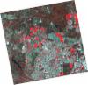
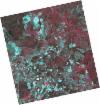
DE2_OPER_HRA_PSH_1C_20210721T111646_N38-723_W008-757_0001
Download Product | Product Info | Browse
Platform Short Name | GEOSAT |
Platform Serial Identifier | 2 |
Product Type | HRA_PSH_1C |
Start Date | 2021-07-21T11:16:46Z |
Stop Date | 2021-07-21T11:16:49Z |
Original Name | DE2_PSH_L1C_000000_20210721T111646_20210721T111649_DE2_38410_ECC3.zip |
Footprint | 38.6665466311 -8.64945852042 38.8056218193 -8.6823528854 38.7803531767 -8.86501088207 38.6412735555 -8.83159310808 38.6665466311 -8.64945852042 |
Orbit Direction | ASCENDING |
Scene Centre Longitude | W008 |
Scene Centre Latitude | N38 |
Cloud Cover Percentage | -1 |
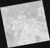
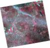
DE2_OPER_HRA_PM4_1C_20210721T111646_N38-723_W008-757_0001
Download Product | Product Info | Browse
Platform Short Name | GEOSAT |
Platform Serial Identifier | 2 |
Product Type | HRA_PM4_1C |
Start Date | 2021-07-21T11:16:46Z |
Stop Date | 2021-07-21T11:16:49Z |
Original Name | DE2_PM4_L1C_000000_20210721T111646_20210721T111649_DE2_38410_ECC3.zip |
Footprint | 38.6665466311 -8.64945852042 38.8056218193 -8.6823528854 38.7803531767 -8.86501088207 38.6412735555 -8.83159310808 38.6665466311 -8.64945852042 |
Orbit Direction | ASCENDING |
Scene Centre Longitude | W008 |
Scene Centre Latitude | N38 |
Cloud Cover Percentage | -1 |
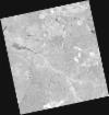
DE2_OPER_HRA_PSH_1C_20210507T111124_N38-840_W008-682_0001
Download Product | Product Info | Browse
Platform Short Name | GEOSAT |
Platform Serial Identifier | 2 |
Product Type | HRA_PSH_1C |
Start Date | 2021-05-07T11:11:24Z |
Stop Date | 2021-05-07T11:11:26Z |
Original Name | DE2_PSH_L1C_000000_20210507T111124_20210507T111126_DE2_37297_BCED.zip |
Footprint | 38.7895272392 -8.59046202041 38.9163516913 -8.62413092085 38.8920303381 -8.7749536552 38.7652209803 -8.74108873041 38.7895272392 -8.59046202041 |
Orbit Direction | ASCENDING |
Scene Centre Longitude | W008 |
Scene Centre Latitude | N38 |
Cloud Cover Percentage | -1 |
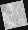
DE2_OPER_HRA_PM4_1C_20210507T111124_N38-840_W008-682_0001
Download Product | Product Info | Browse
Platform Short Name | GEOSAT |
Platform Serial Identifier | 2 |
Product Type | HRA_PM4_1C |
Start Date | 2021-05-07T11:11:24Z |
Stop Date | 2021-05-07T11:11:26Z |
Original Name | DE2_PM4_L1C_000000_20210507T111124_20210507T111126_DE2_37297_BCED.zip |
Footprint | 38.7895272392 -8.59046202041 38.9163516913 -8.62413092085 38.8920303381 -8.7749536552 38.7652209803 -8.74108873041 38.7895272392 -8.59046202041 |
Orbit Direction | ASCENDING |
Scene Centre Longitude | W008 |
Scene Centre Latitude | N38 |
Cloud Cover Percentage | -1 |
DE2_OPER_HRA_PM4_1C_20210507T111122_N38-725_W008-651_0001
Download Product | Product Info | Browse
Platform Short Name | GEOSAT |
Platform Serial Identifier | 2 |
Product Type | HRA_PM4_1C |
Start Date | 2021-05-07T11:11:22Z |
Stop Date | 2021-05-07T11:11:24Z |
Original Name | DE2_PM4_L1C_000000_20210507T111122_20210507T111124_DE2_37297_FE4D.zip |
Footprint | 38.6744154318 -8.55990744563 38.8012847239 -8.59356457472 38.7769813062 -8.7441890926 38.6501398478 -8.71010432502 38.6744154318 -8.55990744563 |
Orbit Direction | ASCENDING |
Scene Centre Longitude | W008 |
Scene Centre Latitude | N38 |
Cloud Cover Percentage | -1 |
DE2_OPER_HRA_PSH_1C_20210507T111122_N38-725_W008-651_0001
Download Product | Product Info | Browse
Platform Short Name | GEOSAT |
Platform Serial Identifier | 2 |
Product Type | HRA_PSH_1C |
Start Date | 2021-05-07T11:11:22Z |
Stop Date | 2021-05-07T11:11:24Z |
Original Name | DE2_PSH_L1C_000000_20210507T111122_20210507T111124_DE2_37297_FE4D.zip |
Footprint | 38.6744154318 -8.55990744563 38.8012847239 -8.59356457472 38.7769813062 -8.7441890926 38.6501398478 -8.71010432502 38.6744154318 -8.55990744563 |
Orbit Direction | ASCENDING |
Scene Centre Longitude | W008 |
Scene Centre Latitude | N38 |
Cloud Cover Percentage | -1 |
DE2_OPER_HRA_PSH_1C_20210319T112144_N38-865_W008-546_0001
Download Product | Product Info | Browse
Platform Short Name | GEOSAT |
Platform Serial Identifier | 2 |
Product Type | HRA_PSH_1C |
Start Date | 2021-03-19T11:21:44Z |
Stop Date | 2021-03-19T11:21:47Z |
Original Name | DE2_PSH_L1C_000000_20210319T112144_20210319T112147_DE2_36570_B6C2.zip |
Footprint | 38.8063020218 -8.43203581674 38.9506336624 -8.46536819755 38.9248005547 -8.66191352625 38.7805407952 -8.62762527473 38.8063020218 -8.43203581674 |
Orbit Direction | ASCENDING |
Scene Centre Longitude | W008 |
Scene Centre Latitude | N38 |
Cloud Cover Percentage | -1 |
DE2_OPER_HRA_PM4_1C_20210319T112144_N38-865_W008-546_0001
Download Product | Product Info | Browse
Platform Short Name | GEOSAT |
Platform Serial Identifier | 2 |
Product Type | HRA_PM4_1C |
Start Date | 2021-03-19T11:21:44Z |
Stop Date | 2021-03-19T11:21:47Z |
Original Name | DE2_PM4_L1C_000000_20210319T112144_20210319T112147_DE2_36570_B6C2.zip |
Footprint | 38.8063020218 -8.43203581674 38.9506336624 -8.46536819755 38.9248005547 -8.66191352625 38.7805407952 -8.62762527473 38.8063020218 -8.43203581674 |
Orbit Direction | ASCENDING |
Scene Centre Longitude | W008 |
Scene Centre Latitude | N38 |
Cloud Cover Percentage | -1 |
DE2_OPER_HRA_PM4_1C_20210319T112142_N38-734_W008-516_0001
Download Product | Product Info | Browse
Platform Short Name | GEOSAT |
Platform Serial Identifier | 2 |
Product Type | HRA_PM4_1C |
Start Date | 2021-03-19T11:21:42Z |
Stop Date | 2021-03-19T11:21:45Z |
Original Name | DE2_PM4_L1C_000000_20210319T112142_20210319T112145_DE2_36570_BB80.zip |
Footprint | 38.6753688909 -8.40167077198 38.8196926905 -8.43518650112 38.7938933557 -8.63103623679 38.6496087901 -8.59697413368 38.6753688909 -8.40167077198 |
Orbit Direction | ASCENDING |
Scene Centre Longitude | W008 |
Scene Centre Latitude | N38 |
Cloud Cover Percentage | -1 |
DE2_OPER_HRA_PSH_1C_20210319T112142_N38-734_W008-516_0001
Download Product | Product Info | Browse
Platform Short Name | GEOSAT |
Platform Serial Identifier | 2 |
Product Type | HRA_PSH_1C |
Start Date | 2021-03-19T11:21:42Z |
Stop Date | 2021-03-19T11:21:45Z |
Original Name | DE2_PSH_L1C_000000_20210319T112142_20210319T112145_DE2_36570_BB80.zip |
Footprint | 38.6753688909 -8.40167077198 38.8196926905 -8.43518650112 38.7938933557 -8.63103623679 38.6496087901 -8.59697413368 38.6753688909 -8.40167077198 |
Orbit Direction | ASCENDING |
Scene Centre Longitude | W008 |
Scene Centre Latitude | N38 |
Cloud Cover Percentage | -1 |