ESA TPM Map Catalogue - Product List
back to previous node |
list of download URLs
Collection G2_Portugal_2021
GEOSAT-2 Portugal Coverage 2021 collection. More details here.
List of available products (latitude from 38.6515 to 38.7299 dg, longitude from -27.3125 to -27.1613 dg)..
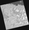
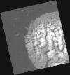
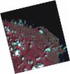
DE2_OPER_HRA_PM4_1C_20210712T121046_N38-745_W027-238_0001
Download Product | Product Info | Browse
Platform Short Name | GEOSAT |
Platform Serial Identifier | 2 |
Product Type | HRA_PM4_1C |
Start Date | 2021-07-12T12:10:46Z |
Stop Date | 2021-07-12T12:10:49Z |
Original Name | DE2_PM4_L1C_000000_20210712T121046_20210712T121049_DE2_38277_7DC7.zip |
Footprint | 38.6969652097 -27.1443653623 38.8222030371 -27.184611273 38.7941933791 -27.332030586 38.6688155718 -27.292249856 38.6969652097 -27.1443653623 |
Orbit Direction | ASCENDING |
Scene Centre Longitude | W027 |
Scene Centre Latitude | N38 |
Cloud Cover Percentage | -1 |
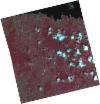
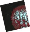
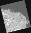
DE2_OPER_HRA_PSH_1C_20210712T121046_N38-745_W027-238_0001
Download Product | Product Info | Browse
Platform Short Name | GEOSAT |
Platform Serial Identifier | 2 |
Product Type | HRA_PSH_1C |
Start Date | 2021-07-12T12:10:46Z |
Stop Date | 2021-07-12T12:10:49Z |
Original Name | DE2_PSH_L1C_000000_20210712T121046_20210712T121049_DE2_38277_7DC7.zip |
Footprint | 38.6969652097 -27.1443653623 38.8222030371 -27.184611273 38.7941933791 -27.332030586 38.6688155718 -27.292249856 38.6969652097 -27.1443653623 |
Orbit Direction | ASCENDING |
Scene Centre Longitude | W027 |
Scene Centre Latitude | N38 |
Cloud Cover Percentage | -1 |
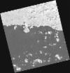
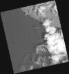
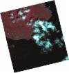
DE2_OPER_HRA_PM4_1C_20210712T121045_N38-631_W027-202_0001
Download Product | Product Info | Browse
Platform Short Name | GEOSAT |
Platform Serial Identifier | 2 |
Product Type | HRA_PM4_1C |
Start Date | 2021-07-12T12:10:45Z |
Stop Date | 2021-07-12T12:10:47Z |
Original Name | DE2_PM4_L1C_000000_20210712T121045_20210712T121047_DE2_38277_EB9B.zip |
Footprint | 38.5831015477 -27.109469139 38.7085926458 -27.1480116854 38.6804659527 -27.2957031817 38.5551461104 -27.2565664759 38.5831015477 -27.109469139 |
Orbit Direction | ASCENDING |
Scene Centre Longitude | W027 |
Scene Centre Latitude | N38 |
Cloud Cover Percentage | -1 |
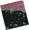
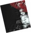
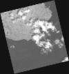
DE2_OPER_HRA_PSH_1C_20210712T121045_N38-631_W027-202_0001
Download Product | Product Info | Browse
Platform Short Name | GEOSAT |
Platform Serial Identifier | 2 |
Product Type | HRA_PSH_1C |
Start Date | 2021-07-12T12:10:45Z |
Stop Date | 2021-07-12T12:10:47Z |
Original Name | DE2_PSH_L1C_000000_20210712T121045_20210712T121047_DE2_38277_EB9B.zip |
Footprint | 38.5831015477 -27.109469139 38.7085926458 -27.1480116854 38.6804659527 -27.2957031817 38.5551461104 -27.2565664759 38.5831015477 -27.109469139 |
Orbit Direction | ASCENDING |
Scene Centre Longitude | W027 |
Scene Centre Latitude | N38 |
Cloud Cover Percentage | -1 |
DE2_OPER_HRA_PM4_1C_20210530T121922_N38-747_W027-353_0001
Download Product | Product Info | Browse
Platform Short Name | GEOSAT |
Platform Serial Identifier | 2 |
Product Type | HRA_PM4_1C |
Start Date | 2021-05-30T12:19:22Z |
Stop Date | 2021-05-30T12:19:25Z |
Original Name | DE2_PM4_L1C_000000_20210530T121922_20210530T121925_DE2_37639_E82F.zip |
Footprint | 38.6985040885 -27.2652283038 38.8216036631 -27.3007181502 38.796573974 -27.4417957205 38.6736868882 -27.4060692688 38.6985040885 -27.2652283038 |
Orbit Direction | ASCENDING |
Scene Centre Longitude | W027 |
Scene Centre Latitude | N38 |
Cloud Cover Percentage | -1 |
DE2_OPER_HRA_PSH_1C_20210530T121922_N38-747_W027-353_0001
Download Product | Product Info | Browse
Platform Short Name | GEOSAT |
Platform Serial Identifier | 2 |
Product Type | HRA_PSH_1C |
Start Date | 2021-05-30T12:19:22Z |
Stop Date | 2021-05-30T12:19:25Z |
Original Name | DE2_PSH_L1C_000000_20210530T121922_20210530T121925_DE2_37639_E82F.zip |
Footprint | 38.6985040885 -27.2652283038 38.8216036631 -27.3007181502 38.796573974 -27.4417957205 38.6736868882 -27.4060692688 38.6985040885 -27.2652283038 |
Orbit Direction | ASCENDING |
Scene Centre Longitude | W027 |
Scene Centre Latitude | N38 |
Cloud Cover Percentage | -1 |
DE2_OPER_HRA_PM4_1C_20210530T121920_N38-635_W027-320_0001
Download Product | Product Info | Browse
Platform Short Name | GEOSAT |
Platform Serial Identifier | 2 |
Product Type | HRA_PM4_1C |
Start Date | 2021-05-30T12:19:20Z |
Stop Date | 2021-05-30T12:19:23Z |
Original Name | DE2_PM4_L1C_000000_20210530T121920_20210530T121923_DE2_37639_1EED.zip |
Footprint | 38.586841727 -27.2326532506 38.7099120415 -27.2686174141 38.685036841 -27.4094188419 38.5619562445 -27.3732441531 38.586841727 -27.2326532506 |
Orbit Direction | ASCENDING |
Scene Centre Longitude | W027 |
Scene Centre Latitude | N38 |
Cloud Cover Percentage | -1 |
DE2_OPER_HRA_PSH_1C_20210530T121920_N38-635_W027-320_0001
Download Product | Product Info | Browse
Platform Short Name | GEOSAT |
Platform Serial Identifier | 2 |
Product Type | HRA_PSH_1C |
Start Date | 2021-05-30T12:19:20Z |
Stop Date | 2021-05-30T12:19:23Z |
Original Name | DE2_PSH_L1C_000000_20210530T121920_20210530T121923_DE2_37639_1EED.zip |
Footprint | 38.586841727 -27.2326532506 38.7099120415 -27.2686174141 38.685036841 -27.4094188419 38.5619562445 -27.3732441531 38.586841727 -27.2326532506 |
Orbit Direction | ASCENDING |
Scene Centre Longitude | W027 |
Scene Centre Latitude | N38 |
Cloud Cover Percentage | -1 |
DE2_OPER_HRA_PSH_1C_20210511T121356_N38-764_W027-122_0001
Download Product | Product Info | Browse
Platform Short Name | GEOSAT |
Platform Serial Identifier | 2 |
Product Type | HRA_PSH_1C |
Start Date | 2021-05-11T12:13:56Z |
Stop Date | 2021-05-11T12:13:59Z |
Original Name | DE2_PSH_L1C_000000_20210511T121356_20210511T121359_DE2_37357_1561.zip |
Footprint | 38.7162045774 -27.0318824301 38.8401709645 -27.0699362091 38.8131094616 -27.2141492308 38.6891641239 -27.1750501312 38.7162045774 -27.0318824301 |
Orbit Direction | ASCENDING |
Scene Centre Longitude | W027 |
Scene Centre Latitude | N38 |
Cloud Cover Percentage | -1 |
DE2_OPER_HRA_PM4_1C_20210511T121356_N38-764_W027-122_0001
Download Product | Product Info | Browse
Platform Short Name | GEOSAT |
Platform Serial Identifier | 2 |
Product Type | HRA_PM4_1C |
Start Date | 2021-05-11T12:13:56Z |
Stop Date | 2021-05-11T12:13:59Z |
Original Name | DE2_PM4_L1C_000000_20210511T121356_20210511T121359_DE2_37357_1561.zip |
Footprint | 38.7162045774 -27.0318824301 38.8401709645 -27.0699362091 38.8131094616 -27.2141492308 38.6891641239 -27.1750501312 38.7162045774 -27.0318824301 |
Orbit Direction | ASCENDING |
Scene Centre Longitude | W027 |
Scene Centre Latitude | N38 |
Cloud Cover Percentage | -1 |
DE2_OPER_HRA_PSH_1C_20210511T121354_N38-651_W027-088_0001
Download Product | Product Info | Browse
Platform Short Name | GEOSAT |
Platform Serial Identifier | 2 |
Product Type | HRA_PSH_1C |
Start Date | 2021-05-11T12:13:54Z |
Stop Date | 2021-05-11T12:13:57Z |
Original Name | DE2_PSH_L1C_000000_20210511T121354_20210511T121357_DE2_37357_599E.zip |
Footprint | 38.6033823624 -26.9972149835 38.7275381435 -27.0353905721 38.7007367616 -27.1785542577 38.5762073756 -27.1410408969 38.6033823624 -26.9972149835 |
Orbit Direction | ASCENDING |
Scene Centre Longitude | W027 |
Scene Centre Latitude | N38 |
Cloud Cover Percentage | -1 |
DE2_OPER_HRA_PM4_1C_20210511T121354_N38-651_W027-088_0001
Download Product | Product Info | Browse
Platform Short Name | GEOSAT |
Platform Serial Identifier | 2 |
Product Type | HRA_PM4_1C |
Start Date | 2021-05-11T12:13:54Z |
Stop Date | 2021-05-11T12:13:57Z |
Original Name | DE2_PM4_L1C_000000_20210511T121354_20210511T121357_DE2_37357_599E.zip |
Footprint | 38.6033823624 -26.9972149835 38.7275381435 -27.0353905721 38.7007367616 -27.1785542577 38.5762073756 -27.1410408969 38.6033823624 -26.9972149835 |
Orbit Direction | ASCENDING |
Scene Centre Longitude | W027 |
Scene Centre Latitude | N38 |
Cloud Cover Percentage | -1 |