ESA TPM Map Catalogue - Product List
back to previous node |
list of download URLs
Collection G2_Portugal_2021
GEOSAT-2 Portugal Coverage 2021 collection. More details here.
List of available products (latitude from 38.6515 to 38.7299 dg, longitude from -7.40187 to -7.2575 dg)..
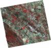
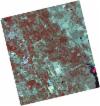
DE2_OPER_HRA_PSH_1C_20210727T111313_N38-780_W007-477_0001
Download Product | Product Info | Browse
Platform Short Name | GEOSAT |
Platform Serial Identifier | 2 |
Product Type | HRA_PSH_1C |
Start Date | 2021-07-27T11:13:13Z |
Stop Date | 2021-07-27T11:13:16Z |
Original Name | DE2_PSH_L1C_000000_20210727T111313_20210727T111316_DE2_38499_7773.zip |
Footprint | 38.7214501845 -7.36411357405 38.8648359252 -7.39758703006 38.8390685273 -7.59224536993 38.6958007034 -7.55750127089 38.7214501845 -7.36411357405 |
Orbit Direction | ASCENDING |
Scene Centre Longitude | W007 |
Scene Centre Latitude | N38 |
Cloud Cover Percentage | -1 |
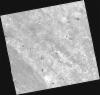
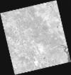
DE2_OPER_HRA_PM4_1C_20210727T111313_N38-780_W007-477_0001
Download Product | Product Info | Browse
Platform Short Name | GEOSAT |
Platform Serial Identifier | 2 |
Product Type | HRA_PM4_1C |
Start Date | 2021-07-27T11:13:13Z |
Stop Date | 2021-07-27T11:13:16Z |
Original Name | DE2_PM4_L1C_000000_20210727T111313_20210727T111316_DE2_38499_7773.zip |
Footprint | 38.7214501845 -7.36411357405 38.8648359252 -7.39758703006 38.8390685273 -7.59224536993 38.6958007034 -7.55750127089 38.7214501845 -7.36411357405 |
Orbit Direction | ASCENDING |
Scene Centre Longitude | W007 |
Scene Centre Latitude | N38 |
Cloud Cover Percentage | -1 |
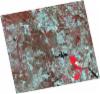
DE2_OPER_HRA_PSH_1C_20210727T111311_N38-650_W007-446_0001
Download Product | Product Info | Browse
Platform Short Name | GEOSAT |
Platform Serial Identifier | 2 |
Product Type | HRA_PSH_1C |
Start Date | 2021-07-27T11:13:11Z |
Stop Date | 2021-07-27T11:13:14Z |
Original Name | DE2_PSH_L1C_000000_20210727T111311_20210727T111314_DE2_38499_8A4F.zip |
Footprint | 38.5915997021 -7.33229297889 38.734744922 -7.36710635756 38.7090470117 -7.56078016691 38.5658599574 -7.52638431297 38.5915997021 -7.33229297889 |
Orbit Direction | ASCENDING |
Scene Centre Longitude | W007 |
Scene Centre Latitude | N38 |
Cloud Cover Percentage | -1 |
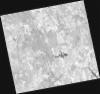
DE2_OPER_HRA_PM4_1C_20210727T111311_N38-650_W007-446_0001
Download Product | Product Info | Browse
Platform Short Name | GEOSAT |
Platform Serial Identifier | 2 |
Product Type | HRA_PM4_1C |
Start Date | 2021-07-27T11:13:11Z |
Stop Date | 2021-07-27T11:13:14Z |
Original Name | DE2_PM4_L1C_000000_20210727T111311_20210727T111314_DE2_38499_8A4F.zip |
Footprint | 38.5915997021 -7.33229297889 38.734744922 -7.36710635756 38.7090470117 -7.56078016691 38.5658599574 -7.52638431297 38.5915997021 -7.33229297889 |
Orbit Direction | ASCENDING |
Scene Centre Longitude | W007 |
Scene Centre Latitude | N38 |
Cloud Cover Percentage | -1 |
DE2_OPER_HRA_PSH_1C_20210720T110116_N38-746_W007-349_0001
Download Product | Product Info | Browse
Platform Short Name | GEOSAT |
Platform Serial Identifier | 2 |
Product Type | HRA_PSH_1C |
Start Date | 2021-07-20T11:01:16Z |
Stop Date | 2021-07-20T11:01:19Z |
Original Name | DE2_PSH_L1C_000000_20210720T110116_20210720T110119_DE2_38395_2480.zip |
Footprint | 38.6964682361 -7.25950730055 38.8216516312 -7.29405073511 38.7972043755 -7.43931228869 38.672024911 -7.40455928849 38.6964682361 -7.25950730055 |
Orbit Direction | ASCENDING |
Scene Centre Longitude | W007 |
Scene Centre Latitude | N38 |
Cloud Cover Percentage | -1 |
DE2_OPER_HRA_PM4_1C_20210720T110116_N38-746_W007-349_0001
Download Product | Product Info | Browse
Platform Short Name | GEOSAT |
Platform Serial Identifier | 2 |
Product Type | HRA_PM4_1C |
Start Date | 2021-07-20T11:01:16Z |
Stop Date | 2021-07-20T11:01:19Z |
Original Name | DE2_PM4_L1C_000000_20210720T110116_20210720T110119_DE2_38395_2480.zip |
Footprint | 38.6964682361 -7.25950730055 38.8216516312 -7.29405073511 38.7972043755 -7.43931228869 38.672024911 -7.40455928849 38.6964682361 -7.25950730055 |
Orbit Direction | ASCENDING |
Scene Centre Longitude | W007 |
Scene Centre Latitude | N38 |
Cloud Cover Percentage | -1 |