ESA TPM Map Catalogue - Product List
back to previous node |
list of download URLs
Collection G2_Portugal_2021
GEOSAT-2 Portugal Coverage 2021 collection. More details here.
List of available products (latitude from 38.6515 to 38.7299 dg, longitude from -7.75625 to -7.61188 dg)..
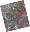
DE2_OPER_HRA_PSH_1C_20210702T111146_N38-738_W007-635_0001
Download Product | Product Info | BrowsePlatform Short Name | GEOSAT |
Platform Serial Identifier | 2 |
Product Type | HRA_PSH_1C |
Start Date | 2021-07-02T11:11:46Z |
Stop Date | 2021-07-02T11:11:49Z |
Original Name | DE2_PSH_L1C_000000_20210702T111146_20210702T111149_DE2_38128_6914.zip |
Footprint | 38.6818583733 -7.53092299291 38.819265871 -7.56495661888 38.7942991172 -7.74064460144 38.6568211658 -7.70685450162 38.6818583733 -7.53092299291 |
Orbit Direction | ASCENDING |
Scene Centre Longitude | W007 |
Scene Centre Latitude | N38 |
Cloud Cover Percentage | -1 |
DE2_OPER_HRA_PM4_1C_20210702T111146_N38-738_W007-635_0001
Download Product | Product Info | BrowsePlatform Short Name | GEOSAT |
Platform Serial Identifier | 2 |
Product Type | HRA_PM4_1C |
Start Date | 2021-07-02T11:11:46Z |
Stop Date | 2021-07-02T11:11:49Z |
Original Name | DE2_PM4_L1C_000000_20210702T111146_20210702T111149_DE2_38128_6914.zip |
Footprint | 38.6818583733 -7.53092299291 38.819265871 -7.56495661888 38.7942991172 -7.74064460144 38.6568211658 -7.70685450162 38.6818583733 -7.53092299291 |
Orbit Direction | ASCENDING |
Scene Centre Longitude | W007 |
Scene Centre Latitude | N38 |
Cloud Cover Percentage | -1 |
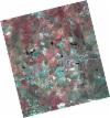
DE2_OPER_HRA_PSH_1C_20210702T111144_N38-613_W007-605_0001
Download Product | Product Info | BrowsePlatform Short Name | GEOSAT |
Platform Serial Identifier | 2 |
Product Type | HRA_PSH_1C |
Start Date | 2021-07-02T11:11:44Z |
Stop Date | 2021-07-02T11:11:47Z |
Original Name | DE2_PSH_L1C_000000_20210702T111144_20210702T111147_DE2_38128_EC5D.zip |
Footprint | 38.5571789742 -7.50060203252 38.6945650332 -7.53422468298 38.6695615121 -7.70996160449 38.5321858423 -7.67602196958 38.5571789742 -7.50060203252 |
Orbit Direction | ASCENDING |
Scene Centre Longitude | W007 |
Scene Centre Latitude | N38 |
Cloud Cover Percentage | -1 |
DE2_OPER_HRA_PM4_1C_20210702T111144_N38-613_W007-605_0001
Download Product | Product Info | BrowsePlatform Short Name | GEOSAT |
Platform Serial Identifier | 2 |
Product Type | HRA_PM4_1C |
Start Date | 2021-07-02T11:11:44Z |
Stop Date | 2021-07-02T11:11:47Z |
Original Name | DE2_PM4_L1C_000000_20210702T111144_20210702T111147_DE2_38128_EC5D.zip |
Footprint | 38.5571789742 -7.50060203252 38.6945650332 -7.53422468298 38.6695615121 -7.70996160449 38.5321858423 -7.67602196958 38.5571789742 -7.50060203252 |
Orbit Direction | ASCENDING |
Scene Centre Longitude | W007 |
Scene Centre Latitude | N38 |
Cloud Cover Percentage | -1 |
DE2_OPER_HRA_PSH_1C_20210525T110120_N38-759_W007-787_0001
Download Product | Product Info | BrowsePlatform Short Name | GEOSAT |
Platform Serial Identifier | 2 |
Product Type | HRA_PSH_1C |
Start Date | 2021-05-25T11:01:20Z |
Stop Date | 2021-05-25T11:01:22Z |
Original Name | DE2_PSH_L1C_000000_20210525T110120_20210525T110122_DE2_37564_3B58.zip |
Footprint | 38.7101052955 -7.69894266215 38.833301086 -7.73433246171 38.808320437 -7.87555135741 38.6851225683 -7.83991246445 38.7101052955 -7.69894266215 |
Orbit Direction | ASCENDING |
Scene Centre Longitude | W007 |
Scene Centre Latitude | N38 |
Cloud Cover Percentage | -1 |
DE2_OPER_HRA_PM4_1C_20210525T110120_N38-759_W007-787_0001
Download Product | Product Info | BrowsePlatform Short Name | GEOSAT |
Platform Serial Identifier | 2 |
Product Type | HRA_PM4_1C |
Start Date | 2021-05-25T11:01:20Z |
Stop Date | 2021-05-25T11:01:22Z |
Original Name | DE2_PM4_L1C_000000_20210525T110120_20210525T110122_DE2_37564_3B58.zip |
Footprint | 38.7101052955 -7.69894266215 38.833301086 -7.73433246171 38.808320437 -7.87555135741 38.6851225683 -7.83991246445 38.7101052955 -7.69894266215 |
Orbit Direction | ASCENDING |
Scene Centre Longitude | W007 |
Scene Centre Latitude | N38 |
Cloud Cover Percentage | -1 |
DE2_OPER_HRA_PSH_1C_20210525T110118_N38-647_W007-754_0001
Download Product | Product Info | BrowsePlatform Short Name | GEOSAT |
Platform Serial Identifier | 2 |
Product Type | HRA_PSH_1C |
Start Date | 2021-05-25T11:01:18Z |
Stop Date | 2021-05-25T11:01:21Z |
Original Name | DE2_PSH_L1C_000000_20210525T110118_20210525T110121_DE2_37564_64EA.zip |
Footprint | 38.5984305181 -7.66680485666 38.721503102 -7.70225585528 38.6965300217 -7.84322100984 38.573482686 -7.80756510064 38.5984305181 -7.66680485666 |
Orbit Direction | ASCENDING |
Scene Centre Longitude | W007 |
Scene Centre Latitude | N38 |
Cloud Cover Percentage | -1 |
DE2_OPER_HRA_PM4_1C_20210525T110118_N38-647_W007-754_0001
Download Product | Product Info | BrowsePlatform Short Name | GEOSAT |
Platform Serial Identifier | 2 |
Product Type | HRA_PM4_1C |
Start Date | 2021-05-25T11:01:18Z |
Stop Date | 2021-05-25T11:01:21Z |
Original Name | DE2_PM4_L1C_000000_20210525T110118_20210525T110121_DE2_37564_64EA.zip |
Footprint | 38.5984305181 -7.66680485666 38.721503102 -7.70225585528 38.6965300217 -7.84322100984 38.573482686 -7.80756510064 38.5984305181 -7.66680485666 |
Orbit Direction | ASCENDING |
Scene Centre Longitude | W007 |
Scene Centre Latitude | N38 |
Cloud Cover Percentage | -1 |


