ESA TPM Map Catalogue - Product List
back to previous node |
list of download URLs
Collection G2_Portugal_2021
GEOSAT-2 Portugal Coverage 2021 collection. More details here.
List of available products (latitude from 38.6515 to 38.7299 dg, longitude from -7.90062 to -7.75625 dg)..
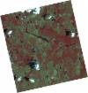
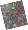
DE2_OPER_HRA_PSH_1C_20210613T110638_N38-722_W007-900_0001
Download Product | Product Info | Browse
Platform Short Name | GEOSAT |
Platform Serial Identifier | 2 |
Product Type | HRA_PSH_1C |
Start Date | 2021-06-13T11:06:38Z |
Stop Date | 2021-06-13T11:06:40Z |
Original Name | DE2_PSH_L1C_000000_20210613T110638_20210613T110640_DE2_37846_CAA1.zip |
Footprint | 38.6711400858 -7.80842092031 38.797784875 -7.8424235074 38.7734588719 -7.99168482895 38.6468078719 -7.95762737474 38.6711400858 -7.80842092031 |
Orbit Direction | ASCENDING |
Scene Centre Longitude | W007 |
Scene Centre Latitude | N38 |
Cloud Cover Percentage | -1 |
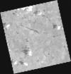
DE2_OPER_HRA_PM4_1C_20210613T110638_N38-722_W007-900_0001
Download Product | Product Info | Browse
Platform Short Name | GEOSAT |
Platform Serial Identifier | 2 |
Product Type | HRA_PM4_1C |
Start Date | 2021-06-13T11:06:38Z |
Stop Date | 2021-06-13T11:06:40Z |
Original Name | DE2_PM4_L1C_000000_20210613T110638_20210613T110640_DE2_37846_CAA1.zip |
Footprint | 38.6711400858 -7.80842092031 38.797784875 -7.8424235074 38.7734588719 -7.99168482895 38.6468078719 -7.95762737474 38.6711400858 -7.80842092031 |
Orbit Direction | ASCENDING |
Scene Centre Longitude | W007 |
Scene Centre Latitude | N38 |
Cloud Cover Percentage | -1 |
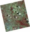
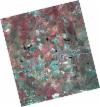
DE2_OPER_HRA_PSH_1C_20210613T110636_N38-607_W007-869_0001
Download Product | Product Info | Browse
Platform Short Name | GEOSAT |
Platform Serial Identifier | 2 |
Product Type | HRA_PSH_1C |
Start Date | 2021-06-13T11:06:36Z |
Stop Date | 2021-06-13T11:06:38Z |
Original Name | DE2_PSH_L1C_000000_20210613T110636_20210613T110638_DE2_37846_5D9F.zip |
Footprint | 38.556057505 -7.77730549455 38.6828995788 -7.81170080065 38.6585686344 -7.96074103866 38.5317272011 -7.92626572786 38.556057505 -7.77730549455 |
Orbit Direction | ASCENDING |
Scene Centre Longitude | W007 |
Scene Centre Latitude | N38 |
Cloud Cover Percentage | -1 |
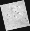
DE2_OPER_HRA_PM4_1C_20210613T110636_N38-607_W007-869_0001
Download Product | Product Info | Browse
Platform Short Name | GEOSAT |
Platform Serial Identifier | 2 |
Product Type | HRA_PM4_1C |
Start Date | 2021-06-13T11:06:36Z |
Stop Date | 2021-06-13T11:06:38Z |
Original Name | DE2_PM4_L1C_000000_20210613T110636_20210613T110638_DE2_37846_5D9F.zip |
Footprint | 38.556057505 -7.77730549455 38.6828995788 -7.81170080065 38.6585686344 -7.96074103866 38.5317272011 -7.92626572786 38.556057505 -7.77730549455 |
Orbit Direction | ASCENDING |
Scene Centre Longitude | W007 |
Scene Centre Latitude | N38 |
Cloud Cover Percentage | -1 |
DE2_OPER_HRA_PSH_1C_20210525T110120_N38-759_W007-787_0001
Download Product | Product Info | Browse
Platform Short Name | GEOSAT |
Platform Serial Identifier | 2 |
Product Type | HRA_PSH_1C |
Start Date | 2021-05-25T11:01:20Z |
Stop Date | 2021-05-25T11:01:22Z |
Original Name | DE2_PSH_L1C_000000_20210525T110120_20210525T110122_DE2_37564_3B58.zip |
Footprint | 38.7101052955 -7.69894266215 38.833301086 -7.73433246171 38.808320437 -7.87555135741 38.6851225683 -7.83991246445 38.7101052955 -7.69894266215 |
Orbit Direction | ASCENDING |
Scene Centre Longitude | W007 |
Scene Centre Latitude | N38 |
Cloud Cover Percentage | -1 |
DE2_OPER_HRA_PM4_1C_20210525T110120_N38-759_W007-787_0001
Download Product | Product Info | Browse
Platform Short Name | GEOSAT |
Platform Serial Identifier | 2 |
Product Type | HRA_PM4_1C |
Start Date | 2021-05-25T11:01:20Z |
Stop Date | 2021-05-25T11:01:22Z |
Original Name | DE2_PM4_L1C_000000_20210525T110120_20210525T110122_DE2_37564_3B58.zip |
Footprint | 38.7101052955 -7.69894266215 38.833301086 -7.73433246171 38.808320437 -7.87555135741 38.6851225683 -7.83991246445 38.7101052955 -7.69894266215 |
Orbit Direction | ASCENDING |
Scene Centre Longitude | W007 |
Scene Centre Latitude | N38 |
Cloud Cover Percentage | -1 |
DE2_OPER_HRA_PSH_1C_20210525T110118_N38-647_W007-754_0001
Download Product | Product Info | Browse
Platform Short Name | GEOSAT |
Platform Serial Identifier | 2 |
Product Type | HRA_PSH_1C |
Start Date | 2021-05-25T11:01:18Z |
Stop Date | 2021-05-25T11:01:21Z |
Original Name | DE2_PSH_L1C_000000_20210525T110118_20210525T110121_DE2_37564_64EA.zip |
Footprint | 38.5984305181 -7.66680485666 38.721503102 -7.70225585528 38.6965300217 -7.84322100984 38.573482686 -7.80756510064 38.5984305181 -7.66680485666 |
Orbit Direction | ASCENDING |
Scene Centre Longitude | W007 |
Scene Centre Latitude | N38 |
Cloud Cover Percentage | -1 |
DE2_OPER_HRA_PM4_1C_20210525T110118_N38-647_W007-754_0001
Download Product | Product Info | Browse
Platform Short Name | GEOSAT |
Platform Serial Identifier | 2 |
Product Type | HRA_PM4_1C |
Start Date | 2021-05-25T11:01:18Z |
Stop Date | 2021-05-25T11:01:21Z |
Original Name | DE2_PM4_L1C_000000_20210525T110118_20210525T110121_DE2_37564_64EA.zip |
Footprint | 38.5984305181 -7.66680485666 38.721503102 -7.70225585528 38.6965300217 -7.84322100984 38.573482686 -7.80756510064 38.5984305181 -7.66680485666 |
Orbit Direction | ASCENDING |
Scene Centre Longitude | W007 |
Scene Centre Latitude | N38 |
Cloud Cover Percentage | -1 |