ESA TPM Map Catalogue - Product List
back to previous node |
list of download URLs


Collection G2_Portugal_2021
GEOSAT-2 Portugal Coverage 2021 collection. More details here.
List of available products (latitude from 38.6515 to 38.7299 dg, longitude from -8.18938 to -8.045 dg)..
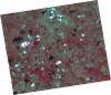
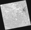
DE2_OPER_HRA_PSH_1C_20211004T111928_N38-796_W007-991_0001
Download Product | Product Info | Browse
Platform Short Name | GEOSAT |
Platform Serial Identifier | 2 |
Product Type | HRA_PSH_1C |
Start Date | 2021-10-04T11:19:28Z |
Stop Date | 2021-10-04T11:19:31Z |
Original Name | DE2_PSH_L1C_000000_20211004T111928_20211004T111931_DE2_39523_BF4C.zip |
Footprint | 38.7300651522 -7.85067873778 38.8914323155 -7.88297625382 38.8637958431 -8.13167034911 38.7023456187 -8.09940203577 38.7300651522 -7.85067873778 |
Orbit Direction | ASCENDING |
Scene Centre Longitude | W007 |
Scene Centre Latitude | N38 |
Cloud Cover Percentage | -1 |
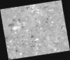
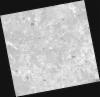
DE2_OPER_HRA_PM4_1C_20211004T111928_N38-796_W007-991_0001
Download Product | Product Info | Browse
Platform Short Name | GEOSAT |
Platform Serial Identifier | 2 |
Product Type | HRA_PM4_1C |
Start Date | 2021-10-04T11:19:28Z |
Stop Date | 2021-10-04T11:19:31Z |
Original Name | DE2_PM4_L1C_000000_20211004T111928_20211004T111931_DE2_39523_BF4C.zip |
Footprint | 38.7300651522 -7.85067873778 38.8914323155 -7.88297625382 38.8637958431 -8.13167034911 38.7023456187 -8.09940203577 38.7300651522 -7.85067873778 |
Orbit Direction | ASCENDING |
Scene Centre Longitude | W007 |
Scene Centre Latitude | N38 |
Cloud Cover Percentage | -1 |
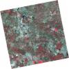
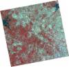
DE2_OPER_HRA_PSH_1C_20210921T111131_N38-752_W008-178_0001
Download Product | Product Info | Browse
Platform Short Name | GEOSAT |
Platform Serial Identifier | 2 |
Product Type | HRA_PSH_1C |
Start Date | 2021-09-21T11:11:31Z |
Stop Date | 2021-09-21T11:11:34Z |
Original Name | DE2_PSH_L1C_000000_20210921T111131_20210921T111134_DE2_39330_345E.zip |
Footprint | 38.6959055902 -8.07357541766 38.8340846308 -8.10648015165 38.8090220414 -8.28488245303 38.6709313336 -8.25083306747 38.6959055902 -8.07357541766 |
Orbit Direction | ASCENDING |
Scene Centre Longitude | W008 |
Scene Centre Latitude | N38 |
Cloud Cover Percentage | -1 |
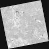
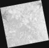
DE2_OPER_HRA_PM4_1C_20210921T111131_N38-752_W008-178_0001
Download Product | Product Info | Browse
Platform Short Name | GEOSAT |
Platform Serial Identifier | 2 |
Product Type | HRA_PM4_1C |
Start Date | 2021-09-21T11:11:31Z |
Stop Date | 2021-09-21T11:11:34Z |
Original Name | DE2_PM4_L1C_000000_20210921T111131_20210921T111134_DE2_39330_345E.zip |
Footprint | 38.6959055902 -8.07357541766 38.8340846308 -8.10648015165 38.8090220414 -8.28488245303 38.6709313336 -8.25083306747 38.6959055902 -8.07357541766 |
Orbit Direction | ASCENDING |
Scene Centre Longitude | W008 |
Scene Centre Latitude | N38 |
Cloud Cover Percentage | -1 |
DE2_OPER_HRA_PSH_1C_20210921T111129_N38-627_W008-148_0001
Download Product | Product Info | Browse
Platform Short Name | GEOSAT |
Platform Serial Identifier | 2 |
Product Type | HRA_PSH_1C |
Start Date | 2021-09-21T11:11:29Z |
Stop Date | 2021-09-21T11:11:32Z |
Original Name | DE2_PSH_L1C_000000_20210921T111129_20210921T111132_DE2_39330_59DB.zip |
Footprint | 38.5709408775 -8.04305251266 38.708703823 -8.07665357621 38.683719174 -8.25404543653 38.5459164528 -8.220305417 38.5709408775 -8.04305251266 |
Orbit Direction | ASCENDING |
Scene Centre Longitude | W008 |
Scene Centre Latitude | N38 |
Cloud Cover Percentage | -1 |
DE2_OPER_HRA_PM4_1C_20210921T111129_N38-627_W008-148_0001
Download Product | Product Info | Browse
Platform Short Name | GEOSAT |
Platform Serial Identifier | 2 |
Product Type | HRA_PM4_1C |
Start Date | 2021-09-21T11:11:29Z |
Stop Date | 2021-09-21T11:11:32Z |
Original Name | DE2_PM4_L1C_000000_20210921T111129_20210921T111132_DE2_39330_59DB.zip |
Footprint | 38.5709408775 -8.04305251266 38.708703823 -8.07665357621 38.683719174 -8.25404543653 38.5459164528 -8.220305417 38.5709408775 -8.04305251266 |
Orbit Direction | ASCENDING |
Scene Centre Longitude | W008 |
Scene Centre Latitude | N38 |
Cloud Cover Percentage | -1 |
DE2_OPER_HRA_PSH_1C_20210626T111515_N38-754_W008-026_0001
Download Product | Product Info | Browse
Platform Short Name | GEOSAT |
Platform Serial Identifier | 2 |
Product Type | HRA_PSH_1C |
Start Date | 2021-06-26T11:15:15Z |
Stop Date | 2021-06-26T11:15:17Z |
Original Name | DE2_PSH_L1C_000000_20210626T111515_20210626T111517_DE2_38039_841B.zip |
Footprint | 38.6966125461 -7.91675011345 38.8375113108 -7.94972671549 38.8120463553 -8.13631584123 38.6711676377 -8.1029051127 38.6966125461 -7.91675011345 |
Orbit Direction | ASCENDING |
Scene Centre Longitude | W008 |
Scene Centre Latitude | N38 |
Cloud Cover Percentage | -1 |
DE2_OPER_HRA_PM4_1C_20210626T111515_N38-754_W008-026_0001
Download Product | Product Info | Browse
Platform Short Name | GEOSAT |
Platform Serial Identifier | 2 |
Product Type | HRA_PM4_1C |
Start Date | 2021-06-26T11:15:15Z |
Stop Date | 2021-06-26T11:15:17Z |
Original Name | DE2_PM4_L1C_000000_20210626T111515_20210626T111517_DE2_38039_841B.zip |
Footprint | 38.6966125461 -7.91675011345 38.8375113108 -7.94972671549 38.8120463553 -8.13631584123 38.6711676377 -8.1029051127 38.6966125461 -7.91675011345 |
Orbit Direction | ASCENDING |
Scene Centre Longitude | W008 |
Scene Centre Latitude | N38 |
Cloud Cover Percentage | -1 |
DE2_OPER_HRA_PSH_1C_20210626T111513_N38-626_W007-996_0001
Download Product | Product Info | Browse
Platform Short Name | GEOSAT |
Platform Serial Identifier | 2 |
Product Type | HRA_PSH_1C |
Start Date | 2021-06-26T11:15:13Z |
Stop Date | 2021-06-26T11:15:15Z |
Original Name | DE2_PSH_L1C_000000_20210626T111513_20210626T111515_DE2_38039_DE4F.zip |
Footprint | 38.5687234325 -7.88634653155 38.7096842614 -7.91973580479 38.6841706459 -8.10633852179 38.5432459235 -8.07278336715 38.5687234325 -7.88634653155 |
Orbit Direction | ASCENDING |
Scene Centre Longitude | W007 |
Scene Centre Latitude | N38 |
Cloud Cover Percentage | -1 |
DE2_OPER_HRA_PM4_1C_20210626T111513_N38-626_W007-996_0001
Download Product | Product Info | Browse
Platform Short Name | GEOSAT |
Platform Serial Identifier | 2 |
Product Type | HRA_PM4_1C |
Start Date | 2021-06-26T11:15:13Z |
Stop Date | 2021-06-26T11:15:15Z |
Original Name | DE2_PM4_L1C_000000_20210626T111513_20210626T111515_DE2_38039_DE4F.zip |
Footprint | 38.5687234325 -7.88634653155 38.7096842614 -7.91973580479 38.6841706459 -8.10633852179 38.5432459235 -8.07278336715 38.5687234325 -7.88634653155 |
Orbit Direction | ASCENDING |
Scene Centre Longitude | W007 |
Scene Centre Latitude | N38 |
Cloud Cover Percentage | -1 |