ESA TPM Map Catalogue - Product List
back to previous node |
list of download URLs

Collection G2_Portugal_2021
GEOSAT-2 Portugal Coverage 2021 collection. More details here.
List of available products (latitude from 38.6515 to 38.7299 dg, longitude from -9.18688 to -9.0425 dg)..
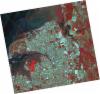
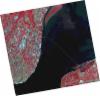
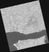
DE2_OPER_HRA_PSH_1C_20210715T112017_N38-712_W008-952_0001
Download Product | Product Info | Browse
Platform Short Name | GEOSAT |
Platform Serial Identifier | 2 |
Product Type | HRA_PSH_1C |
Start Date | 2021-07-15T11:20:17Z |
Stop Date | 2021-07-15T11:20:20Z |
Original Name | DE2_PSH_L1C_000000_20210715T112017_20210715T112020_DE2_38321_6E33.zip |
Footprint | 38.6531220433 -8.83642671206 38.7981205574 -8.86973626973 38.7723342245 -9.06866983319 38.6271212682 -9.03544455353 38.6531220433 -8.83642671206 |
Orbit Direction | ASCENDING |
Scene Centre Longitude | W008 |
Scene Centre Latitude | N38 |
Cloud Cover Percentage | -1 |
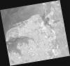
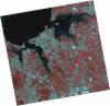
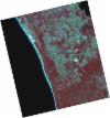
DE2_OPER_HRA_PM4_1C_20210715T112017_N38-712_W008-952_0001
Download Product | Product Info | Browse
Platform Short Name | GEOSAT |
Platform Serial Identifier | 2 |
Product Type | HRA_PM4_1C |
Start Date | 2021-07-15T11:20:17Z |
Stop Date | 2021-07-15T11:20:20Z |
Original Name | DE2_PM4_L1C_000000_20210715T112017_20210715T112020_DE2_38321_6E33.zip |
Footprint | 38.6531220433 -8.83642671206 38.7981205574 -8.86973626973 38.7723342245 -9.06866983319 38.6271212682 -9.03544455353 38.6531220433 -8.83642671206 |
Orbit Direction | ASCENDING |
Scene Centre Longitude | W008 |
Scene Centre Latitude | N38 |
Cloud Cover Percentage | -1 |
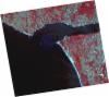
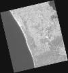
DE2_OPER_HRA_PSH_1C_20210508T112652_N38-651_W009-266_0001
Download Product | Product Info | Browse
Platform Short Name | GEOSAT |
Platform Serial Identifier | 2 |
Product Type | HRA_PSH_1C |
Start Date | 2021-05-08T11:26:52Z |
Stop Date | 2021-05-08T11:26:55Z |
Original Name | DE2_PSH_L1C_000000_20210508T112652_20210508T112655_DE2_37312_00A5.zip |
Footprint | 38.5881876416 -9.13825693785 38.7413399555 -9.17213104808 38.7144458618 -9.39527482379 38.561830271 -9.35950441271 38.5881876416 -9.13825693785 |
Orbit Direction | ASCENDING |
Scene Centre Longitude | W009 |
Scene Centre Latitude | N38 |
Cloud Cover Percentage | -1 |
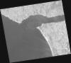
DE2_OPER_HRA_PM4_1C_20210508T112652_N38-651_W009-266_0001
Download Product | Product Info | Browse
Platform Short Name | GEOSAT |
Platform Serial Identifier | 2 |
Product Type | HRA_PM4_1C |
Start Date | 2021-05-08T11:26:52Z |
Stop Date | 2021-05-08T11:26:55Z |
Original Name | DE2_PM4_L1C_000000_20210508T112652_20210508T112655_DE2_37312_00A5.zip |
Footprint | 38.5881876416 -9.13825693785 38.7413399555 -9.17213104808 38.7144458618 -9.39527482379 38.561830271 -9.35950441271 38.5881876416 -9.13825693785 |
Orbit Direction | ASCENDING |
Scene Centre Longitude | W009 |
Scene Centre Latitude | N38 |
Cloud Cover Percentage | -1 |
DE2_OPER_HRA_PSH_1C_20210419T112114_N38-767_W009-071_0001
Download Product | Product Info | Browse
Platform Short Name | GEOSAT |
Platform Serial Identifier | 2 |
Product Type | HRA_PSH_1C |
Start Date | 2021-04-19T11:21:14Z |
Stop Date | 2021-04-19T11:21:17Z |
Original Name | DE2_PSH_L1C_000000_20210419T112114_20210419T112117_DE2_37030_8747.zip |
Footprint | 38.7100118308 -8.96258515487 38.8498162165 -8.99598672466 38.8243100238 -9.18140263483 38.6846472675 -9.14699654846 38.7100118308 -8.96258515487 |
Orbit Direction | ASCENDING |
Scene Centre Longitude | W009 |
Scene Centre Latitude | N38 |
Cloud Cover Percentage | -1 |
DE2_OPER_HRA_PM4_1C_20210419T112114_N38-767_W009-071_0001
Download Product | Product Info | Browse
Platform Short Name | GEOSAT |
Platform Serial Identifier | 2 |
Product Type | HRA_PM4_1C |
Start Date | 2021-04-19T11:21:14Z |
Stop Date | 2021-04-19T11:21:17Z |
Original Name | DE2_PM4_L1C_000000_20210419T112114_20210419T112117_DE2_37030_8747.zip |
Footprint | 38.7100118308 -8.96258515487 38.8498162165 -8.99598672466 38.8243100238 -9.18140263483 38.6846472675 -9.14699654846 38.7100118308 -8.96258515487 |
Orbit Direction | ASCENDING |
Scene Centre Longitude | W009 |
Scene Centre Latitude | N38 |
Cloud Cover Percentage | -1 |
DE2_OPER_HRA_PSH_1C_20210419T112112_N38-640_W009-041_0001
Download Product | Product Info | Browse
Platform Short Name | GEOSAT |
Platform Serial Identifier | 2 |
Product Type | HRA_PSH_1C |
Start Date | 2021-04-19T11:21:12Z |
Stop Date | 2021-04-19T11:21:15Z |
Original Name | DE2_PSH_L1C_000000_20210419T112112_20210419T112115_DE2_37030_9B42.zip |
Footprint | 38.5831333325 -8.93259857171 38.7229627645 -8.9657965678 38.6976339729 -9.1500245356 38.5577956058 -9.11667008107 38.5831333325 -8.93259857171 |
Orbit Direction | ASCENDING |
Scene Centre Longitude | W009 |
Scene Centre Latitude | N38 |
Cloud Cover Percentage | -1 |
DE2_OPER_HRA_PM4_1C_20210419T112112_N38-640_W009-041_0001
Download Product | Product Info | Browse
Platform Short Name | GEOSAT |
Platform Serial Identifier | 2 |
Product Type | HRA_PM4_1C |
Start Date | 2021-04-19T11:21:12Z |
Stop Date | 2021-04-19T11:21:15Z |
Original Name | DE2_PM4_L1C_000000_20210419T112112_20210419T112115_DE2_37030_9B42.zip |
Footprint | 38.5831333325 -8.93259857171 38.7229627645 -8.9657965678 38.6976339729 -9.1500245356 38.5577956058 -9.11667008107 38.5831333325 -8.93259857171 |
Orbit Direction | ASCENDING |
Scene Centre Longitude | W009 |
Scene Centre Latitude | N38 |
Cloud Cover Percentage | -1 |
DE2_OPER_HRA_PSH_1C_20210418T110544_N38-715_W009-221_0001
Download Product | Product Info | Browse
Platform Short Name | GEOSAT |
Platform Serial Identifier | 2 |
Product Type | HRA_PSH_1C |
Start Date | 2021-04-18T11:05:44Z |
Stop Date | 2021-04-18T11:05:46Z |
Original Name | DE2_PSH_L1C_000000_20210418T110544_20210418T110546_DE2_37015_D38E.zip |
Footprint | 38.6671725005 -9.13257222283 38.7898991614 -9.16932020893 38.7641561012 -9.31040449965 38.6414196633 -9.2735495773 38.6671725005 -9.13257222283 |
Orbit Direction | ASCENDING |
Scene Centre Longitude | W009 |
Scene Centre Latitude | N38 |
Cloud Cover Percentage | -1 |
DE2_OPER_HRA_PM4_1C_20210418T110544_N38-715_W009-221_0001
Download Product | Product Info | Browse
Platform Short Name | GEOSAT |
Platform Serial Identifier | 2 |
Product Type | HRA_PM4_1C |
Start Date | 2021-04-18T11:05:44Z |
Stop Date | 2021-04-18T11:05:46Z |
Original Name | DE2_PM4_L1C_000000_20210418T110544_20210418T110546_DE2_37015_D38E.zip |
Footprint | 38.6671725005 -9.13257222283 38.7898991614 -9.16932020893 38.7641561012 -9.31040449965 38.6414196633 -9.2735495773 38.6671725005 -9.13257222283 |
Orbit Direction | ASCENDING |
Scene Centre Longitude | W009 |
Scene Centre Latitude | N38 |
Cloud Cover Percentage | -1 |
DE2_OPER_HRA_PSH_1C_20210418T110542_N38-604_W009-188_0001
Download Product | Product Info | Browse
Platform Short Name | GEOSAT |
Platform Serial Identifier | 2 |
Product Type | HRA_PSH_1C |
Start Date | 2021-04-18T11:05:42Z |
Stop Date | 2021-04-18T11:05:45Z |
Original Name | DE2_PSH_L1C_000000_20210418T110542_20210418T110545_DE2_37015_CF0A.zip |
Footprint | 38.5557703531 -9.09935659195 38.6785573315 -9.13597322265 38.6527869183 -9.2769457252 38.5300237298 -9.24018857567 38.5557703531 -9.09935659195 |
Orbit Direction | ASCENDING |
Scene Centre Longitude | W009 |
Scene Centre Latitude | N38 |
Cloud Cover Percentage | -1 |
DE2_OPER_HRA_PM4_1C_20210418T110542_N38-604_W009-188_0001
Download Product | Product Info | Browse
Platform Short Name | GEOSAT |
Platform Serial Identifier | 2 |
Product Type | HRA_PM4_1C |
Start Date | 2021-04-18T11:05:42Z |
Stop Date | 2021-04-18T11:05:45Z |
Original Name | DE2_PM4_L1C_000000_20210418T110542_20210418T110545_DE2_37015_CF0A.zip |
Footprint | 38.5557703531 -9.09935659195 38.6785573315 -9.13597322265 38.6527869183 -9.2769457252 38.5300237298 -9.24018857567 38.5557703531 -9.09935659195 |
Orbit Direction | ASCENDING |
Scene Centre Longitude | W009 |
Scene Centre Latitude | N38 |
Cloud Cover Percentage | -1 |