ESA TPM Map Catalogue - Product List
back to previous node |
list of download URLs
Collection G2_Portugal_2021
GEOSAT-2 Portugal Coverage 2021 collection. More details here.
List of available products (latitude from 38.5731 to 38.6515 dg, longitude from -7.75625 to -7.61188 dg)..
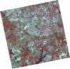
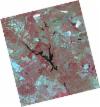
DE2_OPER_HRA_PSH_1C_20210702T111144_N38-613_W007-605_0001
Download Product | Product Info | Browse
Platform Short Name | GEOSAT |
Platform Serial Identifier | 2 |
Product Type | HRA_PSH_1C |
Start Date | 2021-07-02T11:11:44Z |
Stop Date | 2021-07-02T11:11:47Z |
Original Name | DE2_PSH_L1C_000000_20210702T111144_20210702T111147_DE2_38128_EC5D.zip |
Footprint | 38.5571789742 -7.50060203252 38.6945650332 -7.53422468298 38.6695615121 -7.70996160449 38.5321858423 -7.67602196958 38.5571789742 -7.50060203252 |
Orbit Direction | ASCENDING |
Scene Centre Longitude | W007 |
Scene Centre Latitude | N38 |
Cloud Cover Percentage | -1 |
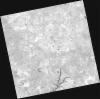
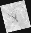
DE2_OPER_HRA_PM4_1C_20210702T111144_N38-613_W007-605_0001
Download Product | Product Info | Browse
Platform Short Name | GEOSAT |
Platform Serial Identifier | 2 |
Product Type | HRA_PM4_1C |
Start Date | 2021-07-02T11:11:44Z |
Stop Date | 2021-07-02T11:11:47Z |
Original Name | DE2_PM4_L1C_000000_20210702T111144_20210702T111147_DE2_38128_EC5D.zip |
Footprint | 38.5571789742 -7.50060203252 38.6945650332 -7.53422468298 38.6695615121 -7.70996160449 38.5321858423 -7.67602196958 38.5571789742 -7.50060203252 |
Orbit Direction | ASCENDING |
Scene Centre Longitude | W007 |
Scene Centre Latitude | N38 |
Cloud Cover Percentage | -1 |
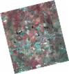
DE2_OPER_HRA_PSH_1C_20210525T110118_N38-647_W007-754_0001
Download Product | Product Info | Browse
Platform Short Name | GEOSAT |
Platform Serial Identifier | 2 |
Product Type | HRA_PSH_1C |
Start Date | 2021-05-25T11:01:18Z |
Stop Date | 2021-05-25T11:01:21Z |
Original Name | DE2_PSH_L1C_000000_20210525T110118_20210525T110121_DE2_37564_64EA.zip |
Footprint | 38.5984305181 -7.66680485666 38.721503102 -7.70225585528 38.6965300217 -7.84322100984 38.573482686 -7.80756510064 38.5984305181 -7.66680485666 |
Orbit Direction | ASCENDING |
Scene Centre Longitude | W007 |
Scene Centre Latitude | N38 |
Cloud Cover Percentage | -1 |
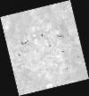
DE2_OPER_HRA_PM4_1C_20210525T110118_N38-647_W007-754_0001
Download Product | Product Info | Browse
Platform Short Name | GEOSAT |
Platform Serial Identifier | 2 |
Product Type | HRA_PM4_1C |
Start Date | 2021-05-25T11:01:18Z |
Stop Date | 2021-05-25T11:01:21Z |
Original Name | DE2_PM4_L1C_000000_20210525T110118_20210525T110121_DE2_37564_64EA.zip |
Footprint | 38.5984305181 -7.66680485666 38.721503102 -7.70225585528 38.6965300217 -7.84322100984 38.573482686 -7.80756510064 38.5984305181 -7.66680485666 |
Orbit Direction | ASCENDING |
Scene Centre Longitude | W007 |
Scene Centre Latitude | N38 |
Cloud Cover Percentage | -1 |
DE2_OPER_HRA_PSH_1C_20210525T110116_N38-535_W007-722_0001
Download Product | Product Info | Browse
Platform Short Name | GEOSAT |
Platform Serial Identifier | 2 |
Product Type | HRA_PSH_1C |
Start Date | 2021-05-25T11:01:16Z |
Stop Date | 2021-05-25T11:01:19Z |
Original Name | DE2_PSH_L1C_000000_20210525T110116_20210525T110119_DE2_37564_7221.zip |
Footprint | 38.486846499 -7.63463087817 38.6098290701 -7.67009107248 38.5848841727 -7.81084671486 38.4618996356 -7.77518340293 38.486846499 -7.63463087817 |
Orbit Direction | ASCENDING |
Scene Centre Longitude | W007 |
Scene Centre Latitude | N38 |
Cloud Cover Percentage | -1 |
DE2_OPER_HRA_PM4_1C_20210525T110116_N38-535_W007-722_0001
Download Product | Product Info | Browse
Platform Short Name | GEOSAT |
Platform Serial Identifier | 2 |
Product Type | HRA_PM4_1C |
Start Date | 2021-05-25T11:01:16Z |
Stop Date | 2021-05-25T11:01:19Z |
Original Name | DE2_PM4_L1C_000000_20210525T110116_20210525T110119_DE2_37564_7221.zip |
Footprint | 38.486846499 -7.63463087817 38.6098290701 -7.67009107248 38.5848841727 -7.81084671486 38.4618996356 -7.77518340293 38.486846499 -7.63463087817 |
Orbit Direction | ASCENDING |
Scene Centre Longitude | W007 |
Scene Centre Latitude | N38 |
Cloud Cover Percentage | -1 |